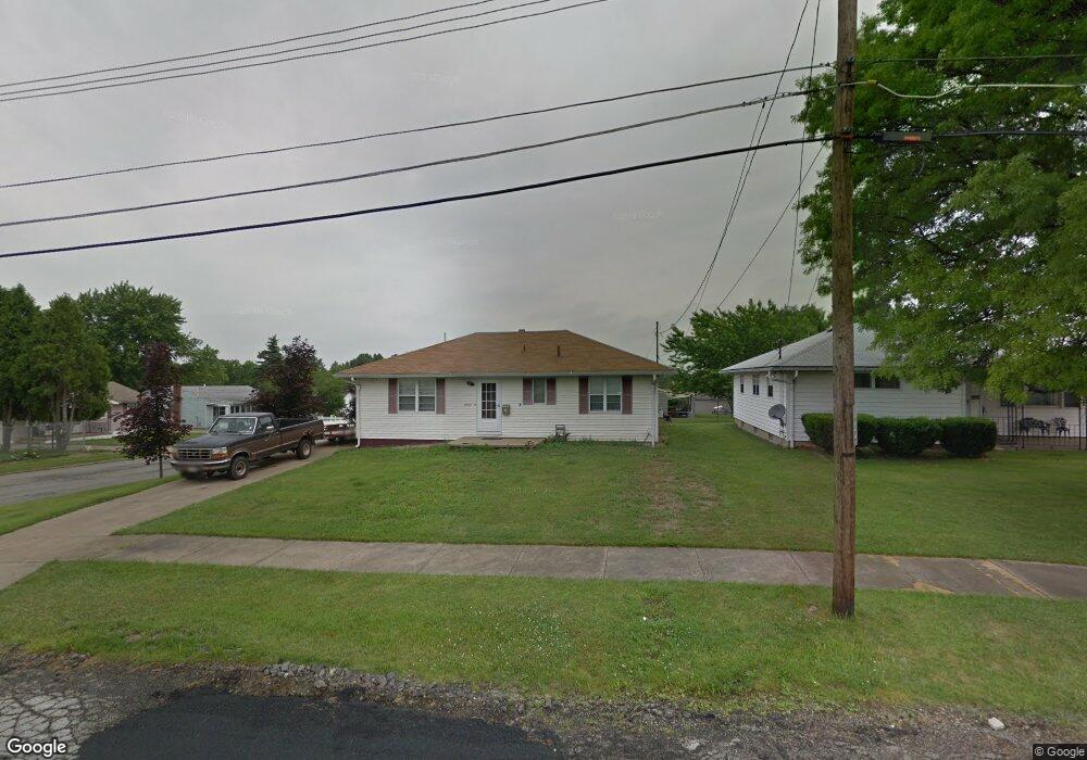
2940 Burbank Ave Youngstown, OH 44509
Belle Vista NeighborhoodEstimated Value: $73,000 - $100,000
3
Beds
1
Bath
1,040
Sq Ft
$88/Sq Ft
Est. Value
About This Home
This home is located at 2940 Burbank Ave, Youngstown, OH 44509 and is currently estimated at $91,620, approximately $88 per square foot. 2940 Burbank Ave is a home located in Mahoning County with nearby schools including Volney Rogers Elementary School, Chaney High School, and Summit Academy - Youngstown.
Ownership History
Date
Name
Owned For
Owner Type
Purchase Details
Closed on
May 20, 2009
Sold by
Lasalle Bank National Association
Bought by
Turney Brooke A
Current Estimated Value
Home Financials for this Owner
Home Financials are based on the most recent Mortgage that was taken out on this home.
Original Mortgage
$28,179
Outstanding Balance
$17,814
Interest Rate
4.86%
Mortgage Type
FHA
Estimated Equity
$73,806
Purchase Details
Closed on
Feb 17, 2009
Sold by
Luther Jeffrey L and Case #07Cv 4339
Bought by
Lasalle Bank National Association
Purchase Details
Closed on
Jun 24, 1998
Sold by
Luther John and Etherington Mary Lou
Bought by
Luther Jeffrey P
Home Financials for this Owner
Home Financials are based on the most recent Mortgage that was taken out on this home.
Original Mortgage
$42,000
Interest Rate
7.27%
Purchase Details
Closed on
Jan 1, 1990
Bought by
Luther Leona
Create a Home Valuation Report for This Property
The Home Valuation Report is an in-depth analysis detailing your home's value as well as a comparison with similar homes in the area
Home Values in the Area
Average Home Value in this Area
Purchase History
| Date | Buyer | Sale Price | Title Company |
|---|---|---|---|
| Turney Brooke A | $28,700 | Resource Title Agency Inc | |
| Lasalle Bank National Association | $40,000 | None Available | |
| Luther Jeffrey P | $38,000 | -- | |
| Luther Leona | -- | -- |
Source: Public Records
Mortgage History
| Date | Status | Borrower | Loan Amount |
|---|---|---|---|
| Open | Turney Brooke A | $28,179 | |
| Previous Owner | Luther Jeffrey P | $42,000 |
Source: Public Records
Tax History Compared to Growth
Tax History
| Year | Tax Paid | Tax Assessment Tax Assessment Total Assessment is a certain percentage of the fair market value that is determined by local assessors to be the total taxable value of land and additions on the property. | Land | Improvement |
|---|---|---|---|---|
| 2024 | $858 | $17,540 | $1,660 | $15,880 |
| 2023 | $852 | $17,540 | $1,660 | $15,880 |
| 2022 | $809 | $12,820 | $1,640 | $11,180 |
| 2021 | $809 | $12,820 | $1,640 | $11,180 |
| 2020 | $814 | $12,820 | $1,640 | $11,180 |
| 2019 | $797 | $11,240 | $1,440 | $9,800 |
| 2018 | $805 | $11,240 | $1,440 | $9,800 |
| 2017 | $982 | $11,240 | $1,440 | $9,800 |
| 2016 | $1,163 | $17,570 | $2,230 | $15,340 |
| 2015 | $1,139 | $17,570 | $2,230 | $15,340 |
| 2014 | $1,132 | $17,570 | $2,230 | $15,340 |
| 2013 | $1,117 | $17,570 | $2,230 | $15,340 |
Source: Public Records
Map
Nearby Homes
- 434 N Bon Air Ave
- 446 N Schenley Ave
- 453 N Dunlap Ave
- 141 Wesley Ave Unit 143
- 635 N Hazelwood Ave
- 59 Rhoda Ave
- 425 Manchester Ave
- 26 N Glenellen Ave
- 43 N Schenley Ave
- 175 N Hartford Ave
- 50 Manchester Ave
- 6 S Glenellen Ave
- 12 Bouquet Ave
- 40 Manchester Ave
- 107 N Hartford Ave
- 104 N Meridian Rd
- 2129 Tippecanoe Ave
- 46 Matta Ave
- 23 Manchester Ave
- 2113 Manhattan Ave