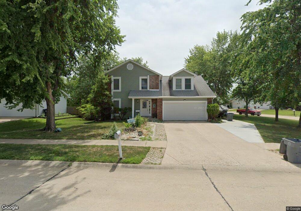
2942 White Stable Dr O Fallon, MO 63368
O'Fallon AreaEstimated Value: $331,000 - $380,000
About This Home
This home is located at 2942 White Stable Dr, O Fallon, MO 63368 and is currently estimated at $354,907, approximately $186 per square foot. 2942 White Stable Dr is a home located in St. Charles County with nearby schools including Pheasant Point Elementary School, Fort Zumwalt South Middle School, and Fort Zumwalt South High School.
Ownership History
We collect this data history from publicly available records. To have your information removed, we recommend requesting removal directly through your county’s website.
Purchase Details
Home Financials for this Owner
Home Financials are based on the most recent Mortgage that was taken out on this home.Home Values in the Area
Average Home Value in this Area
Purchase History
We collect this data history from publicly available records. To have your information removed, we recommend requesting removal directly through your county’s website.
| Date | Buyer | Sale Price | Title Company |
|---|---|---|---|
| -- | Continental Title |
Mortgage History
We collect this data history from publicly available records. To have your information removed, we recommend requesting removal directly through your county’s website.
| Date | Status | Borrower | Loan Amount |
|---|---|---|---|
| Open | $151,110 | ||
| Previous Owner | $150,000 | ||
| Previous Owner | $152,000 | ||
| Previous Owner | $38,000 | ||
| Previous Owner | $165,000 |
Tax History
We collect this data history from publicly available records. To have your information removed, we recommend requesting removal directly through your county’s website.
| Year | Tax Paid | Tax Assessment Tax Assessment Total Assessment is a certain percentage of the fair market value that is determined by local assessors to be the total taxable value of land and additions on the property. | Land | Improvement |
|---|---|---|---|---|
| 2025 | $3,563 | $58,898 | ||
| 2023 | $3,566 | $54,057 | $0 | $0 |
| 2022 | $3,295 | $46,565 | $0 | $0 |
| 2021 | $3,304 | $46,565 | $0 | $0 |
| 2020 | $2,844 | $38,524 | $0 | $0 |
| 2019 | $2,851 | $38,524 | $0 | $0 |
| 2018 | $2,713 | $35,060 | $0 | $0 |
| 2017 | $2,668 | $35,060 | $0 | $0 |
| 2016 | $3,192 | $40,304 | $0 | $0 |
| 2015 | $2,975 | $40,304 | $0 | $0 |
| 2014 | $2,679 | $35,786 | $0 | $0 |
Map
- 6432 Sprucefield Dr
- 1153 Spring Orchard Dr
- 6523 Star Buck Dr
- 6402 High Meadow Dr
- 1001 Summersweet Dr
- 8 Jacqueline Cir
- 28 Twinleaf Ct
- 118 Fallon Villa Ct
- 114 Fallon Villa Ct
- 110 Fallon Villa Ct
- 229 Coachman Way
- 28 Jacobs Ct W
- 149 Lamplighter Way
- 7 Red Cedar Parc Ct
- 204 Jacobs Way
- 53 Lions Head Ct
- 605 Castlebrook Dr
- 423 Ancestry Dr
- 2829 Royallvalley Way
- 4 Royallbend Ct
- 2936 White Stable Dr
- 6445 Clover Farm Dr
- 6450 Clover Farm Dr
- 6454 Clover Farm Dr
- 2932 White Stable Dr
- 6444 Windy Wheat Dr
- 2941 White Stable Dr
- 6446 Clover Farm Dr
- 6441 Clover Farm Dr
- 2945 White Stable Dr
- 2937 White Stable Dr
- 6440 Windy Wheat Dr
- 2949 White Stable Dr
- 6442 Clover Farm Dr
- 2933 White Stable Dr
- 6437 Clover Farm Dr
- 6501 High Meadow Dr
- 2953 White Stable Dr
- 6447 High Meadow Dr
- 6505 High Meadow Dr
Ask me questions while you tour the home.