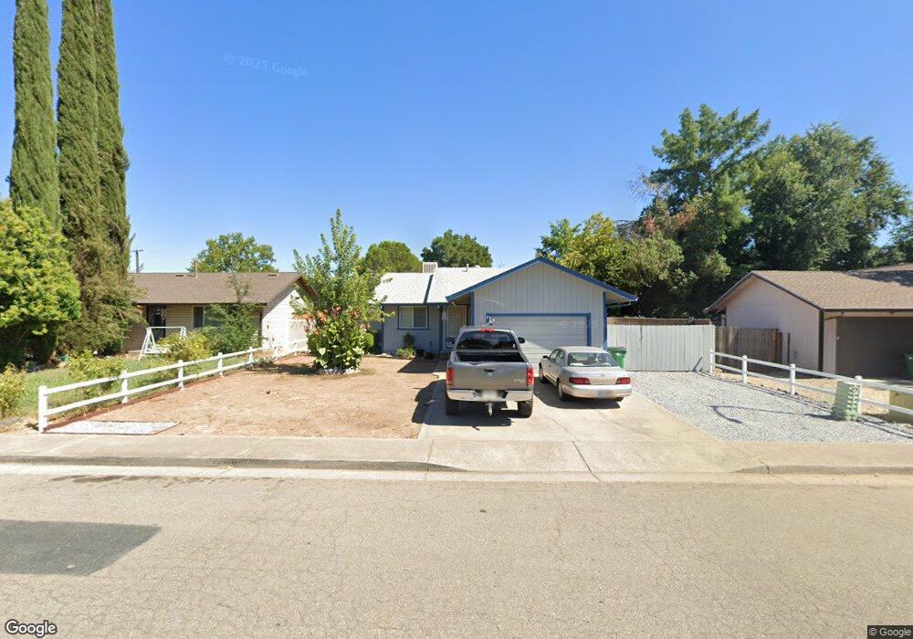
2945 Red Bud Dr Anderson, CA 96007
Balls Ferry Road NeighborhoodEstimated Value: $201,000 - $295,000
2
Beds
1
Bath
900
Sq Ft
$264/Sq Ft
Est. Value
About This Home
This home is located at 2945 Red Bud Dr, Anderson, CA 96007 and is currently estimated at $237,172, approximately $263 per square foot. 2945 Red Bud Dr is a home located in Shasta County with nearby schools including Meadow Lane Elementary School, Anderson Heights Elementary School, and Anderson Middle School.
Ownership History
Date
Name
Owned For
Owner Type
Purchase Details
Closed on
Oct 22, 1998
Sold by
Moravec Gary D and Moravec Kerrie B
Bought by
Ford Donald K
Current Estimated Value
Home Financials for this Owner
Home Financials are based on the most recent Mortgage that was taken out on this home.
Original Mortgage
$54,400
Outstanding Balance
$11,715
Interest Rate
6.71%
Estimated Equity
$225,457
Create a Home Valuation Report for This Property
The Home Valuation Report is an in-depth analysis detailing your home's value as well as a comparison with similar homes in the area
Home Values in the Area
Average Home Value in this Area
Purchase History
| Date | Buyer | Sale Price | Title Company |
|---|---|---|---|
| Ford Donald K | -- | Fidelity National Title Co |
Source: Public Records
Mortgage History
| Date | Status | Borrower | Loan Amount |
|---|---|---|---|
| Open | Ford Donald K | $54,400 |
Source: Public Records
Tax History Compared to Growth
Tax History
| Year | Tax Paid | Tax Assessment Tax Assessment Total Assessment is a certain percentage of the fair market value that is determined by local assessors to be the total taxable value of land and additions on the property. | Land | Improvement |
|---|---|---|---|---|
| 2025 | $1,416 | $106,575 | $25,068 | $81,507 |
| 2024 | $1,403 | $104,486 | $24,577 | $79,909 |
| 2023 | $1,403 | $102,439 | $24,096 | $78,343 |
| 2022 | $1,363 | $100,431 | $23,624 | $76,807 |
| 2021 | $1,356 | $98,462 | $23,161 | $75,301 |
| 2020 | $1,366 | $97,453 | $22,924 | $74,529 |
| 2019 | $1,316 | $95,543 | $22,475 | $73,068 |
| 2018 | $1,302 | $93,671 | $22,035 | $71,636 |
| 2017 | $1,300 | $91,835 | $21,603 | $70,232 |
| 2016 | $1,229 | $90,035 | $21,180 | $68,855 |
| 2015 | $1,239 | $88,683 | $20,862 | $67,821 |
| 2014 | $1,227 | $86,947 | $20,454 | $66,493 |
Source: Public Records
Map
Nearby Homes
- 2345 Shenandoah Dr
- 2827 Stingy Ln
- 2867 Pinto Ln
- 0 Shady Ln Unit 25-1204
- 3100 Driftstone Dr
- 3081 Sharon Ave
- 21118 Merrill Ln
- 3006 Joyce Dr
- 2648 Tremonto Rd
- 15.79 Stingy Ln
- 0 Stingy Ln
- 3244 Sharon Ave
- 21133 Ronald St
- 21077 Dodson Ln
- 2785 North St
- 2325 North St
- 3262 Camellia St
- 3371 Bardick Rd
- 3252 Daisy St
- 3381 Southwood Dr
- 2945 Red Bud Ln
- 2955 Red Bud Ln
- 2580 Balls Ferry Rd
- 2935 Red Bud Ln
- 2480 S Balls Ferry Rd
- 2925 Red Bud Ln
- 0 Red Bud Dr
- 2515 Lupine St
- 2905 Red Bud Dr
- 2510 Lupine St
- 2905 Red Bud Ln
- 2485 Toyon St
- 2525 Lupine St
- 2460 S Balls Ferry Rd
- 2475 Toyon St
- 2520 Lupine St
- 2900 Red Bud Dr
- 2900 Red Bud Ln
- 2535 Lupine St
- 6121 Balls Ferry Rd