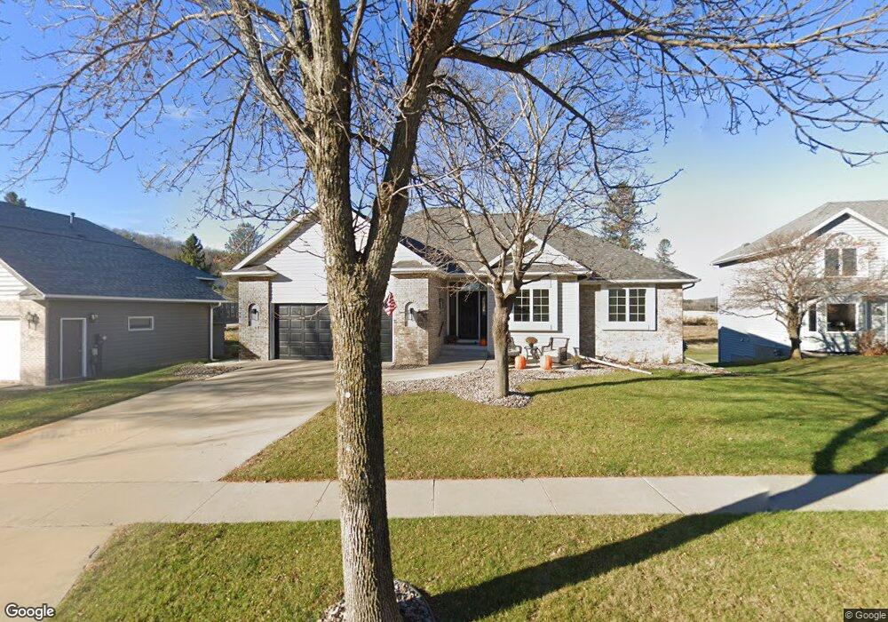
2945 Stonegate Ct SW Rochester, MN 55902
Estimated Value: $579,000 - $636,632
5
Beds
3
Baths
3,967
Sq Ft
$155/Sq Ft
Est. Value
About This Home
This home is located at 2945 Stonegate Ct SW, Rochester, MN 55902 and is currently estimated at $616,658, approximately $155 per square foot. 2945 Stonegate Ct SW is a home located in Olmsted County with nearby schools including Bamber Valley Elementary School, John Adams Middle School, and Mayo Senior High School.
Ownership History
Date
Name
Owned For
Owner Type
Purchase Details
Closed on
Aug 24, 2022
Sold by
Royce Bradley and Royce Kelsey
Bought by
Lehner Michael and Lehner Kelly
Current Estimated Value
Home Financials for this Owner
Home Financials are based on the most recent Mortgage that was taken out on this home.
Original Mortgage
$628,500
Outstanding Balance
$600,878
Interest Rate
5.51%
Mortgage Type
New Conventional
Estimated Equity
$15,780
Purchase Details
Closed on
Aug 13, 2021
Sold by
Jones Richard G and Jones Richard G
Bought by
Royce Bradley and Royce Kelsey
Purchase Details
Closed on
Sep 6, 2009
Sold by
Jones Richard G and Jones Lenore R
Bought by
Jones Lenore R and Jones Richard G
Create a Home Valuation Report for This Property
The Home Valuation Report is an in-depth analysis detailing your home's value as well as a comparison with similar homes in the area
Home Values in the Area
Average Home Value in this Area
Purchase History
| Date | Buyer | Sale Price | Title Company |
|---|---|---|---|
| Lehner Michael | $628,500 | -- | |
| Royce Bradley | $415,000 | Rochester Title & Escrow Co | |
| Jones Lenore R | -- | None Available | |
| Royce Bradley Bradley | $415,000 | -- |
Source: Public Records
Mortgage History
| Date | Status | Borrower | Loan Amount |
|---|---|---|---|
| Open | Lehner Michael | $628,500 |
Source: Public Records
Tax History Compared to Growth
Tax History
| Year | Tax Paid | Tax Assessment Tax Assessment Total Assessment is a certain percentage of the fair market value that is determined by local assessors to be the total taxable value of land and additions on the property. | Land | Improvement |
|---|---|---|---|---|
| 2024 | $6,914 | $491,900 | $60,000 | $431,900 |
| 2023 | $5,974 | $474,400 | $50,000 | $424,400 |
| 2022 | $4,440 | $355,600 | $50,000 | $305,600 |
| 2021 | $4,250 | $329,300 | $50,000 | $279,300 |
| 2020 | $4,274 | $311,800 | $30,000 | $281,800 |
| 2019 | $4,040 | $301,900 | $30,000 | $271,900 |
| 2018 | $3,706 | $287,800 | $31,100 | $256,700 |
| 2017 | $3,630 | $269,600 | $31,100 | $238,500 |
| 2016 | $3,318 | $246,600 | $29,500 | $217,100 |
| 2015 | $3,058 | $220,100 | $29,000 | $191,100 |
| 2014 | $3,006 | $216,100 | $28,900 | $187,200 |
| 2012 | -- | $219,600 | $28,988 | $190,612 |
Source: Public Records
Map
Nearby Homes
- 2944 Mayowood Common Cir SW
- 3018 Mayowood Common Cir SW
- 1650 Mayowood Ct SW
- 1658 Mayowood Ct SW
- 1702 Mayowood Ct SW
- 1710 Mayowood Ct SW
- 1726 Mayowood Rd SW
- 1739 Mayowood Ct SW
- 1750 Mayowood Rd SW
- 1758 Mayowood Rd SW
- 1787 Mayowood Rd SW
- 1782 Mayowood Ct SW
- 1851 Mayowood Ct SW
- 1798 Mayowood Rd SW
- 1835 Mayowood Rd SW
- 1806 Mayowood Rd SW
- 1822 Mayowood Rd SW
- 1846 Mayowood Rd SW
- 1975 Waterford Place SW
- 1987 Waterford Place SW
- 2941 Stonegate Ct SW
- 2949 Stonegate Ct SW
- 2937 Stonegate Ct SW
- 2944 Stonegate Ct SW
- 2940 Stonegate Ct SW
- 2933 Stonegate Ct SW
- 2950 Stonegate Ct SW
- 2934 Stonegate Ct SW
- 2945 Mayowood Common Cir SW
- 2951 Mayowood Common Cir SW
- 2939 Mayowood Common Cir SW
- 2928 Stonegate Ct SW
- 2929 Stonegate Ct SW
- 2957 Mayowood Common Cir SW
- 1917 Stonewall Ln SW
- 1923 Stonewall Ln SW
- 2933 Mayowood Common Cir SW
- 1911 Stonewall Ln SW
- 1929 Stonewall Ln SW
- 1905 Stonewall Ln SW