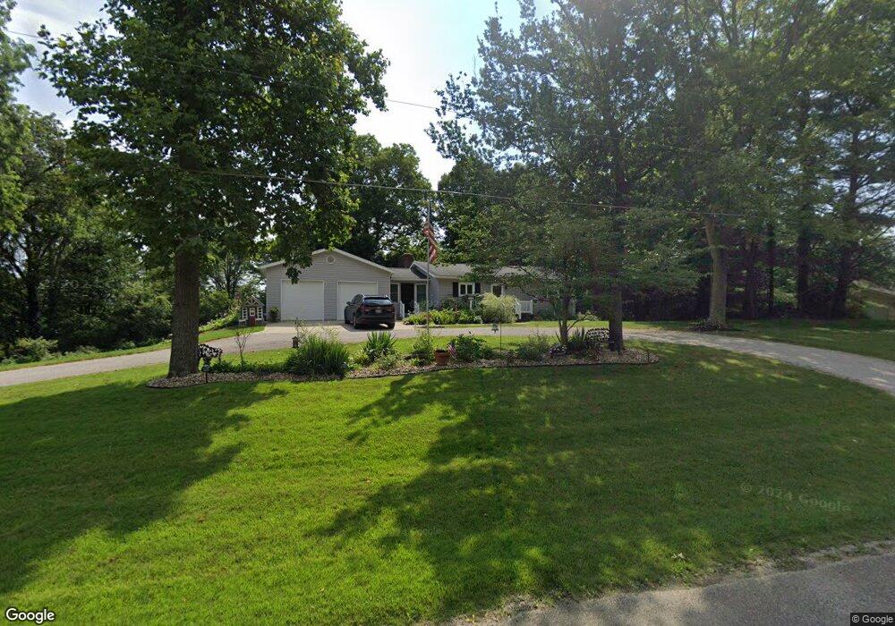
2945 Township Road 659 Loudonville, OH 44842
Estimated Value: $193,000 - $224,000
2
Beds
1
Bath
1,080
Sq Ft
$192/Sq Ft
Est. Value
About This Home
This home is located at 2945 Township Road 659, Loudonville, OH 44842 and is currently estimated at $207,261, approximately $191 per square foot. 2945 Township Road 659 is a home located in Ashland County with nearby schools including Budd Elementary School, McMullen Elementary School, and Loudonville High School.
Ownership History
Date
Name
Owned For
Owner Type
Purchase Details
Closed on
Sep 9, 2017
Sold by
Adams Samuel A and Adams Jill R
Bought by
Conway Ryan C and Conway Mackenzie M
Current Estimated Value
Home Financials for this Owner
Home Financials are based on the most recent Mortgage that was taken out on this home.
Original Mortgage
$110,000
Outstanding Balance
$90,853
Interest Rate
3.5%
Mortgage Type
New Conventional
Estimated Equity
$116,408
Purchase Details
Closed on
Jan 31, 2007
Purchase Details
Closed on
Jan 1, 1990
Create a Home Valuation Report for This Property
The Home Valuation Report is an in-depth analysis detailing your home's value as well as a comparison with similar homes in the area
Home Values in the Area
Average Home Value in this Area
Purchase History
| Date | Buyer | Sale Price | Title Company |
|---|---|---|---|
| Conway Ryan C | $130,000 | Chicago Title Agency | |
| -- | -- | -- | |
| -- | -- | -- |
Source: Public Records
Mortgage History
| Date | Status | Borrower | Loan Amount |
|---|---|---|---|
| Open | Conway Ryan C | $110,000 |
Source: Public Records
Tax History Compared to Growth
Tax History
| Year | Tax Paid | Tax Assessment Tax Assessment Total Assessment is a certain percentage of the fair market value that is determined by local assessors to be the total taxable value of land and additions on the property. | Land | Improvement |
|---|---|---|---|---|
| 2024 | $2,116 | $57,160 | $11,120 | $46,040 |
| 2023 | $2,116 | $57,160 | $11,120 | $46,040 |
| 2022 | $1,669 | $39,420 | $7,670 | $31,750 |
| 2021 | $1,693 | $39,420 | $7,670 | $31,750 |
| 2020 | $1,590 | $39,420 | $7,670 | $31,750 |
| 2019 | $1,360 | $33,620 | $7,550 | $26,070 |
| 2018 | $1,368 | $33,620 | $7,550 | $26,070 |
| 2017 | $1,414 | $33,620 | $7,550 | $26,070 |
| 2016 | $1,252 | $30,560 | $6,860 | $23,700 |
| 2015 | $1,243 | $30,560 | $6,860 | $23,700 |
| 2013 | $1,332 | $33,110 | $5,940 | $27,170 |
Source: Public Records
Map
Nearby Homes
- 513 N Mount Vernon Ave
- 723 Pearl Dr
- 316 E Campbell St
- 524 N Union St
- 333 E Campbell St
- 500 Stone Meadow Cir
- 526 E Campbell St
- 518 Snyder Dr
- 1406 Pearl Dr
- 2818 Township Road 2812
- 3183 County Road 3175
- 0 County Road 917
- 6620 Township Road 451
- 136 Bridge St
- 3317 Township Road 539
- 78 Forest Hill Rd
- 6913 County Road 22
- 609 Ohio 95
- 14602 Township Road 469
- 14355 Township Road 467
- 2947 Township Road 659
- 0 N View Dr Unit 52611
- 0 N View Dr Unit 52141
- 0 N View Dr Unit LOT 1 220200
- 0 N View Dr Unit LOT 1 9046133
- 0 N View Dr Unit LOT 220200
- 0 Township Road 659
- 2941 Township Road 659
- 2953 Township Road 659
- 2953 N View Dr
- 2948 Township Road 659
- 131 Northview Heights
- 2959 Township Road 659
- 799 W Main St
- 2956 Township Road 659
- 0 Tr 659
- 2963 Township Road 659
- 819 W Main St
- 811 W Main St
- 825 W Main St