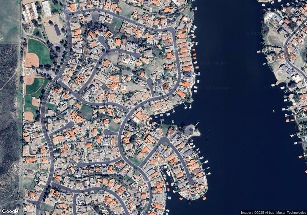
29464 Big Range Rd Canyon Lake, CA 92587
Estimated Value: $954,533 - $1,093,000
4
Beds
4
Baths
2,933
Sq Ft
$346/Sq Ft
Est. Value
About This Home
This home is located at 29464 Big Range Rd, Canyon Lake, CA 92587 and is currently estimated at $1,014,633, approximately $345 per square foot. 29464 Big Range Rd is a home located in Riverside County with nearby schools including Tuscany Hills Elementary School, Canyon Lake Middle School, and Temescal Canyon High School.
Ownership History
Date
Name
Owned For
Owner Type
Purchase Details
Closed on
Mar 8, 2021
Sold by
Nancy A Sternad Trust and Sternad Nancy A
Bought by
Sternad Family Trust and Sternacl
Current Estimated Value
Purchase Details
Closed on
Jan 10, 2013
Sold by
Sternad Thomas C and Sternad Nancy A
Bought by
Sternad Nancy A
Home Financials for this Owner
Home Financials are based on the most recent Mortgage that was taken out on this home.
Original Mortgage
$229,000
Interest Rate
3.27%
Mortgage Type
New Conventional
Purchase Details
Closed on
Mar 11, 2010
Sold by
Robin Investment Inc
Bought by
Sternad Thomas C and Sternad Nancy A
Home Financials for this Owner
Home Financials are based on the most recent Mortgage that was taken out on this home.
Original Mortgage
$260,000
Interest Rate
4.95%
Mortgage Type
New Conventional
Purchase Details
Closed on
Sep 1, 2009
Sold by
Gibson Martin C
Bought by
Robin Investment Inc
Purchase Details
Closed on
May 26, 2004
Sold by
Odell Jeanne K
Bought by
Gibson Martin C
Home Financials for this Owner
Home Financials are based on the most recent Mortgage that was taken out on this home.
Original Mortgage
$405,000
Interest Rate
5.92%
Mortgage Type
Stand Alone First
Purchase Details
Closed on
Apr 2, 2004
Sold by
Carlton David Franklin
Bought by
Carlton Vicki R
Home Financials for this Owner
Home Financials are based on the most recent Mortgage that was taken out on this home.
Original Mortgage
$405,000
Interest Rate
5.92%
Mortgage Type
Stand Alone First
Purchase Details
Closed on
Feb 19, 2004
Sold by
Fitzgerald Robert M and Fitzgerald Mary E
Bought by
Carlton Vicki R
Purchase Details
Closed on
Aug 29, 2000
Sold by
Vincent Depalma and Vincent Marie Depalma
Bought by
Fitzgerald Robert M and Fitzgerald Mary E
Home Financials for this Owner
Home Financials are based on the most recent Mortgage that was taken out on this home.
Original Mortgage
$372,000
Interest Rate
8.37%
Mortgage Type
Purchase Money Mortgage
Create a Home Valuation Report for This Property
The Home Valuation Report is an in-depth analysis detailing your home's value as well as a comparison with similar homes in the area
Home Values in the Area
Average Home Value in this Area
Purchase History
| Date | Buyer | Sale Price | Title Company |
|---|---|---|---|
| Sternad Family Trust | -- | None Listed On Document | |
| Sternad Nancy A | -- | Fidelity National Title | |
| Sternad Thomas C | $560,000 | Lawyers Title Company | |
| Robin Investment Inc | $402,000 | Lawyers Title | |
| Gibson Martin C | -- | Commonwealth Land Title Co | |
| Gibson Martin C | $675,000 | Commonwealth Land Title Co | |
| Carlton Vicki R | -- | Stewart Title Guaranty | |
| Carlton Vicki R | $675,000 | Stewart Title Guaranty | |
| Fitzgerald Robert M | $465,000 | Stewart Title Company |
Source: Public Records
Mortgage History
| Date | Status | Borrower | Loan Amount |
|---|---|---|---|
| Previous Owner | Sternad Nancy A | $229,000 | |
| Previous Owner | Sternad Thomas C | $260,000 | |
| Previous Owner | Gibson Martin C | $405,000 | |
| Previous Owner | Fitzgerald Robert M | $372,000 |
Source: Public Records
Tax History
| Year | Tax Paid | Tax Assessment Tax Assessment Total Assessment is a certain percentage of the fair market value that is determined by local assessors to be the total taxable value of land and additions on the property. | Land | Improvement |
|---|---|---|---|---|
| 2025 | $8,114 | $722,841 | $232,337 | $490,504 |
| 2023 | $8,114 | $694,774 | $223,316 | $471,458 |
| 2022 | $7,709 | $681,152 | $218,938 | $462,214 |
| 2021 | $7,546 | $667,797 | $214,646 | $453,151 |
| 2020 | $7,467 | $660,951 | $212,446 | $448,505 |
| 2019 | $7,069 | $647,992 | $208,281 | $439,711 |
| 2018 | $6,925 | $635,288 | $204,198 | $431,090 |
| 2017 | $6,778 | $622,833 | $200,195 | $422,638 |
| 2016 | $6,513 | $610,621 | $196,270 | $414,351 |
| 2015 | $6,430 | $601,451 | $193,323 | $408,128 |
| 2014 | $6,261 | $589,672 | $189,537 | $400,135 |
Source: Public Records
Map
Nearby Homes
- 22196 Hoofbeat Way
- 29566 Big Range Rd
- 22170 Mustang Ct
- 22176 Dogie Place
- 22443 Whirlaway Ct
- 29629 Big Range Rd
- 0 Mustang Ct Unit AR26002055
- 22138 Drover Way
- 22207 Vacation Dr
- 29110 Longhorn Dr
- 22283 Vacation Dr
- 22535 San Joaquin Dr W
- 29595 Longhorn Dr
- 22262 San Joaquin Dr W
- 22564 Inspiration Point
- 29670 Longhorn Dr
- 29710 Longhorn Dr
- 28970 Vacation Dr
- 30026 Big Range Rd
- 22711 Inspiration Point
- 29452 Big Range Rd
- 29440 Big Range Rd
- 29494 Big Range Rd
- 0 Pinto Dr
- 29441 Big Range Rd
- 29506 Big Range Rd
- 29428 Big Range Rd
- 29471 Big Range Rd
- 29483 Big Range Rd
- 29518 Big Range Rd
- 29495 Big Range Rd
- 22294 Whirlaway Ct
- 29411 Big Range Rd
- 29411 Big Range Rd
- 29404 Big Range Rd
- 29507 Big Range Rd
- 22280 Whirlaway Ct
- 22286 Pinto Dr
- 29542 Big Range Rd
- 22281 Pinto Dr
