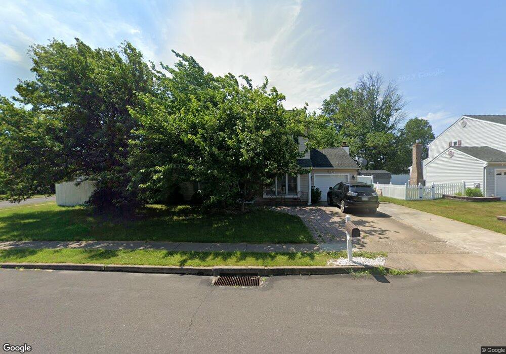
2949 Wexford Rd Bensalem, PA 19020
Neshaminy Valley NeighborhoodEstimated Value: $407,000 - $599,000
4
Beds
2
Baths
2,160
Sq Ft
$245/Sq Ft
Est. Value
About This Home
This home is located at 2949 Wexford Rd, Bensalem, PA 19020 and is currently estimated at $529,243, approximately $245 per square foot. 2949 Wexford Rd is a home located in Bucks County with nearby schools including Valley Elementary School, St. Ephrem School, and Bensalem Baptist School.
Ownership History
Date
Name
Owned For
Owner Type
Purchase Details
Closed on
Jun 29, 1999
Sold by
Deblass Thomas B and Deblass Glenys D
Bought by
Sardar Sarfraz and Sardar Shamsa S
Current Estimated Value
Home Financials for this Owner
Home Financials are based on the most recent Mortgage that was taken out on this home.
Original Mortgage
$111,910
Outstanding Balance
$30,926
Interest Rate
7.39%
Estimated Equity
$498,317
Purchase Details
Closed on
Dec 7, 1990
Bought by
Deblass Thomas B and Deblass Glenys D
Create a Home Valuation Report for This Property
The Home Valuation Report is an in-depth analysis detailing your home's value as well as a comparison with similar homes in the area
Home Values in the Area
Average Home Value in this Area
Purchase History
| Date | Buyer | Sale Price | Title Company |
|---|---|---|---|
| Sardar Sarfraz | $117,800 | -- | |
| Deblass Thomas B | $125,000 | -- |
Source: Public Records
Mortgage History
| Date | Status | Borrower | Loan Amount |
|---|---|---|---|
| Open | Sardar Sarfraz | $111,910 |
Source: Public Records
Tax History Compared to Growth
Tax History
| Year | Tax Paid | Tax Assessment Tax Assessment Total Assessment is a certain percentage of the fair market value that is determined by local assessors to be the total taxable value of land and additions on the property. | Land | Improvement |
|---|---|---|---|---|
| 2025 | $6,449 | $29,540 | $6,080 | $23,460 |
| 2024 | $6,449 | $29,540 | $6,080 | $23,460 |
| 2023 | $6,267 | $29,540 | $6,080 | $23,460 |
| 2022 | $6,230 | $29,540 | $6,080 | $23,460 |
| 2021 | $6,230 | $29,540 | $6,080 | $23,460 |
| 2020 | $6,167 | $29,540 | $6,080 | $23,460 |
| 2019 | $6,030 | $29,540 | $6,080 | $23,460 |
| 2018 | $5,890 | $29,540 | $6,080 | $23,460 |
| 2017 | $5,853 | $29,540 | $6,080 | $23,460 |
| 2016 | $5,853 | $29,540 | $6,080 | $23,460 |
| 2015 | -- | $29,540 | $6,080 | $23,460 |
| 2014 | -- | $29,540 | $6,080 | $23,460 |
Source: Public Records
Map
Nearby Homes
- 3200 Ellington Ct
- 5762 Prescott Ct
- 6501 Saratoga Turn
- 3255 Independence Ct
- 6257 Nathan Hale Ct
- 6369 Powder Horn Ct
- 2493 Barnsleigh Dr
- 927 Bellevue Ave
- 1838 Sheri Rd
- 4525 Winding Brook Dr Unit 4525
- 5813 Edge Ave
- 6561 Neshaminy Valley Dr
- 4902 Oxford Ct
- 4828 Oxford Ct
- 1407 Cornflower Ln
- 440 Dehaven Ave
- 3021 Claridge Rd
- 223 Saddlebrook Dr
- 225 Saddlebrook Dr
- 5178 Neshaminy Blvd
- 2943 Wexford Rd
- 2955 Camborne Ct
- 2961 Camborne Ct
- 2937 Wexford Rd
- 2531 Nashua Rd
- 2978 Wexford Rd
- 2984 Wexford Rd
- 2972 Wexford Rd
- 2519 Nashua Rd
- 2525 Nashua Rd
- 2513 Nashua Rd
- 2990 Wexford Rd
- 2967 Camborne Ct
- 2966 Wexford Rd
- 2507 Nashua Rd
- 3000 Rampart Rd
- 2973 Camborne Ct
- 2960 Wexford Rd
- 2548 Nashua Rd
- 2542 Nashua Rd