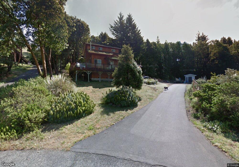
295 Burns Ct Whitethorn, CA 95589
Shelter Cove NeighborhoodEstimated Value: $340,000 - $520,000
2
Beds
2
Baths
1,296
Sq Ft
$328/Sq Ft
Est. Value
About This Home
This home is located at 295 Burns Ct, Whitethorn, CA 95589 and is currently estimated at $425,432, approximately $328 per square foot. 295 Burns Ct is a home located in Humboldt County.
Ownership History
Date
Name
Owned For
Owner Type
Purchase Details
Closed on
Sep 6, 2018
Sold by
Flora Barry R and Flora Marty
Bought by
Olsen Summer J
Current Estimated Value
Home Financials for this Owner
Home Financials are based on the most recent Mortgage that was taken out on this home.
Original Mortgage
$237,500
Outstanding Balance
$206,687
Interest Rate
4.5%
Mortgage Type
New Conventional
Estimated Equity
$218,745
Purchase Details
Closed on
Jul 3, 2018
Sold by
Flora Barry R and Flora Marty
Bought by
Olsen Summer J
Home Financials for this Owner
Home Financials are based on the most recent Mortgage that was taken out on this home.
Original Mortgage
$237,500
Interest Rate
4.5%
Mortgage Type
New Conventional
Purchase Details
Closed on
Dec 19, 1997
Sold by
Kuhn Eric W
Bought by
Flora Barry R and Flora Marty
Home Financials for this Owner
Home Financials are based on the most recent Mortgage that was taken out on this home.
Original Mortgage
$12,500
Interest Rate
6.95%
Mortgage Type
Seller Take Back
Create a Home Valuation Report for This Property
The Home Valuation Report is an in-depth analysis detailing your home's value as well as a comparison with similar homes in the area
Home Values in the Area
Average Home Value in this Area
Purchase History
| Date | Buyer | Sale Price | Title Company |
|---|---|---|---|
| Olsen Summer J | $250,000 | Lawyers Title | |
| Olsen Summer J | $250,000 | Lawyers Title | |
| Flora Barry R | $17,500 | Humboldt Land Title Company |
Source: Public Records
Mortgage History
| Date | Status | Borrower | Loan Amount |
|---|---|---|---|
| Open | Olsen Summer J | $237,500 | |
| Previous Owner | Olsen Summer J | $237,500 | |
| Previous Owner | Flora Barry R | $12,500 |
Source: Public Records
Tax History Compared to Growth
Tax History
| Year | Tax Paid | Tax Assessment Tax Assessment Total Assessment is a certain percentage of the fair market value that is determined by local assessors to be the total taxable value of land and additions on the property. | Land | Improvement |
|---|---|---|---|---|
| 2025 | $3,255 | $278,873 | $94,816 | $184,057 |
| 2024 | $3,255 | $273,406 | $92,957 | $180,449 |
| 2023 | $3,268 | $268,046 | $91,135 | $176,911 |
| 2022 | $3,221 | $262,792 | $89,349 | $173,443 |
| 2021 | $3,107 | $257,641 | $87,598 | $170,043 |
| 2020 | $3,125 | $255,000 | $86,700 | $168,300 |
| 2019 | $3,053 | $250,000 | $85,000 | $165,000 |
| 2018 | $2,231 | $181,278 | $24,547 | $156,731 |
| 2017 | $2,093 | $177,724 | $24,066 | $153,658 |
| 2016 | $2,080 | $174,241 | $23,595 | $150,646 |
| 2015 | $2,069 | $171,625 | $23,241 | $148,384 |
| 2014 | $1,954 | $168,264 | $22,786 | $145,478 |
Source: Public Records
Map
Nearby Homes
- 296 Burns Ct
- 289 Burns Ct
- 2600 Toth Rd
- 982 Willow Glen
- 856 Toth Rd
- 247 Burns Ct
- 39 Seneca Ct
- 274 Burns Ct
- 874 Toth Rd
- 215 Burns Ct
- 835 Toth Rd
- 902 Toth Rd
- 896 Willow Glen
- 228 Burns Ct
- 178 & 780 Burns Ct & Forest St
- 178 & 790 Burns Ct & Forest St
- 935 Toth Rd
- 178 & 780 Burns Ct
- 154 Burns Ct
- 292 Burns Ct