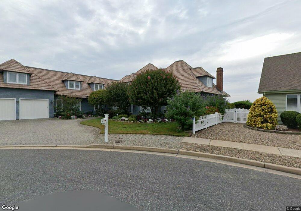
295 Curtis Point Dr Mantoloking, NJ 08738
Estimated Value: $5,590,000 - $6,374,000
5
Beds
6
Baths
5,674
Sq Ft
$1,069/Sq Ft
Est. Value
About This Home
This home is located at 295 Curtis Point Dr, Mantoloking, NJ 08738 and is currently estimated at $6,064,121, approximately $1,068 per square foot. 295 Curtis Point Dr is a home located in Ocean County with nearby schools including Emma Havens Young Elementary School, Lake Riviera Middle School, and Brick Township High School.
Ownership History
Date
Name
Owned For
Owner Type
Purchase Details
Closed on
May 5, 2006
Sold by
Evslin Tom I and Evslin Mary A
Bought by
Druskin Robert and Druskin Harriett
Current Estimated Value
Purchase Details
Closed on
Feb 17, 1999
Sold by
Quinn Jeanne
Bought by
Quinn Kevin
Purchase Details
Closed on
May 15, 1997
Sold by
Walter Charles J
Bought by
Quinn Kevin and Quinn Jeanne
Home Financials for this Owner
Home Financials are based on the most recent Mortgage that was taken out on this home.
Original Mortgage
$400,000
Interest Rate
8.12%
Create a Home Valuation Report for This Property
The Home Valuation Report is an in-depth analysis detailing your home's value as well as a comparison with similar homes in the area
Home Values in the Area
Average Home Value in this Area
Purchase History
| Date | Buyer | Sale Price | Title Company |
|---|---|---|---|
| Druskin Robert | $4,800,000 | None Available | |
| Quinn Kevin | -- | Old Republic Natl Title Ins | |
| Quinn Kevin | $750,000 | -- |
Source: Public Records
Mortgage History
| Date | Status | Borrower | Loan Amount |
|---|---|---|---|
| Previous Owner | Quinn Kevin | $400,000 |
Source: Public Records
Tax History Compared to Growth
Tax History
| Year | Tax Paid | Tax Assessment Tax Assessment Total Assessment is a certain percentage of the fair market value that is determined by local assessors to be the total taxable value of land and additions on the property. | Land | Improvement |
|---|---|---|---|---|
| 2025 | $69,764 | $2,700,900 | $1,482,400 | $1,218,500 |
| 2024 | $66,307 | $2,700,900 | $1,482,400 | $1,218,500 |
| 2023 | $65,443 | $2,700,900 | $1,482,400 | $1,218,500 |
| 2022 | $65,443 | $2,700,900 | $1,482,400 | $1,218,500 |
| 2021 | $64,065 | $2,700,900 | $1,482,400 | $1,218,500 |
| 2020 | $63,255 | $2,700,900 | $1,482,400 | $1,218,500 |
| 2019 | $62,202 | $2,700,900 | $1,482,400 | $1,218,500 |
| 2018 | $60,770 | $2,700,900 | $1,482,400 | $1,218,500 |
| 2017 | $59,123 | $2,700,900 | $1,482,400 | $1,218,500 |
| 2016 | $58,826 | $2,700,900 | $1,482,400 | $1,218,500 |
| 2015 | $57,286 | $2,700,900 | $1,482,400 | $1,218,500 |
| 2014 | $56,827 | $2,700,900 | $1,482,400 | $1,218,500 |
Source: Public Records
Map
Nearby Homes
- 275 Curtis Point Dr
- 233 Curtis Point Dr
- 122 Squan Beach Dr
- 304 Schooner Ln
- 150 Sunset Ln
- 1519 Runyon Ln
- 308 Cove Dr
- 366 Highway 35 N
- 1318 Ocean Ave
- 438 Highway 35 N Unit 1304
- 12 Shell Rd
- 124 Saint Lawrence Blvd
- 64 W Granada Dr
- 1207 Ocean Ave
- 1201 Ocean Ave
- 45 W Granada Dr
- 305 Alameda Dr
- 34 W Granada Dr
- 108 Rochester Dr
- 515 New Jersey 35
- 291 Curtis Point Dr
- 296 Curtis Point Dr
- 287 Curtis Point Dr
- 292 Curtis Point Dr
- 225 Squan Beach Dr
- 229 Squan Beach Dr
- 283 Curtis Point Dr
- 221 Squan Beach Dr
- 284 Curtis Point Dr
- 279 Curtis Point Dr
- 217 Squan Beach Dr
- 213 Squan Beach Dr
- 282 Curtis Point Dr
- 248 Squan Beach Dr
- 201 Squan Beach Dr
- 205 Squan Beach Dr
- 197 Squan Beach Dr
- 244 Squan Beach Dr
- 240 Squan Beach Dr
- 193 Squan Beach Dr