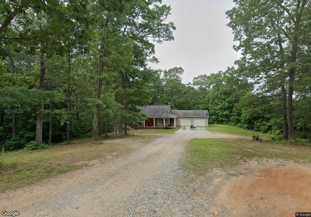
295 Josie Ln Canton, GA 30114
Estimated Value: $211,000 - $522,572
4
Beds
3
Baths
1,794
Sq Ft
$226/Sq Ft
Est. Value
About This Home
This home is located at 295 Josie Ln, Canton, GA 30114 and is currently estimated at $405,643, approximately $226 per square foot. 295 Josie Ln is a home located in Cherokee County with nearby schools including J. Knox Elementary School, Teasley Middle School, and Cherokee High School.
Ownership History
Date
Name
Owned For
Owner Type
Purchase Details
Closed on
Jan 30, 2025
Sold by
Frankum Amanda Gail
Bought by
Faulkner Jimmy W and Frankum Amanda Gail
Current Estimated Value
Purchase Details
Closed on
Jan 24, 2025
Sold by
Faulkner Jimmy W
Bought by
Frankum Amanda Gail and Frankum Kim N
Purchase Details
Closed on
Mar 25, 2009
Sold by
Faulkner Jimmy W and Faulkner Linda G
Bought by
Faulkner Jimmy W and Faulkner Linda G
Home Financials for this Owner
Home Financials are based on the most recent Mortgage that was taken out on this home.
Original Mortgage
$308,139
Interest Rate
5.14%
Mortgage Type
FHA
Purchase Details
Closed on
Apr 28, 2008
Sold by
Faulkner Jimmy W
Bought by
Faulkner Jimmy W and Faulkner Linda G
Home Financials for this Owner
Home Financials are based on the most recent Mortgage that was taken out on this home.
Original Mortgage
$303,586
Interest Rate
5.82%
Mortgage Type
FHA
Create a Home Valuation Report for This Property
The Home Valuation Report is an in-depth analysis detailing your home's value as well as a comparison with similar homes in the area
Home Values in the Area
Average Home Value in this Area
Purchase History
| Date | Buyer | Sale Price | Title Company |
|---|---|---|---|
| Faulkner Jimmy W | -- | -- | |
| Frankum Amanda Gail | $207,000 | -- | |
| Faulkner Jimmy W | -- | -- | |
| Faulkner Jimmy W | $303,586 | -- | |
| Faulkner Jimmy W | -- | -- |
Source: Public Records
Mortgage History
| Date | Status | Borrower | Loan Amount |
|---|---|---|---|
| Previous Owner | Faulkner Jimmy W | $308,139 | |
| Previous Owner | Faulkner Jimmy W | $303,586 |
Source: Public Records
Tax History Compared to Growth
Tax History
| Year | Tax Paid | Tax Assessment Tax Assessment Total Assessment is a certain percentage of the fair market value that is determined by local assessors to be the total taxable value of land and additions on the property. | Land | Improvement |
|---|---|---|---|---|
| 2024 | $1,080 | $196,560 | $21,280 | $175,280 |
| 2023 | $1,233 | $199,240 | $21,280 | $177,960 |
| 2022 | $988 | $152,920 | $21,280 | $131,640 |
| 2021 | $958 | $123,160 | $17,720 | $105,440 |
| 2020 | $873 | $100,280 | $17,720 | $82,560 |
| 2019 | $741 | $85,520 | $17,720 | $67,800 |
| 2018 | $731 | $82,920 | $17,720 | $65,200 |
| 2017 | $764 | $211,300 | $17,720 | $66,800 |
| 2016 | $730 | $196,100 | $15,880 | $62,560 |
| 2015 | $743 | $193,800 | $13,440 | $64,080 |
| 2014 | $720 | $187,000 | $11,600 | $63,200 |
Source: Public Records
Map
Nearby Homes
- 7840 Knox Bridge Hwy
- 537 Oriole Farm Trail Unit 4L
- 805 Cardinal Point Unit 4L
- 229 Crestwood Dr
- 4983 Millwood Dr
- 431 Gold Crossing
- 210 Oakview Dr
- 233 Oakview Dr
- 905 Fox Croft Place
- 906 Fox Croft Place
- 105 Bridle Ct
- 503 Fable Ln
- 137 Legend Creek Dr
- 117 Market Ln
- 259 Deer Valley Run
- 273 Deer Valley Run
- 305 Deer Valley Run
- 309 Deer Valley Run
- 272 Deer Valley Run
- 280 Josie Ln
- 275 Josie Ln
- 195 Josie Ln
- 6777 Neil Densmore Trail
- 6731 Neil Densmore Trail
- 6770 Neil Densmore Trail
- 6714 Neil Densmore Trail
- 6722 Neil Densmore Trail
- Lot 8 Neal Densmore Trail Rd
- 506 Neil Ct
- 6793 Neil Densmore Trail
- 520 Oriole Farm Trail
- 522 Oriole Farm Trail
- 524 Oriole Farm Trail
- 516 Oriole Farm Trail
- 526 Oriole Farm Trail Unit 4L
- 514 Oriole Farm Trail
- 134 Pope Cir
- 528 Oriole Farm Trail
- 512 Oriole Farm Trail Unit 4L