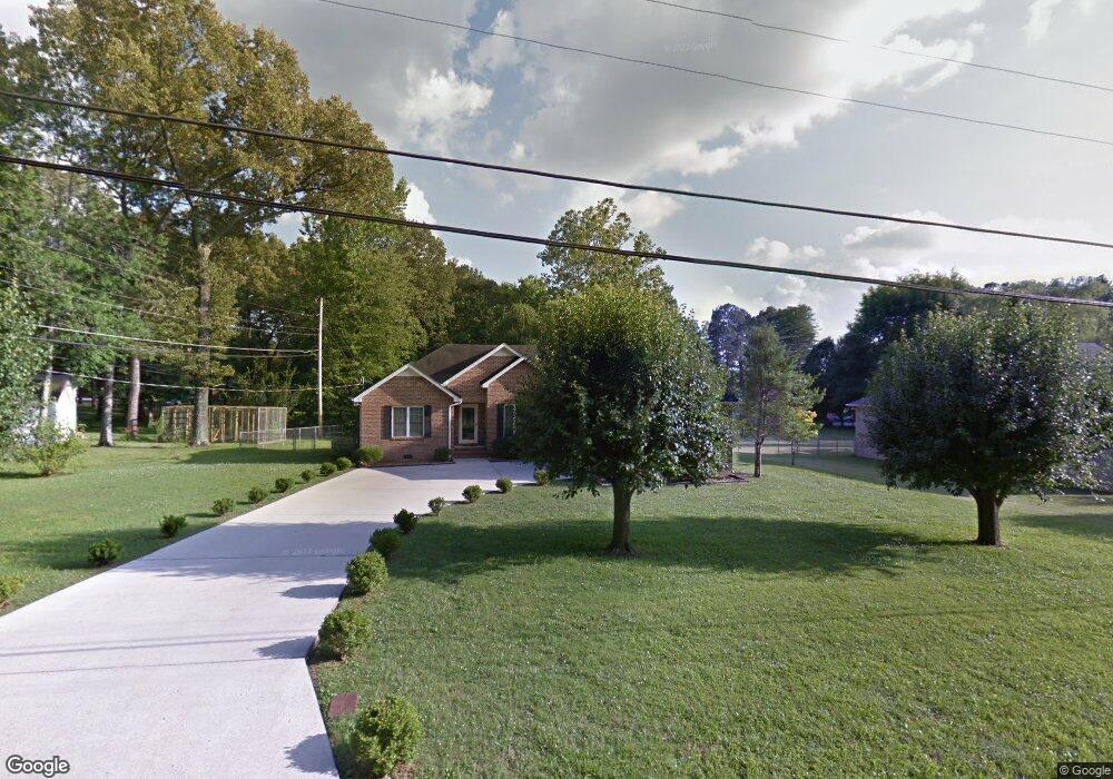
295 White Oak Dr Manchester, TN 37355
Estimated Value: $312,526 - $360,000
--
Bed
3
Baths
1,788
Sq Ft
$192/Sq Ft
Est. Value
About This Home
This home is located at 295 White Oak Dr, Manchester, TN 37355 and is currently estimated at $343,132, approximately $191 per square foot. 295 White Oak Dr is a home located in Coffee County with nearby schools including Westwood Middle School and Temple Baptist Christian School.
Ownership History
Date
Name
Owned For
Owner Type
Purchase Details
Closed on
Oct 25, 2018
Sold by
Porter Charles Larry
Bought by
Woods Bonez Reed
Current Estimated Value
Purchase Details
Closed on
Nov 4, 2014
Sold by
Porter Charles Larry
Bought by
Porter Charles Larry
Purchase Details
Closed on
Jul 3, 2014
Sold by
Porter Charles Larry
Bought by
Porter Charles Larry
Purchase Details
Closed on
Apr 3, 2012
Sold by
Parker-Porter Shannon
Bought by
Porter Charles L
Purchase Details
Closed on
Jul 15, 2008
Sold by
Fletcher Basil Rex
Bought by
Porter Charles L
Purchase Details
Closed on
Jun 29, 2004
Bought by
Fletcher Basil Rex Jr & Shirley
Create a Home Valuation Report for This Property
The Home Valuation Report is an in-depth analysis detailing your home's value as well as a comparison with similar homes in the area
Home Values in the Area
Average Home Value in this Area
Purchase History
| Date | Buyer | Sale Price | Title Company |
|---|---|---|---|
| Woods Bonez Reed | $190,000 | Bell & Alexander Title | |
| Porter Charles Larry | -- | -- | |
| Porter Charles Larry | -- | -- | |
| Porter Charles L | -- | -- | |
| Porter Charles L | $164,000 | -- | |
| Fletcher Basil Rex Jr & Shirley | $123,000 | -- |
Source: Public Records
Tax History Compared to Growth
Tax History
| Year | Tax Paid | Tax Assessment Tax Assessment Total Assessment is a certain percentage of the fair market value that is determined by local assessors to be the total taxable value of land and additions on the property. | Land | Improvement |
|---|---|---|---|---|
| 2024 | $2,468 | $58,525 | $3,750 | $54,775 |
| 2023 | $2,284 | $58,525 | $0 | $0 |
| 2022 | $1,967 | $54,200 | $3,750 | $50,450 |
| 2021 | $1,895 | $41,375 | $3,000 | $38,375 |
| 2020 | $1,895 | $41,375 | $3,000 | $38,375 |
| 2019 | $1,895 | $41,375 | $3,000 | $38,375 |
| 2018 | $1,895 | $41,375 | $3,000 | $38,375 |
| 2017 | $1,893 | $36,075 | $3,000 | $33,075 |
| 2016 | $1,893 | $36,075 | $3,000 | $33,075 |
| 2015 | $1,892 | $36,075 | $3,000 | $33,075 |
| 2014 | $1,893 | $36,081 | $0 | $0 |
Source: Public Records
Map
Nearby Homes
- 141 Doak Rd
- 75 Belmar Rd
- 216 Spring House Dr
- 272 Belmar Cir
- 383 Doak Rd
- 158 Dogwood Dr
- 248 Doak Rd
- Lot 76 Philips
- 401 Doak Rd
- 108 Belmar Cir
- 31 Spring House Dr
- 0 Expressway Dr
- 223 Duck River Rd
- 113 Creek Wood Rd
- 645 Doak Rd
- 0 Sherwood Dr
- 58 Brooklyn Ave
- 31 Brooklyn Ave
- 42 Brooklyn Ave
- 57 Brooklyn Ave
- 315 White Oak Dr
- 249 White Oak Dr
- 177 Doak Rd
- 221 Doak Rd
- 296 White Oak Dr
- 60 Shaw Cir
- 256 White Oak Dr
- 215 White Oak Dr
- 190 Doak Rd
- 162 Doak Rd
- 67 Shaw Cir
- 80 Shaw Cir
- 23 Belmar Cir
- 202 White Oak Dr
- 136 Doak Rd
- 2140 Hillsboro Blvd
- 106 Doak Rd
- 169 White Oak Dr
- 0 White Oak Dr
- 2166 Hillsboro Blvd Unit 2174