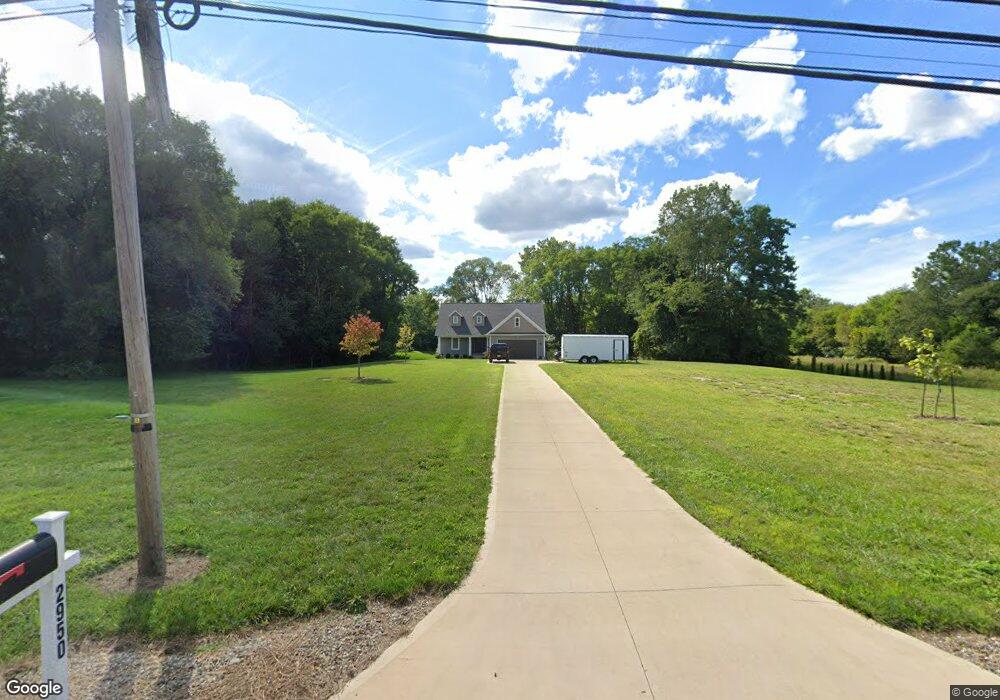
2950 W River Rd N Elyria, OH 44035
Estimated Value: $287,000 - $498,842
2
Beds
2
Baths
2,555
Sq Ft
$136/Sq Ft
Est. Value
About This Home
This home is located at 2950 W River Rd N, Elyria, OH 44035 and is currently estimated at $347,711, approximately $136 per square foot. 2950 W River Rd N is a home with nearby schools including Crestwood Elementary School, Westwood Middle School, and Elyria High School.
Ownership History
Date
Name
Owned For
Owner Type
Purchase Details
Closed on
Nov 3, 2021
Sold by
Stanley John J and Stanley Laurel A
Bought by
Stanley John J and Stanley Laurel A
Current Estimated Value
Purchase Details
Closed on
Mar 28, 2019
Sold by
Griffith John P and Griffith Kc Nicole
Bought by
Stanley John J and Stanley Laurel A
Purchase Details
Closed on
May 29, 2003
Sold by
Griffith Arlene T and Earl Griffith R
Bought by
Griffith Arlene T
Purchase Details
Closed on
May 5, 2000
Sold by
Griffith John P and Arlene Earl
Bought by
Griffith R Earl and Griffith Arlene T
Create a Home Valuation Report for This Property
The Home Valuation Report is an in-depth analysis detailing your home's value as well as a comparison with similar homes in the area
Home Values in the Area
Average Home Value in this Area
Purchase History
| Date | Buyer | Sale Price | Title Company |
|---|---|---|---|
| Stanley John J | -- | None Available | |
| Stanley John J | $62,500 | None Available | |
| Griffith Arlene T | -- | -- | |
| Griffith R Earl | -- | -- |
Source: Public Records
Tax History
| Year | Tax Paid | Tax Assessment Tax Assessment Total Assessment is a certain percentage of the fair market value that is determined by local assessors to be the total taxable value of land and additions on the property. | Land | Improvement |
|---|---|---|---|---|
| 2024 | $6,489 | $136,637 | $36,288 | $100,349 |
| 2023 | $7,387 | $135,030 | $36,831 | $98,200 |
| 2022 | $7,360 | $135,030 | $36,831 | $98,200 |
| 2021 | $1,378 | $24,707 | $24,707 | $0 |
| 2020 | $1,324 | $21,120 | $21,120 | $0 |
| 2019 | $1,316 | $21,120 | $21,120 | $0 |
| 2018 | $1,296 | $21,120 | $21,120 | $0 |
| 2017 | $1,313 | $20,160 | $20,160 | $0 |
| 2016 | $1,297 | $20,160 | $20,160 | $0 |
| 2015 | $1,216 | $20,160 | $20,160 | $0 |
| 2014 | $1,202 | $20,160 | $20,160 | $0 |
| 2013 | $1,192 | $20,160 | $20,160 | $0 |
Source: Public Records
Map
Nearby Homes
- V/L Rear Land Unit 1
- V/L Rear Land Unit 2
- 5193 Liberty Ave
- 416 Deer Crossing
- VL Ridgewood St
- 5196 Farr Ave
- 41629 Northwood St
- 4721 Andover Ave
- 42953 N Ridge Rd
- V/L Grove Ave
- 4510 Riverside Dr
- 4429 Norfolk Ave
- 4411 Tacoma Ave
- 4434 Riverside Dr
- 4223 Palm Ave
- 4217 Camden Ave
- 42190 Helen St
- V/L Clinton Ave
- 2108 E 41st St
- 6445 Lake Ave
- 2920 W River Rd N
- V/L W River Rd N
- 2934 W River Rd N
- 2306 Eschtruth St
- 2312 Eschtruth St
- 3038 W River Rd N
- 2322 Eschtruth St
- 2260 Eschtruth St
- 2300 Eschtruth St
- 2270 Eschtruth St
- 2332 Eschtruth St
- 2894 W River Rd N
- 3050 W River Rd N
- 2370 Eschtruth St
- 2902 W River Rd N
- 3100 W River Rd N
- 3100 W River Rd N
- V/L Eschtruth St
- 2240 Eschtruth St
- 2895 W River Rd N
Your Personal Tour Guide
Ask me questions while you tour the home.