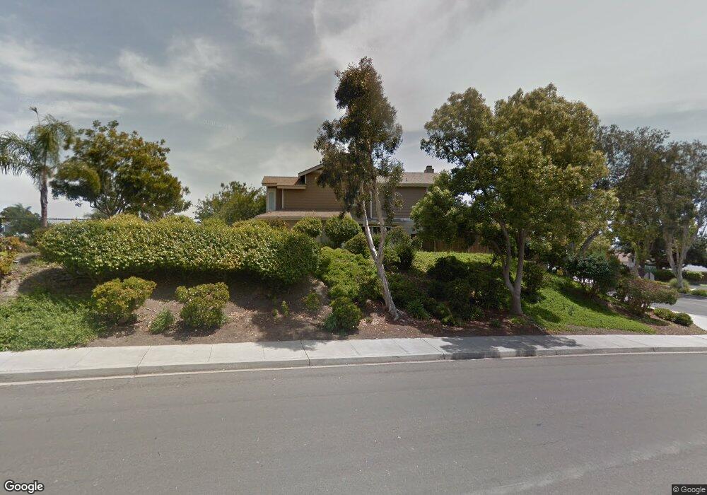
2953 Cape Cod Cir Carlsbad, CA 92010
Calavera Hills NeighborhoodEstimated Value: $881,000 - $1,000,000
3
Beds
3
Baths
1,452
Sq Ft
$639/Sq Ft
Est. Value
About This Home
This home is located at 2953 Cape Cod Cir, Carlsbad, CA 92010 and is currently estimated at $927,684, approximately $638 per square foot. 2953 Cape Cod Cir is a home located in San Diego County with nearby schools including Hope Elementary School, Calavera Hills Middle, and Sage Creek High.
Ownership History
Date
Name
Owned For
Owner Type
Purchase Details
Closed on
Jun 3, 2022
Sold by
Keers Peggy A
Bought by
Peggy A Keers Revocable Trust
Current Estimated Value
Purchase Details
Closed on
Jan 23, 2002
Sold by
Ragosta Robert G
Bought by
Keers Raymond and Keers Peggy
Home Financials for this Owner
Home Financials are based on the most recent Mortgage that was taken out on this home.
Original Mortgage
$201,600
Interest Rate
6.8%
Create a Home Valuation Report for This Property
The Home Valuation Report is an in-depth analysis detailing your home's value as well as a comparison with similar homes in the area
Home Values in the Area
Average Home Value in this Area
Purchase History
| Date | Buyer | Sale Price | Title Company |
|---|---|---|---|
| Peggy A Keers Revocable Trust | -- | None Listed On Document | |
| Keers Raymond | $252,000 | Southland Title |
Source: Public Records
Mortgage History
| Date | Status | Borrower | Loan Amount |
|---|---|---|---|
| Previous Owner | Keers Raymond | $201,600 |
Source: Public Records
Tax History
| Year | Tax Paid | Tax Assessment Tax Assessment Total Assessment is a certain percentage of the fair market value that is determined by local assessors to be the total taxable value of land and additions on the property. | Land | Improvement |
|---|---|---|---|---|
| 2025 | $3,853 | $372,262 | $221,586 | $150,676 |
| 2024 | $3,853 | $364,964 | $217,242 | $147,722 |
| 2023 | $3,831 | $357,809 | $212,983 | $144,826 |
| 2022 | $3,770 | $350,794 | $208,807 | $141,987 |
| 2021 | $3,741 | $343,916 | $204,713 | $139,203 |
| 2020 | $3,715 | $340,390 | $202,614 | $137,776 |
| 2019 | $3,647 | $333,717 | $198,642 | $135,075 |
| 2018 | $3,492 | $327,175 | $194,748 | $132,427 |
| 2017 | $3,432 | $320,761 | $190,930 | $129,831 |
| 2016 | $3,293 | $314,473 | $187,187 | $127,286 |
| 2015 | $3,279 | $309,751 | $184,376 | $125,375 |
| 2014 | $3,223 | $303,685 | $180,765 | $122,920 |
Source: Public Records
Map
Nearby Homes
- 3652 Jetty Point
- 2835 Hillsboro Ct
- 2823 Andover Ave
- 3434 Ravine Dr
- 2808 Winthrop Ave
- 4375 Stanford St
- 2822 Winthrop Ave
- 3593 Granite Ct
- 3019 Glenbrook St
- 4378 Shasta Place
- 3594 Granite Ct
- 3522 Buck Ridge Ave
- 3505 N Fork Ave
- 3712 Ridge Ct
- 3492 Corvallis St
- 3722 Bergen Peak Place
- 2622 Half Dome Place
- 3122 Salina Rd
- 4822 Nelson Ct
- 4843 Nelson Ct
- 2955 Cape Cod Cir
- 2951 Cape Cod Cir
- 2957 Cape Cod Cir
- 2961 Cape Cod Cir
- 2963 Cape Cod Cir
- 2965 Cape Cod Cir
- 2904 Lancaster Rd
- 2896 Lancaster Rd
- 2925 Cape Cod Cir
- 2908 Lancaster Rd
- 2894 Lancaster Rd
- 2910 Lancaster Rd
- 2892 Lancaster Rd
- 2952 Cape Cod Cir
- 2912 Lancaster Rd
- 2954 Cape Cod Cir
- 2890 Lancaster Rd
- 2956 Cape Cod Cir
- 2958 Cape Cod Cir
- 2888 Lancaster Rd
Your Personal Tour Guide
Ask me questions while you tour the home.