Estimated Value: $478,766 - $502,000
Studio
1
Bath
3,351
Sq Ft
$146/Sq Ft
Est. Value
About This Home
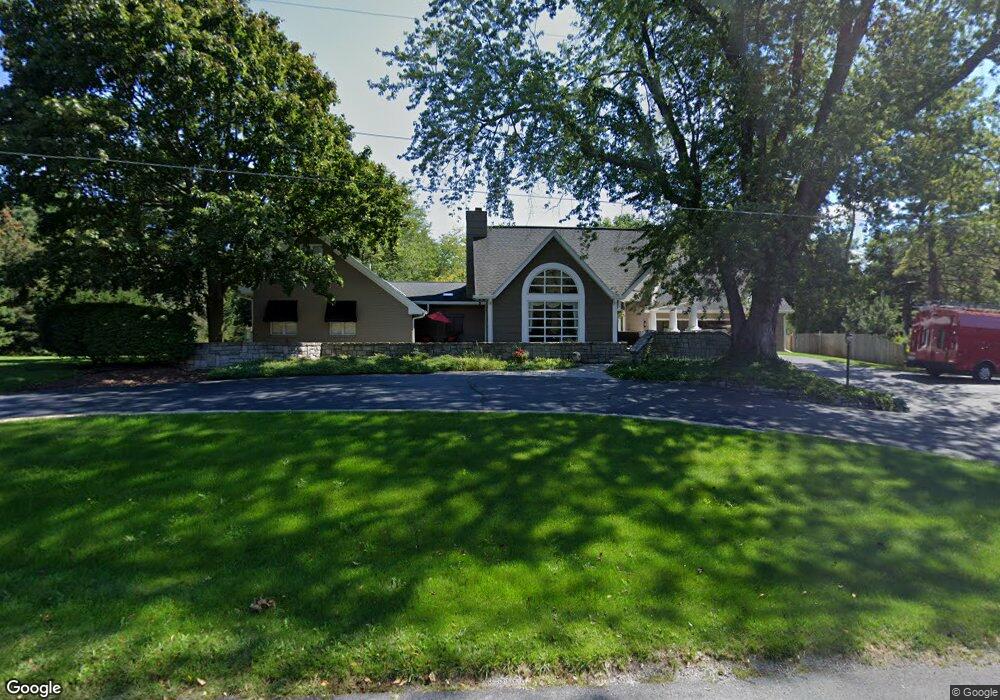
This home is located at 2958 Dobie Rd, Mason, MI 48854 and is currently estimated at $489,922, approximately $146 per square foot. 2958 Dobie Rd is a home located in Ingham County with nearby schools including Hiawatha Elementary School, Kinawa School, and Chippewa Middle School.
Ownership History
Date
Name
Owned For
Owner Type
Purchase Details
Closed on
Aug 26, 2005
Sold by
Bartel Harvey E
Bought by
Parry Craig T and Parry Shannon E
Current Estimated Value
Home Financials for this Owner
Home Financials are based on the most recent Mortgage that was taken out on this home.
Original Mortgage
$344,000
Interest Rate
6.4%
Mortgage Type
New Conventional
Purchase Details
Closed on
Aug 10, 2005
Sold by
Bartel Brenda K
Bought by
Bartel Harvey E
Home Financials for this Owner
Home Financials are based on the most recent Mortgage that was taken out on this home.
Original Mortgage
$344,000
Interest Rate
6.4%
Mortgage Type
New Conventional
Create a Home Valuation Report for This Property
The Home Valuation Report is an in-depth analysis detailing your home's value as well as a comparison with similar homes in the area
Home Values in the Area
Average Home Value in this Area
Purchase History
| Date | Buyer | Sale Price | Title Company |
|---|---|---|---|
| Parry Craig T | $444,000 | Chicago Title Insurance Co | |
| Bartel Harvey E | -- | None Available |
Source: Public Records
Mortgage History
| Date | Status | Borrower | Loan Amount |
|---|---|---|---|
| Previous Owner | Parry Craig T | $344,000 |
Source: Public Records
Tax History
| Year | Tax Paid | Tax Assessment Tax Assessment Total Assessment is a certain percentage of the fair market value that is determined by local assessors to be the total taxable value of land and additions on the property. | Land | Improvement |
|---|---|---|---|---|
| 2025 | $7,824 | $264,400 | $20,700 | $243,700 |
| 2024 | $7,225 | $269,100 | $20,700 | $248,400 |
| 2023 | $7,225 | $236,100 | $20,700 | $215,400 |
| 2022 | $6,876 | $215,700 | $20,700 | $195,000 |
| 2021 | $6,764 | $209,800 | $20,700 | $189,100 |
| 2020 | $6,653 | $211,700 | $20,700 | $191,000 |
| 2019 | $6,403 | $199,100 | $20,700 | $178,400 |
| 2018 | $6,268 | $186,600 | $20,700 | $165,900 |
| 2017 | $5,913 | $186,600 | $20,700 | $165,900 |
| 2016 | -- | $199,100 | $20,700 | $178,400 |
| 2015 | -- | $177,400 | $41,400 | $136,000 |
| 2014 | -- | $162,600 | $41,400 | $121,200 |
Source: Public Records
Map
Nearby Homes
- 3518 Apple Valley Rd Unit 10
- 2004 Timberview Dr
- 3648 E Meadows Ct
- 1995 Belwood Dr
- 3633 Wandering Way
- 2005 Cimarron Dr
- 2060 Tamarack Dr
- 3781 Sandlewood Dr
- 1144 Bonanza Dr
- 3836 Okemos Rd
- 0 Holt Rd
- 3729 Crane Cir
- 3738 Crane Cir
- 3735 Crane Cir
- 2740 Lupine Dr
- 1995 N Every Rd
- 2699 Tapestry Dr
- 4214 Sugar Maple Ln
- 2717 Tapestry Dr Unit 51
- 1315 Leeward Dr
- 2954 Dobie Rd
- 2950 Dobie Rd
- 2988 Dobie Rd Unit 5
- 2975 Dobie Rd
- 2956 Dobie Rd
- 3008 Dobie Rd
- 2949 Dobie Rd
- 1770 Sandhill Rd
- 2990 Dobie Rd
- 2946 Dobie Rd
- 2945 Dobie Rd
- 1806 Sandhill Rd
- 1815 Sandhill Rd
- 1500 Sandhill Rd
- 3065 Dobie Rd
- 2870 Dobie Rd
- 1835 Sandhill Rd
- 3105 Dobie Rd
- 2835 Dobie Rd
- 2863 Dobie Rd
Your Personal Tour Guide
Ask me questions while you tour the home.