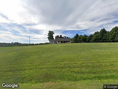
296 Big Rock Rd SW Willis, VA 24380
Estimated Value: $288,000 - $466,000
3
Beds
3
Baths
2,432
Sq Ft
$152/Sq Ft
Est. Value
About This Home
This home is located at 296 Big Rock Rd SW, Willis, VA 24380 and is currently estimated at $368,885, approximately $151 per square foot. 296 Big Rock Rd SW is a home located in Floyd County with nearby schools including Floyd County High School.
Ownership History
Date
Name
Owned For
Owner Type
Purchase Details
Closed on
Dec 27, 2023
Sold by
Ramey Michael
Bought by
Bond Amy D
Current Estimated Value
Home Financials for this Owner
Home Financials are based on the most recent Mortgage that was taken out on this home.
Original Mortgage
$65,000
Outstanding Balance
$64,550
Interest Rate
7.44%
Mortgage Type
Credit Line Revolving
Create a Home Valuation Report for This Property
The Home Valuation Report is an in-depth analysis detailing your home's value as well as a comparison with similar homes in the area
Home Values in the Area
Average Home Value in this Area
Purchase History
| Date | Buyer | Sale Price | Title Company |
|---|---|---|---|
| Bond Amy D | -- | None Listed On Document |
Source: Public Records
Mortgage History
| Date | Status | Borrower | Loan Amount |
|---|---|---|---|
| Open | Bond Amy D | $65,000 | |
| Previous Owner | Ramey Michael | $30,000 |
Source: Public Records
Tax History Compared to Growth
Tax History
| Year | Tax Paid | Tax Assessment Tax Assessment Total Assessment is a certain percentage of the fair market value that is determined by local assessors to be the total taxable value of land and additions on the property. | Land | Improvement |
|---|---|---|---|---|
| 2024 | $1,729 | $258,000 | $56,100 | $201,900 |
| 2023 | $1,677 | $258,000 | $56,100 | $201,900 |
| 2022 | $1,677 | $258,000 | $56,100 | $201,900 |
| 2021 | $1,625 | $258,000 | $56,100 | $201,900 |
| 2020 | $1,548 | $258,000 | $56,100 | $201,900 |
| 2019 | $1,481 | $246,900 | $48,100 | $198,800 |
| 2018 | $1,481 | $246,900 | $48,100 | $198,800 |
| 2017 | $1,358 | $246,900 | $48,100 | $198,800 |
| 2016 | $1,358 | $246,900 | $48,100 | $198,800 |
| 2015 | -- | $246,900 | $48,100 | $198,800 |
| 2014 | -- | $250,000 | $48,100 | $201,900 |
Source: Public Records
Map
Nearby Homes
- 428 Agnes Ln NW
- TBD Mira Fork Rd NW
- TBD Floyd Hwy S
- 981 Alum Ridge Rd NW
- 0 Floyd Hwy S Unit 913465
- 0 Floyd Hwy S
- 173 Evergreen Ln NW
- 128 Mill Pond Rd SW
- 148 Mill Pond Rd SW
- 2118 Merifield Rd NW
- 1029 Burkes Hollow Rd
- 0 Reedsville Rd Unit 911390
- 3512 Conner Grove Rd SW
- 0 Mira Fork Rd NW
- 2158 Ridgeview Rd NW
- 181 Borderline Rd NW
- 174 Sarvisberry Ln SW
- TBD 2 Canning Factory Rd SW
- TBD 2 Long Level Rd SW
- TBD Long Level Rd SW
- 296 Big Rock Rd SW
- 190 Big Rock Rd SW
- 468 Kyle Weeks Rd SW
- 174 Big Rock Rd SW
- 144 Dots Ln SW
- 0 Kyle Weeks Rd SW
- 203 Big Rock Rd SW
- 150 Big Rock Rd SW
- TBD Big Rock Rd
- 0 Big Rock Rd
- 4989 Floyd Hwy S
- 4997 Floyd Hwy S
- 4971 Floyd Hwy S
- 4943 Floyd Hwy S
- 326 Kyle Weeks Rd SW
- 328 Kyle Weeks Rd SW
- 4919 Floyd Hwy S
- 310 Kyle Weeks Rd SW
- 310 Kyle Weeks Rd SW
- 4932 Floyd Hwy S