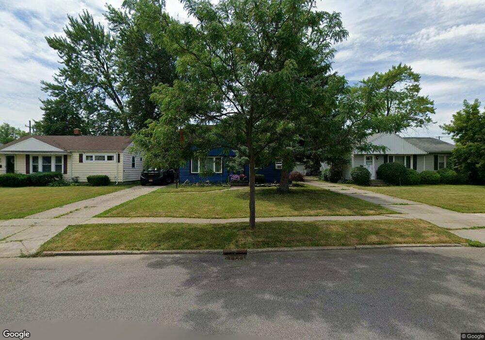
296 Coventry Rd Buffalo, NY 14217
Paramount NeighborhoodEstimated Value: $212,000 - $259,000
3
Beds
1
Bath
1,188
Sq Ft
$201/Sq Ft
Est. Value
About This Home
This home is located at 296 Coventry Rd, Buffalo, NY 14217 and is currently estimated at $238,828, approximately $201 per square foot. 296 Coventry Rd is a home located in Erie County with nearby schools including Herbert Hoover Elementary School, Herbert Hoover Middle School, and Kenmore West Senior High School.
Ownership History
Date
Name
Owned For
Owner Type
Purchase Details
Closed on
Oct 4, 2021
Sold by
Frears James
Bought by
Frears James and Eagan Lisa
Current Estimated Value
Purchase Details
Closed on
Jul 28, 2008
Sold by
Newell Wayne L and Newell Charlene M
Bought by
Frears James
Home Financials for this Owner
Home Financials are based on the most recent Mortgage that was taken out on this home.
Original Mortgage
$71,872
Outstanding Balance
$46,938
Interest Rate
6.4%
Mortgage Type
FHA
Estimated Equity
$191,890
Create a Home Valuation Report for This Property
The Home Valuation Report is an in-depth analysis detailing your home's value as well as a comparison with similar homes in the area
Home Values in the Area
Average Home Value in this Area
Purchase History
| Date | Buyer | Sale Price | Title Company |
|---|---|---|---|
| Frears James | -- | None Available | |
| Frears James | $73,000 | None Available |
Source: Public Records
Mortgage History
| Date | Status | Borrower | Loan Amount |
|---|---|---|---|
| Open | Frears James | $71,872 |
Source: Public Records
Tax History
| Year | Tax Paid | Tax Assessment Tax Assessment Total Assessment is a certain percentage of the fair market value that is determined by local assessors to be the total taxable value of land and additions on the property. | Land | Improvement |
|---|---|---|---|---|
| 2024 | $5,707 | $46,100 | $9,200 | $36,900 |
| 2023 | $5,568 | $46,100 | $9,200 | $36,900 |
| 2022 | $5,230 | $46,100 | $9,200 | $36,900 |
| 2021 | $5,211 | $46,100 | $9,200 | $36,900 |
| 2020 | $4,274 | $46,100 | $9,200 | $36,900 |
| 2019 | $4,205 | $46,100 | $9,200 | $36,900 |
| 2018 | $3,669 | $46,100 | $9,200 | $36,900 |
| 2017 | $2,143 | $46,100 | $9,200 | $36,900 |
| 2016 | $3,955 | $46,100 | $9,200 | $36,900 |
| 2015 | -- | $46,100 | $9,200 | $36,900 |
| 2014 | -- | $46,100 | $9,200 | $36,900 |
Source: Public Records
Map
Nearby Homes
- 1774 Military #59 Rd
- 36 Crane Place Unit 32
- 298 Lowell Rd
- 132 June Rd
- 135 Thurston Ave
- 16 Zimmerman Blvd
- 82 Zimmerman Blvd
- 87 Tulane Rd
- 110 Traverse Blvd
- 77 Liston St
- 75 Fowler Ave
- 46 Cleveland Dr
- 74 Eiseman Ave
- 93 N End Ave
- 350 W Girard Blvd
- 154 Liston St
- 170 Mayville Ave
- 123 Palmer Ave
- 214 Glencove Rd
- 30 Enola Ave
- 292 Coventry Rd
- 302 Coventry Rd
- 286 Coventry Rd
- 4045 Coventry Rd
- 4045 Coventry Rd
- 4045 Coventry Rd
- 299 Homewood Ave
- 305 Homewood Ave
- 282 Coventry Rd
- 291 Homewood Ave
- 301 Coventry Rd
- 291 Coventry Rd
- 283 Homewood Ave
- 307 Coventry Rd
- 276 Coventry Rd
- 285 Coventry Rd
- 281 Coventry Rd
- 311 Coventry Rd
- 279 Homewood Ave
- 272 Coventry Rd
Your Personal Tour Guide
Ask me questions while you tour the home.