Estimated Value: $2,076,000 - $3,962,000
About This Home
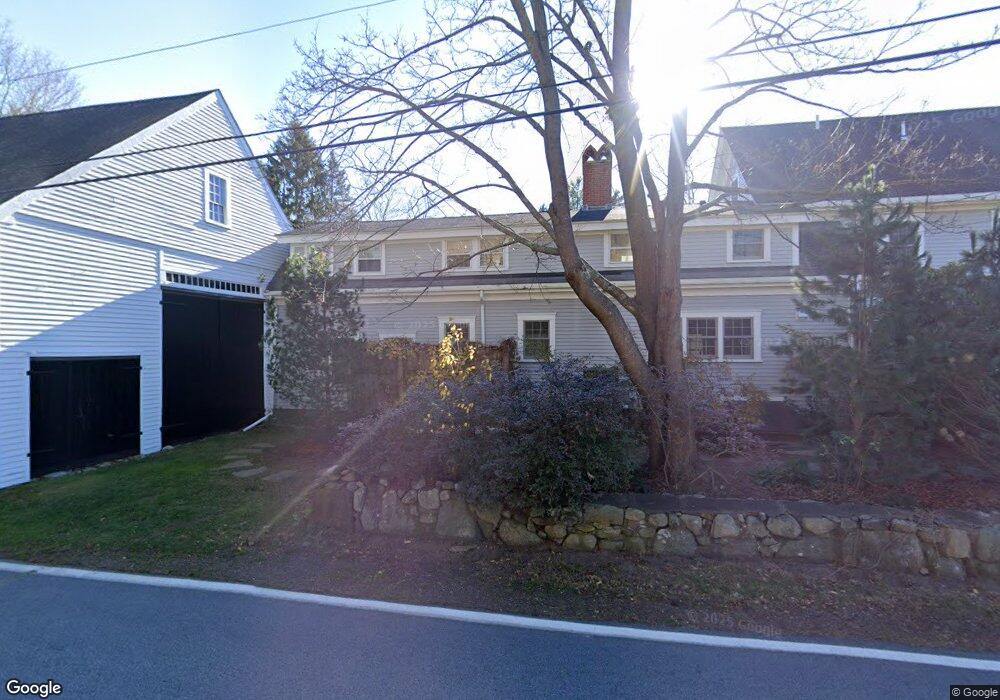
This home is located at 296 Harbor Rd, Rye, NH 03870 and is currently estimated at $2,787,483, approximately $622 per square foot. 296 Harbor Rd is a home located in Rockingham County with nearby schools including Rye Elementary School, Rye Junior High School, and Rye Country Day School.
Ownership History
We collect this data history from publicly available records. To have your information removed, we recommend requesting removal directly through your county’s website.
Purchase Details
Home Financials for this Owner
Home Financials are based on the most recent Mortgage that was taken out on this home.Home Values in the Area
Average Home Value in this Area
Purchase History
We collect this data history from publicly available records. To have your information removed, we recommend requesting removal directly through your county’s website.
| Date | Buyer | Sale Price | Title Company |
|---|---|---|---|
| $850,000 | -- |
Mortgage History
We collect this data history from publicly available records. To have your information removed, we recommend requesting removal directly through your county’s website.
| Date | Status | Borrower | Loan Amount |
|---|---|---|---|
| Open | $900,000 |
Tax History
We collect this data history from publicly available records. To have your information removed, we recommend requesting removal directly through your county’s website.
| Year | Tax Paid | Tax Assessment Tax Assessment Total Assessment is a certain percentage of the fair market value that is determined by local assessors to be the total taxable value of land and additions on the property. | Land | Improvement |
|---|---|---|---|---|
| 2025 | $11,439 | $1,366,700 | $665,700 | $701,000 |
| 2024 | $11,836 | $1,366,700 | $665,700 | $701,000 |
| 2023 | $10,975 | $1,366,700 | $665,700 | $701,000 |
| 2022 | $9,540 | $1,366,700 | $665,700 | $701,000 |
| 2021 | $11,182 | $1,094,100 | $455,300 | $638,800 |
| 2020 | $11,578 | $1,094,100 | $455,300 | $638,800 |
| 2019 | $0 | $877,200 | $455,300 | $421,900 |
| 2018 | $9,941 | $877,200 | $455,300 | $421,900 |
| 2017 | $0 | $876,800 | $455,300 | $421,500 |
| 2016 | $7,499 | $702,200 | $272,200 | $430,000 |
| 2013 | $7,697 | $701,600 | $276,100 | $425,500 |
Map
- 6 Wildwood Ln
- 45 Cable Rd
- 1681 Ocean Blvd
- 32 Cable Rd Unit 5
- 32 Cable Rd Unit 6
- 32 Cable Rd Unit 4
- 32 Cable Rd Unit 3
- 335 Central Rd
- 1591 Ocean Blvd
- 7 Acorn Acres
- 588 Wallis Rd
- 850 Washington Rd
- 850R Washington Rd
- 43 Alehson St
- 4 Highland Park Ave
- 4 White Horse Dr
- 1 South Rd
- 5 Young Ln
- 3-3 South Rd Unit 3-3
- 3-2 South Rd Unit 3-2
- 299 Harbor Rd
- 150 Locke Rd
- 155 Locke Rd
- 166 Locke Rd
- 171 Locke Rd
- 291 Harbor Rd
- 140 Locke Rd
- 140 Locke Rd Unit A
- 294 Harbor Rd
- 149 Locke Rd
- 130 Locke Rd
- 15 Recreation Rd
- 193 Locke Rd
- 281 Harbor Rd
- 199 Locke Rd
- 0 Goss Farm Ln Unit 3 4784579
- 0 Goss Farm Ln Unit 2 4783573
- 0 Goss Farm Ln Unit 4 4783454
- 120 Locke Rd
- 0 Locke Rd Unit 4784665
Ask me questions while you tour the home.