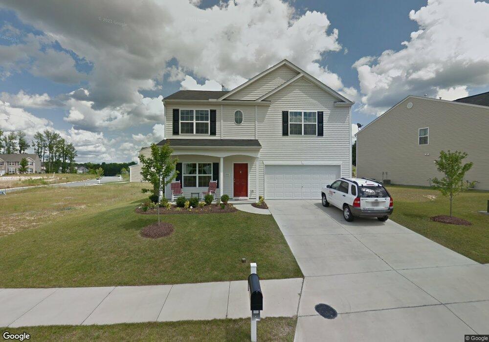
296 Hartsfield Forrest Dr Mc Leansville, NC 27301
Estimated Value: $284,000 - $330,000
4
Beds
3
Baths
2,296
Sq Ft
$133/Sq Ft
Est. Value
About This Home
This home is located at 296 Hartsfield Forrest Dr, Mc Leansville, NC 27301 and is currently estimated at $305,374, approximately $133 per square foot. 296 Hartsfield Forrest Dr is a home with nearby schools including McLeansville Elementary School, Eastern Guilford Middle School, and Eastern Guilford High School.
Ownership History
Date
Name
Owned For
Owner Type
Purchase Details
Closed on
Nov 15, 2016
Sold by
American Homes 4 Rent Properties Four Ll
Bought by
Amh Nc Properties Lp
Current Estimated Value
Purchase Details
Closed on
Mar 4, 2013
Sold by
Pinter Erin B and Pinter Steven
Bought by
American Homes 4 Rent Properties Four Ll
Purchase Details
Closed on
Dec 21, 2010
Sold by
D R Horton Inc
Bought by
Fox Erin B
Home Financials for this Owner
Home Financials are based on the most recent Mortgage that was taken out on this home.
Original Mortgage
$154,215
Interest Rate
4.4%
Mortgage Type
New Conventional
Purchase Details
Closed on
Apr 1, 2010
Bought by
Dr Horton Inc
Create a Home Valuation Report for This Property
The Home Valuation Report is an in-depth analysis detailing your home's value as well as a comparison with similar homes in the area
Home Values in the Area
Average Home Value in this Area
Purchase History
| Date | Buyer | Sale Price | Title Company |
|---|---|---|---|
| Amh Nc Properties Lp | -- | None Available | |
| American Homes 4 Rent Properties Four Ll | $154,000 | None Available | |
| Fox Erin B | $149,000 | None Available | |
| Dr Horton Inc | $320,000 | -- |
Source: Public Records
Mortgage History
| Date | Status | Borrower | Loan Amount |
|---|---|---|---|
| Previous Owner | Fox Erin B | $154,215 |
Source: Public Records
Tax History Compared to Growth
Tax History
| Year | Tax Paid | Tax Assessment Tax Assessment Total Assessment is a certain percentage of the fair market value that is determined by local assessors to be the total taxable value of land and additions on the property. | Land | Improvement |
|---|---|---|---|---|
| 2025 | $3,277 | $233,600 | $40,000 | $193,600 |
| 2024 | $3,277 | $233,600 | $40,000 | $193,600 |
| 2023 | $3,277 | $233,600 | $40,000 | $193,600 |
| 2022 | $3,184 | $233,600 | $40,000 | $193,600 |
| 2021 | $1,946 | $139,700 | $22,000 | $117,700 |
| 2020 | $1,946 | $139,700 | $22,000 | $117,700 |
| 2019 | $1,946 | $139,700 | $0 | $0 |
| 2018 | $1,890 | $139,700 | $0 | $0 |
| 2017 | $1,890 | $139,700 | $0 | $0 |
| 2016 | $2,036 | $147,100 | $0 | $0 |
| 2015 | $2,048 | $147,100 | $0 | $0 |
| 2014 | $2,063 | $147,100 | $0 | $0 |
Source: Public Records
Map
Nearby Homes
- 57 Arbor Hill Place
- 20 Cliffview Ct
- 5914 & 5926 Burlington Rd
- 12 Silverbrook Ct
- 5311 McLeansville Rd
- 209 Debanne Rd
- 100 Birch Creek Rd
- 5101 Burlington Rd
- 210 Clapp Farms Rd
- 5603 Lookout Place
- 107 Pinewood Acres Dr
- 6001 Burlington Rd
- 727 Torbay Dr
- 7 Torbay Dr
- 4 Torbay Dr
- 5 Cappel Ct
- Beddingfield Plan at Bennington Village
- Preston Plan at Bennington Village
- Abbington Plan at Bennington Village
- 731 Torbay Dr
- 298 Hartsfield Forrest Dr
- 294 Hartsfield Forest Dr
- 294 Hartsfield Forrest Dr
- 5302 Sky Hill Dr
- 297 Hartsfield Forrest Dr
- 5210 Sky Hill Dr
- 295 Hartsfield Forrest Dr
- 5304 Sky Hill Dr
- 5303 Sky Hill Dr
- 5208 Sky Hill Dr
- 5301 Sky Hill Dr
- 5305 Sky Hill Dr
- 5213 Sky Hill Dr
- 5306 Sky Hill Dr
- 5206 Sky Hill Dr
- 5209 Sky Hill Dr
- 5211 Sky Hill Dr
- 303 Groves Stone Dr
- 5204 Sky Hill Dr