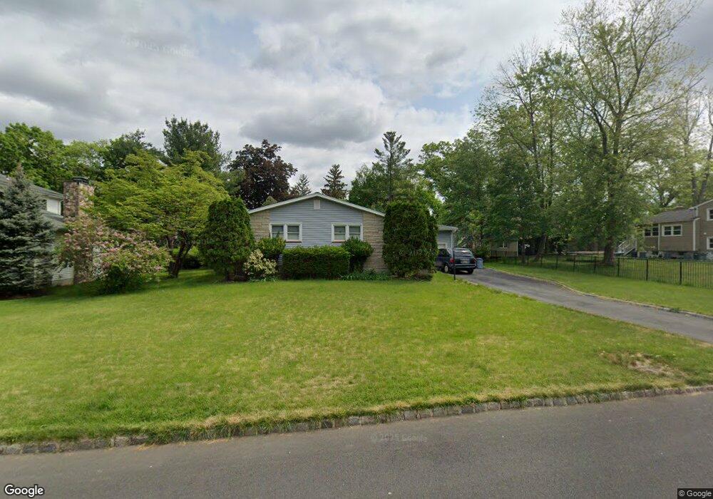
296 Runnymede Pkwy New Providence, NJ 07974
Estimated Value: $682,000 - $985,000
--
Bed
--
Bath
1,592
Sq Ft
$506/Sq Ft
Est. Value
About This Home
This home is located at 296 Runnymede Pkwy, New Providence, NJ 07974 and is currently estimated at $805,615, approximately $506 per square foot. 296 Runnymede Pkwy is a home located in Union County with nearby schools including New Providence High School and The Academy of Our Lady of Peace.
Ownership History
Date
Name
Owned For
Owner Type
Purchase Details
Closed on
Jun 24, 1999
Sold by
Wich Gordon E
Bought by
Wich Gordon E and Wich Christina R
Current Estimated Value
Create a Home Valuation Report for This Property
The Home Valuation Report is an in-depth analysis detailing your home's value as well as a comparison with similar homes in the area
Home Values in the Area
Average Home Value in this Area
Purchase History
| Date | Buyer | Sale Price | Title Company |
|---|---|---|---|
| Wich Gordon E | -- | -- | |
| Wich Gordon E | -- | -- |
Source: Public Records
Tax History Compared to Growth
Tax History
| Year | Tax Paid | Tax Assessment Tax Assessment Total Assessment is a certain percentage of the fair market value that is determined by local assessors to be the total taxable value of land and additions on the property. | Land | Improvement |
|---|---|---|---|---|
| 2025 | $13,850 | $268,300 | $135,300 | $133,000 |
| 2024 | $13,434 | $268,300 | $135,300 | $133,000 |
| 2023 | $13,434 | $268,300 | $135,300 | $133,000 |
| 2022 | $13,249 | $268,300 | $135,300 | $133,000 |
| 2021 | $13,152 | $268,300 | $135,300 | $133,000 |
| 2020 | $13,147 | $268,300 | $135,300 | $133,000 |
| 2019 | $13,066 | $268,300 | $135,300 | $133,000 |
| 2018 | $12,999 | $268,300 | $135,300 | $133,000 |
| 2017 | $12,787 | $268,300 | $135,300 | $133,000 |
| 2016 | $12,607 | $268,300 | $135,300 | $133,000 |
| 2015 | $12,433 | $268,300 | $135,300 | $133,000 |
| 2014 | $12,245 | $268,300 | $135,300 | $133,000 |
Source: Public Records
Map
Nearby Homes
- 16 Terrace Rd
- 36 Terrace Rd
- 14 Holmes Oval
- 19 Slope Dr
- 567 River Rd
- 32 Charnwood Rd
- 11 Earl Place
- 20 High St
- 32 Marion Ave
- 132 Fairview Ave
- 16 Riverbend Ct
- 1200 Springfield Ave Unit 1B
- 29 Walton Ave
- 19 Guenevere Way Ondo
- 131 van Houton Ave
- 282 South St
- 41 Meadowview Ln
- 34 Grant Ave
- 38 Meyersville Rd
- 100 Commonwealth Ave
- 284 Runnymede Pkwy
- 1515 Springfield Ave
- 1505 Springfield Ave
- 30 Wesley Ct
- 278 Runnymede Pkwy
- 33 Wesley Ct
- 295 Runnymede Pkwy
- 305 Runnymede Pkwy
- 281 Runnymede Pkwy
- 1497 Springfield Ave
- 20 Wesley Ct
- 268 Runnymede Pkwy
- 1539 Springfield Ave
- 14 Oxbow Dr
- 1489 Springfield Ave
- 1522 Springfield Ave
- 7 Oxbow Dr
- 1510 Springfield Ave
- 12 Wesley Ct
- 1545 Springfield Ave