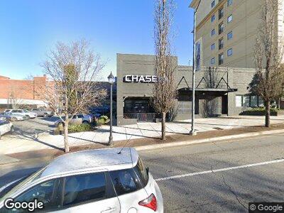
296 W Broad St Athens, GA 30601
Estimated Value: $3,475,121
--
Bed
--
Bath
7,380
Sq Ft
$471/Sq Ft
Est. Value
About This Home
This home is located at 296 W Broad St, Athens, GA 30601 and is currently estimated at $3,475,121, approximately $470 per square foot. 296 W Broad St is a home located in Clarke County with nearby schools including Barrow Elementary School, Clarke Middle School, and Clarke Central High School.
Ownership History
Date
Name
Owned For
Owner Type
Purchase Details
Closed on
Apr 4, 2019
Sold by
Bulldog Retail Investors Llc
Bought by
296 West Broad Llc
Current Estimated Value
Home Financials for this Owner
Home Financials are based on the most recent Mortgage that was taken out on this home.
Original Mortgage
$1,300,000
Outstanding Balance
$129,548
Interest Rate
4.4%
Mortgage Type
Commercial
Estimated Equity
$3,345,573
Purchase Details
Closed on
Jun 30, 2014
Sold by
Pulaski & Broad Llc
Bought by
Bulldog Retail Investors Llc
Purchase Details
Closed on
May 25, 2010
Sold by
Andrews John J
Bought by
Pulaski
Create a Home Valuation Report for This Property
The Home Valuation Report is an in-depth analysis detailing your home's value as well as a comparison with similar homes in the area
Home Values in the Area
Average Home Value in this Area
Purchase History
| Date | Buyer | Sale Price | Title Company |
|---|---|---|---|
| 296 West Broad Llc | $2,000,000 | -- | |
| Bulldog Retail Investors Llc | $1,430,000 | -- | |
| Pulaski | $735,000 | -- |
Source: Public Records
Mortgage History
| Date | Status | Borrower | Loan Amount |
|---|---|---|---|
| Open | 296 West Broad Llc | $1,300,000 | |
| Previous Owner | Andrews John J | $250,398 | |
| Previous Owner | Andrews John J | $38,180 | |
| Previous Owner | Andrews John J | $30,000 | |
| Previous Owner | Andrews John J | $0 |
Source: Public Records
Tax History Compared to Growth
Tax History
| Year | Tax Paid | Tax Assessment Tax Assessment Total Assessment is a certain percentage of the fair market value that is determined by local assessors to be the total taxable value of land and additions on the property. | Land | Improvement |
|---|---|---|---|---|
| 2024 | $29,801 | $924,060 | $505,212 | $418,848 |
| 2023 | $21,265 | $659,384 | $393,672 | $265,712 |
| 2022 | $21,694 | $659,384 | $393,672 | $265,712 |
| 2021 | $22,881 | $659,384 | $393,672 | $265,712 |
| 2020 | $21,742 | $626,578 | $360,866 | $265,712 |
| 2019 | $20,615 | $589,834 | $360,866 | $228,968 |
| 2018 | $19,859 | $568,218 | $328,060 | $240,158 |
| 2017 | $19,893 | $569,188 | $328,060 | $241,128 |
Source: Public Records
Map
Nearby Homes
- 198 Dearing St
- 475 Meigs St
- 365 S Church #1c St
- 365 S Church #1b St
- 365 S Church #1a St
- 365 S Church St Unit 1A
- 365 S Church St Unit 1B
- 365 S Church St Unit 1C
- 485 Meigs St
- 257 Hill St
- 589 Meigs St
- 570 Prince Ave
- 600 Pulaski St
- 145 Hendrix Ave
- 382 N Chase St
- 689 Hill St
- 255 Bloomfield St
- 1226 W Broad St
- 296 W Broad St
- 250 W Broad St Unit 202
- 250 W Broad St Unit 815
- 295 W Clayton St
- 250 W Broad St Unit Suite 601
- 250 W Broad St Unit 718
- 250 W Broad St Unit 714
- 250 W Broad St Unit 626
- 250 W Broad St Unit 618
- 250 W Broad St Unit 301
- 250 W Broad St Unit 207
- 250 W Broad St Unit 617
- 250 W Broad St Unit 608
- 250 W Broad St Unit 806
- 250 W Broad St Unit 620
- 250 W Broad St Unit 801
- 250 W Broad St Unit 409
- 250 W Broad St Unit 614
- 250 W Broad St Unit 206
- 250 W Broad St Unit 520