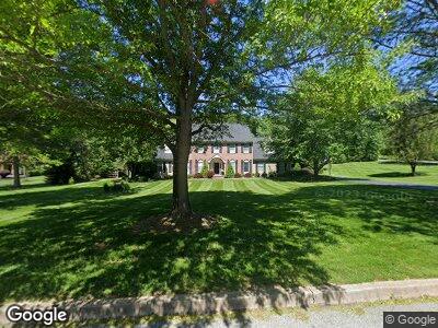
2960 Stover Trail Doylestown, PA 18902
Buckingham NeighborhoodEstimated Value: $1,269,000 - $1,436,000
4
Beds
4
Baths
3,565
Sq Ft
$375/Sq Ft
Est. Value
About This Home
This home is located at 2960 Stover Trail, Doylestown, PA 18902 and is currently estimated at $1,336,503, approximately $374 per square foot. 2960 Stover Trail is a home located in Bucks County with nearby schools including Buckingham Elementary School, Holicong Middle School, and Central Bucks High School - East.
Ownership History
Date
Name
Owned For
Owner Type
Purchase Details
Closed on
Jul 16, 2003
Sold by
Robertson David F and Robertson Elizabeth A
Bought by
Cropp Gregory T and Cropp Jennifer P
Current Estimated Value
Home Financials for this Owner
Home Financials are based on the most recent Mortgage that was taken out on this home.
Original Mortgage
$322,700
Interest Rate
5.28%
Mortgage Type
Unknown
Purchase Details
Closed on
Jun 29, 1990
Bought by
Robertson David F and Robertson Elizabeth A
Create a Home Valuation Report for This Property
The Home Valuation Report is an in-depth analysis detailing your home's value as well as a comparison with similar homes in the area
Home Values in the Area
Average Home Value in this Area
Purchase History
| Date | Buyer | Sale Price | Title Company |
|---|---|---|---|
| Cropp Gregory T | $650,000 | -- | |
| Robertson David F | -- | -- |
Source: Public Records
Mortgage History
| Date | Status | Borrower | Loan Amount |
|---|---|---|---|
| Open | Cropp Gregory T | $345,000 | |
| Closed | Cropp Gregory T | $273,797 | |
| Closed | Cropp Gregory T | $250,000 | |
| Closed | Cropp Gregory T | $322,700 | |
| Closed | Cropp Gregory T | $150,000 |
Source: Public Records
Tax History Compared to Growth
Tax History
| Year | Tax Paid | Tax Assessment Tax Assessment Total Assessment is a certain percentage of the fair market value that is determined by local assessors to be the total taxable value of land and additions on the property. | Land | Improvement |
|---|---|---|---|---|
| 2024 | $13,546 | $83,200 | $19,280 | $63,920 |
| 2023 | $13,087 | $83,200 | $19,280 | $63,920 |
| 2022 | $12,930 | $83,200 | $19,280 | $63,920 |
| 2021 | $12,775 | $83,200 | $19,280 | $63,920 |
| 2020 | $12,775 | $83,200 | $19,280 | $63,920 |
| 2019 | $12,692 | $83,200 | $19,280 | $63,920 |
| 2018 | $12,692 | $83,200 | $19,280 | $63,920 |
| 2017 | $12,588 | $83,200 | $19,280 | $63,920 |
| 2016 | $12,713 | $83,200 | $19,280 | $63,920 |
| 2015 | -- | $83,200 | $19,280 | $63,920 |
| 2014 | -- | $83,200 | $19,280 | $63,920 |
Source: Public Records
Map
Nearby Homes
- 2983 Durham Rd
- 2880 Stover Trail
- 3039 Durham Rd
- 4782 Cobblestone Ct
- 5025 Anderson Rd
- 2773 Anvil Place
- 5066 Mechanicsville Rd
- 4672 Watson Dr
- 5173 York Rd
- 4639 Sands Way
- 3111 Burnt House Hill Rd
- 5248 Mechanicsville Rd
- 3455 Durham Rd
- 3479 Durham Rd
- 4935 Hunt Field Dr
- 5393 Mechanicsville Rd
- 3468 Holicong Rd
- 2775 Red Gate Dr
- 4487 Southview Ln
- 2712 Kent Dr
- 2960 Stover Trail
- 2950 Stover Trail
- 2916 White Tail Ct
- 2925 Stover Trail
- 2945 White Tail Ct
- 2925 White Tail Ct
- 2966 White Tail Ct
- 2940 Stover Trail
- 2930 Stover Trail
- LOT 19 White Tail Ct
- 2974 White Tail Ct
- 2977 White Tail Ct
- 2915 White Tail Ct
- 2896 White Tail Ct
- 2905 Stover Trail
- 2910 Stover Trail
- 2969 Durham Rd
- 2891 White Tail Ct
- 2872 White Tail Ct
- 4995 Paist Rd