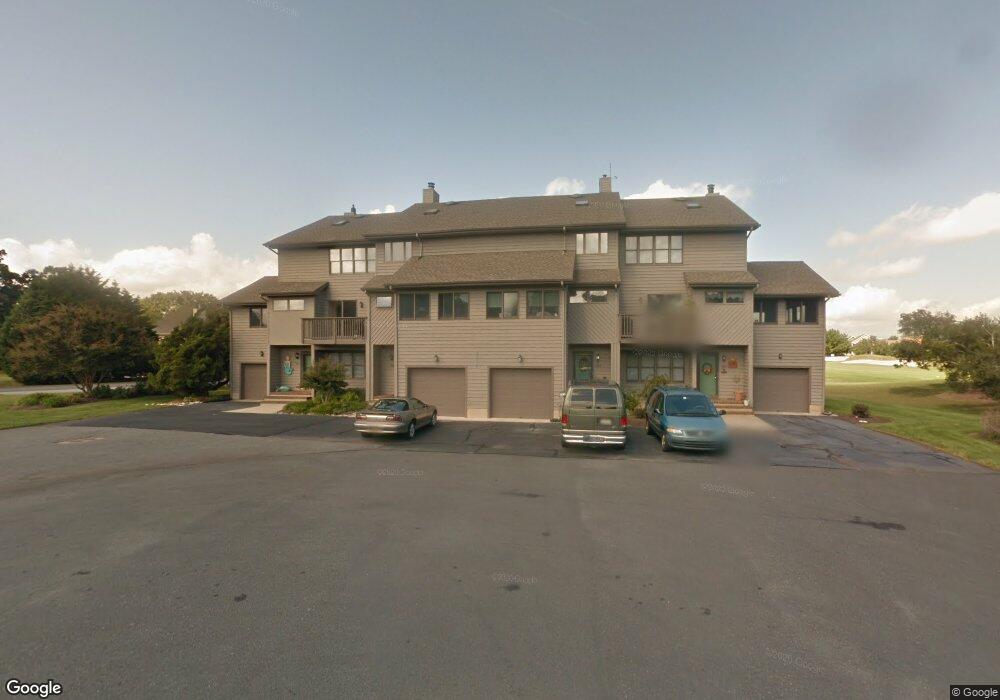
29614 Carnoustie Ct Dagsboro, DE 19939
Estimated Value: $438,000 - $533,000
3
Beds
--
Bath
1,875
Sq Ft
$250/Sq Ft
Est. Value
About This Home
This home is located at 29614 Carnoustie Ct, Dagsboro, DE 19939 and is currently estimated at $468,592, approximately $249 per square foot. 29614 Carnoustie Ct is a home located in Sussex County with nearby schools including Lord Baltimore Elementary School, Selbyville Middle School, and Indian River High School.
Ownership History
Date
Name
Owned For
Owner Type
Purchase Details
Closed on
Feb 18, 2022
Sold by
Wilgus Donald L and Joint Jane
Bought by
Curit Lorin S and Curit Paula D
Current Estimated Value
Home Financials for this Owner
Home Financials are based on the most recent Mortgage that was taken out on this home.
Original Mortgage
$277,500
Outstanding Balance
$258,809
Interest Rate
3.92%
Mortgage Type
New Conventional
Estimated Equity
$209,783
Purchase Details
Closed on
Sep 9, 2015
Sold by
Wilgus Donald L
Bought by
Wilgus Donald L and Joint Jane S
Home Financials for this Owner
Home Financials are based on the most recent Mortgage that was taken out on this home.
Original Mortgage
$132,175
Interest Rate
3.97%
Mortgage Type
New Conventional
Create a Home Valuation Report for This Property
The Home Valuation Report is an in-depth analysis detailing your home's value as well as a comparison with similar homes in the area
Home Values in the Area
Average Home Value in this Area
Purchase History
| Date | Buyer | Sale Price | Title Company |
|---|---|---|---|
| Curit Lorin S | $370,000 | Norman Stephen P | |
| Wilgus Donald L | -- | None Available | |
| Wilgus Donald L | -- | None Available |
Source: Public Records
Mortgage History
| Date | Status | Borrower | Loan Amount |
|---|---|---|---|
| Open | Curit Lorin S | $277,500 | |
| Previous Owner | Wilgus Donald L | $132,175 |
Source: Public Records
Tax History Compared to Growth
Tax History
| Year | Tax Paid | Tax Assessment Tax Assessment Total Assessment is a certain percentage of the fair market value that is determined by local assessors to be the total taxable value of land and additions on the property. | Land | Improvement |
|---|---|---|---|---|
| 2025 | $831 | $29,050 | $0 | $29,050 |
| 2024 | $1,251 | $29,050 | $0 | $29,050 |
| 2023 | $1,249 | $29,050 | $0 | $29,050 |
| 2022 | $1,229 | $29,050 | $0 | $29,050 |
| 2021 | $816 | $29,050 | $0 | $29,050 |
| 2020 | $762 | $29,050 | $0 | $29,050 |
| 2019 | $878 | $29,050 | $0 | $29,050 |
| 2018 | $889 | $30,250 | $0 | $0 |
| 2017 | $1,153 | $30,250 | $0 | $0 |
| 2016 | $769 | $30,250 | $0 | $0 |
| 2015 | $783 | $30,250 | $0 | $0 |
| 2014 | $767 | $30,250 | $0 | $0 |
Source: Public Records
Map
Nearby Homes
- 29586 Carnoustie Ct Unit 1204
- 29586 Carnoustie Ct Unit 1201
- 29601 Carnoustie Ct Unit 902
- Lot 40 Sawtooth Ct
- 29869 Colony Dr
- 29841 Colony Dr
- 34749 Timber Ct
- 34741 Timber Ct
- 29474 Turnberry Dr
- 29580 Turnberry Dr
- 34833 Seagrass Plantation Ln
- 339 Fairway Ln
- 34424 Quail Ln
- 30106 Pelican Beach Cove
- 29664 Colony Dr Unit F-11
- 29664 Colony Dr Unit F6
- 29254 Park View Dr Unit 6
- 29244 Park View Dr
- 34855 Tenleys Trail
- 34856 Tenleys Trail
- 29614 Carnoustie Ct Unit 1002
- 29614 Carnoustie Ct
- 29614 Carnoustie Ct Unit 1003
- 29586 Carnoustie Ct
- 29586 Carnoustie Ct
- 29586 Carnoustie Ct Unit 1203
- 29614 Carnoustie Ct Unit 1001
- 29606 Carnoustie Ct Unit 1101
- 29606 Carnoustie Ct Unit 1104
- 29606 Carnoustie Ct
- 29601 Carnoustie Ct Unit 901
- 29585 Carnoustie Ct Unit 804
- 29585 Carnoustie Ct Unit 803
- 29585 Carnoustie Ct
- 29585 Carnoustie Ct Unit 802
- 1302 Cripple Creek Dr Unit 1302
- 29665 Sawmill Dr
- 29433 Cripple Creek Dr
- 29882 Colony Dr
- 29671 Sawmill Dr