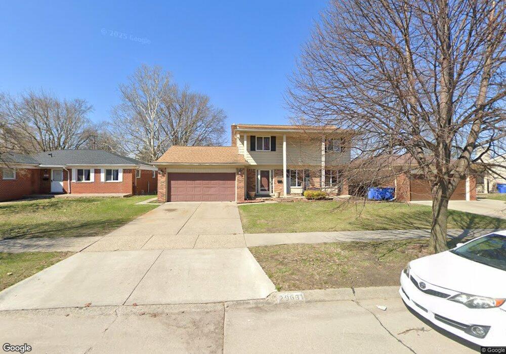
29631 Westbrook Ave Warren, MI 48092
Northwest Warren NeighborhoodEstimated Value: $297,000 - $320,000
4
Beds
3
Baths
1,750
Sq Ft
$178/Sq Ft
Est. Value
About This Home
This home is located at 29631 Westbrook Ave, Warren, MI 48092 and is currently estimated at $311,510, approximately $178 per square foot. 29631 Westbrook Ave is a home located in Macomb County with nearby schools including Lean Elementary School, Beer Middle School, and Warren Mott High School.
Ownership History
Date
Name
Owned For
Owner Type
Purchase Details
Closed on
Oct 12, 2007
Sold by
Cobb Jerome A
Bought by
Hsbc Mortgage Services Inc
Current Estimated Value
Purchase Details
Closed on
Jun 3, 2005
Sold by
Crabtree William L and Crabtree Bonnie J
Bought by
Cobb Jerome A
Home Financials for this Owner
Home Financials are based on the most recent Mortgage that was taken out on this home.
Original Mortgage
$203,700
Interest Rate
8.19%
Mortgage Type
Fannie Mae Freddie Mac
Create a Home Valuation Report for This Property
The Home Valuation Report is an in-depth analysis detailing your home's value as well as a comparison with similar homes in the area
Home Values in the Area
Average Home Value in this Area
Purchase History
| Date | Buyer | Sale Price | Title Company |
|---|---|---|---|
| Hsbc Mortgage Services Inc | $132,496 | None Available | |
| Cobb Jerome A | $203,700 | -- | |
| Cobb Jerome A | -- | -- |
Source: Public Records
Mortgage History
| Date | Status | Borrower | Loan Amount |
|---|---|---|---|
| Previous Owner | Cobb Jerome A | $203,700 |
Source: Public Records
Tax History Compared to Growth
Tax History
| Year | Tax Paid | Tax Assessment Tax Assessment Total Assessment is a certain percentage of the fair market value that is determined by local assessors to be the total taxable value of land and additions on the property. | Land | Improvement |
|---|---|---|---|---|
| 2025 | $4,641 | $145,140 | $0 | $0 |
| 2024 | $4,505 | $139,720 | $0 | $0 |
| 2023 | $4,270 | $124,050 | $0 | $0 |
| 2022 | $4,161 | $109,010 | $0 | $0 |
| 2021 | $4,058 | $102,990 | $0 | $0 |
| 2020 | $3,174 | $99,380 | $0 | $0 |
| 2019 | $3,060 | $88,010 | $0 | $0 |
| 2018 | $3,069 | $82,160 | $0 | $0 |
| 2017 | $3,069 | $78,500 | $10,540 | $67,960 |
| 2016 | $3,065 | $78,500 | $0 | $0 |
| 2015 | $1,727 | $67,940 | $0 | $0 |
| 2012 | -- | $53,420 | $0 | $0 |
Source: Public Records
Map
Nearby Homes
- 2338 Walter Ave
- 2403 Walter Ave
- 1936 Roman Ct
- 1958 Roman Ct
- 1687 Fontaine Ave
- 2209 Cromie Dr
- 30232 Austin Dr
- 29202 W Nottingham Cir
- 1563 Beaupre Ave
- 30140 Manor Dr
- 1405 Dulong Ave
- 1721 Westbrook Dr
- 30600 Manor Dr
- 1336 Dulong Ave
- 3451 Winters Dr
- 1580 Nottingham Dr
- 28767 Alden St
- 28720 Alden St
- 3410 Girard Dr
- 29269 Ryan Rd
- 29643 Westbrook Ave
- 29619 Westbrook Ave
- 29655 Westbrook Ave
- 2275 Marlow Dr
- 29607 Westbrook Ave
- 29703 Westbrook Ave
- 29636 Westbrook Ave
- 29624 Westbrook Ave
- 29648 Westbrook Ave
- 29612 Westbrook Ave
- 2273 Marlow Dr
- 29715 Westbrook Ave
- 29660 Westbrook Ave
- 2198 Walter Ct
- 29710 Westbrook Ave
- 2186 Walter Ct
- 29727 Westbrook Ave
- 2333 Marlow Dr
- 29720 Merrick Ave
- 29581 Westbrook Ave