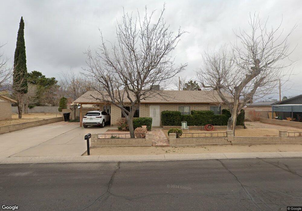
2964 S 12th Ave Safford, AZ 85546
Estimated Value: $342,000 - $539,000
--
Bed
--
Bath
5,221
Sq Ft
$82/Sq Ft
Est. Value
About This Home
This home is located at 2964 S 12th Ave, Safford, AZ 85546 and is currently estimated at $427,829, approximately $81 per square foot. 2964 S 12th Ave is a home located in Graham County with nearby schools including Dorothy Stinson School, Ruth Powell Elementary School, and Lafe Nelson School.
Ownership History
Date
Name
Owned For
Owner Type
Purchase Details
Closed on
Mar 16, 2023
Sold by
Proto Kerri Lynn
Bought by
Proto Kerri Lynn and Counes George
Current Estimated Value
Purchase Details
Closed on
Sep 29, 2021
Sold by
Helen Tellez Mary
Bought by
Proto Kerri Lynn
Purchase Details
Closed on
Sep 9, 2021
Sold by
Helen Tellez Mary
Bought by
Proto Kerri Lynn
Create a Home Valuation Report for This Property
The Home Valuation Report is an in-depth analysis detailing your home's value as well as a comparison with similar homes in the area
Home Values in the Area
Average Home Value in this Area
Purchase History
| Date | Buyer | Sale Price | Title Company |
|---|---|---|---|
| Proto Kerri Lynn | -- | Stewart Title & Trust Of Phoen | |
| Proto Kerri Lynn | -- | None Listed On Document | |
| Proto Kerri Lynn | -- | None Listed On Document |
Source: Public Records
Tax History Compared to Growth
Tax History
| Year | Tax Paid | Tax Assessment Tax Assessment Total Assessment is a certain percentage of the fair market value that is determined by local assessors to be the total taxable value of land and additions on the property. | Land | Improvement |
|---|---|---|---|---|
| 2026 | $2,172 | -- | -- | -- |
| 2025 | $2,172 | $40,872 | $4,602 | $36,270 |
| 2024 | $607 | $12,313 | $4,602 | $7,711 |
| 2023 | $607 | $10,330 | $4,111 | $6,219 |
| 2022 | $591 | $9,209 | $3,917 | $5,292 |
| 2021 | $657 | $0 | $0 | $0 |
| 2020 | $633 | $0 | $0 | $0 |
| 2019 | $665 | $0 | $0 | $0 |
| 2018 | $633 | $0 | $0 | $0 |
| 2017 | $592 | $0 | $0 | $0 |
| 2016 | $609 | $0 | $0 | $0 |
| 2015 | $570 | $0 | $0 | $0 |
Source: Public Records
Map
Nearby Homes
- 8th and Discovery --
- 1318 W 26th St
- 1405 W 24th St
- 0 Star Fire Cir Unit 1719797
- 0 Star Fire Cir Unit 1719796
- 0 Star Fire Cir Unit 4 22415917
- 1006 W Palm Cir
- 10 Santa fe Place
- 2204 S 10th Ave
- 315 W 24th St
- 1919 W 26th St
- 550 W Burrell Ln
- 1879 W Peppertree Dr Unit C13
- 1879 W Peppertree Dr Unit C14
- 1879 W Peppertree Dr Unit B7
- 1879 W Peppertree Dr Unit B3
- 1879 W Peppertree Dr Unit B4
- 1879 W Peppertree Dr Unit B2
- 1879 W Peppertree Dr Unit A10
- 3354 S Us Highway 191
- 2964 S 12th Ave
- 2944 S 12th Ave
- 2967 S 12th Ave
- 2971 S Heather Ln
- 2980 S 12th Ave
- 2939 S Heather Ln
- 2991 S 12th Ave
- 2924 S 12th Ave
- 2945 S 12th Ave
- 1180 S 29th Place
- 2998 S 12th Ave
- 2979 S Heather Ln
- 1250 W Apricot Loop
- 1198 S 29th Place
- 1175 S 29th Place
- 1198 W Apricot Loop
- 2944 S Heather Ln
- 2940 S Heather Ln
- 1180 W Apricot Loop
- 2908 S 12th Ave