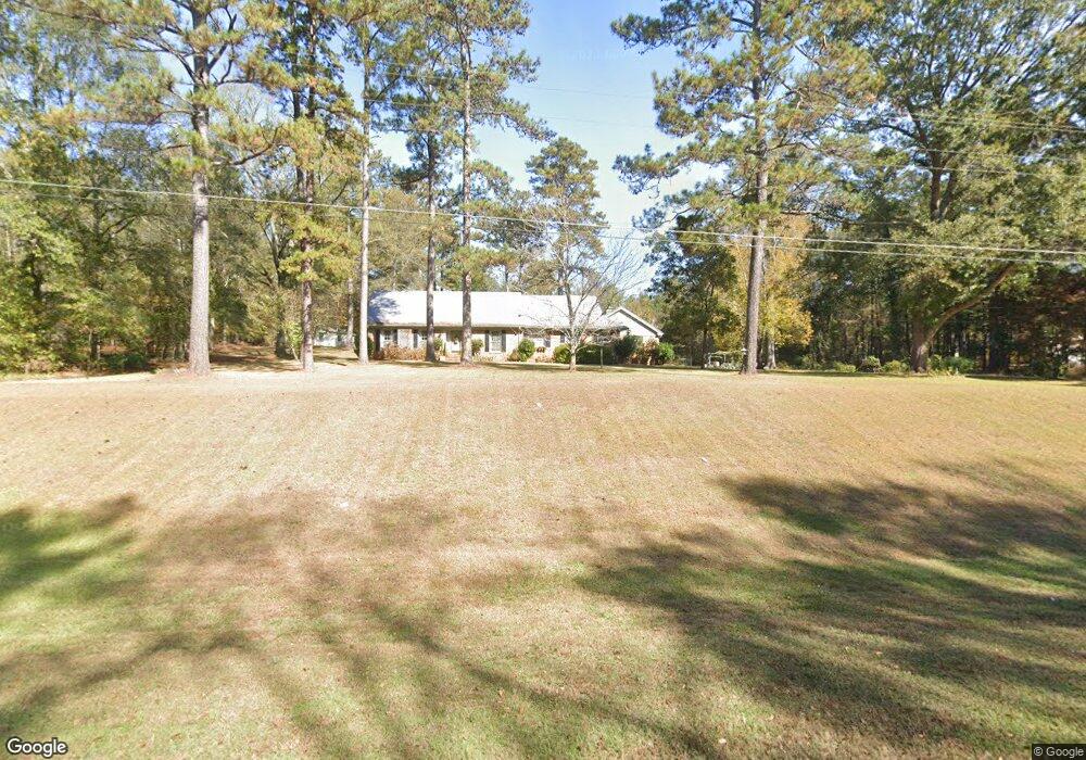
2966 Mooty Bridge Rd Lagrange, GA 30240
Estimated Value: $402,452 - $473,000
4
Beds
3
Baths
3,050
Sq Ft
$142/Sq Ft
Est. Value
About This Home
This home is located at 2966 Mooty Bridge Rd, Lagrange, GA 30240 and is currently estimated at $434,613, approximately $142 per square foot. 2966 Mooty Bridge Rd is a home located in Troup County with nearby schools including Hillcrest Elementary School, Franklin Forest Elementary School, and Hollis Hand Elementary School.
Ownership History
Date
Name
Owned For
Owner Type
Purchase Details
Closed on
Jun 27, 2025
Sold by
Cummings Phillips Betty
Bought by
Lundy Donna and Lundy Richard
Current Estimated Value
Purchase Details
Closed on
Sep 19, 1996
Sold by
Shep Phillips
Bought by
Phillips Betty C
Purchase Details
Closed on
May 7, 1996
Sold by
Shepperd H Phillips
Bought by
Shep Phillips
Purchase Details
Closed on
Apr 12, 1996
Sold by
Shepperd H Phillips
Bought by
Shepperd H Phillips
Create a Home Valuation Report for This Property
The Home Valuation Report is an in-depth analysis detailing your home's value as well as a comparison with similar homes in the area
Purchase History
| Date | Buyer | Sale Price | Title Company |
|---|---|---|---|
| Lundy Donna | $400,000 | -- | |
| Phillips Betty C | -- | -- | |
| Shep Phillips | -- | -- | |
| Shepperd H Phillips | -- | -- |
Source: Public Records
Tax History
| Year | Tax Paid | Tax Assessment Tax Assessment Total Assessment is a certain percentage of the fair market value that is determined by local assessors to be the total taxable value of land and additions on the property. | Land | Improvement |
|---|---|---|---|---|
| 2025 | $4,292 | $157,360 | $9,000 | $148,360 |
| 2024 | $3,184 | $143,640 | $9,000 | $134,640 |
| 2023 | $2,381 | $114,200 | $9,000 | $105,200 |
| 2022 | $2,787 | $101,840 | $9,000 | $92,840 |
| 2021 | $2,557 | $86,784 | $8,600 | $78,184 |
| 2020 | $2,557 | $86,784 | $8,600 | $78,184 |
| 2019 | $2,515 | $85,368 | $17,200 | $68,168 |
| 2018 | $2,327 | $79,156 | $17,200 | $61,956 |
| 2017 | $2,327 | $79,156 | $17,200 | $61,956 |
| 2016 | $2,298 | $78,168 | $17,200 | $60,968 |
| 2015 | $2,302 | $78,168 | $17,200 | $60,968 |
| 2014 | $2,208 | $74,960 | $17,200 | $57,760 |
| 2013 | -- | $77,068 | $17,200 | $59,868 |
Source: Public Records
Map
Nearby Homes
- 219 E Yorktown Dr
- 206 Sturbridge Dr
- 64 Waterview Ct
- 111 Copper Creek Dr
- 120 Copper Creek Dr
- 135 Copper Creek Dr
- 0 Waterview Dr Unit 10558462
- 107 Cameron Pointe Dr
- 102 Cameron Pointe Dr
- 110 Pond View Point
- 130 Sunny Point Cir
- 24 N Brooks Rd
- 178 Waterview Dr
- 103 Woodchase
- 109 Windridge
- 107 Windridge
- 103 Windridge
- 114 Taylor Len Dr
- 209 River Oaks Dr
- 107 Edgemont Ct
- 2926 Mooty Bridge Rd
- o Mooty Bridge Rd
- 3010 Mooty Bridge Rd
- 3536 Mooty Bridge Rd
- 3033 Mooty Bridge Rd
- 203 Sanders Rd
- 213 Sanders Rd
- 153 Sanders Rd
- 95 Sanders Rd
- 83 Sanders Rd
- 311 W Yorktown Dr
- 309 W Yorktown Dr
- 307 W Yorktown Dr
- 1408 Antioch Rd
- 65 Sanders Rd
- 178186 Sanders Rd
- 1353 Mooty Bridge Rd
- 1351 Mooty Bridge Rd
- 1349 Mooty Bridge Rd
- 1347 Mooty Bridge Rd
Your Personal Tour Guide
Ask me questions while you tour the home.