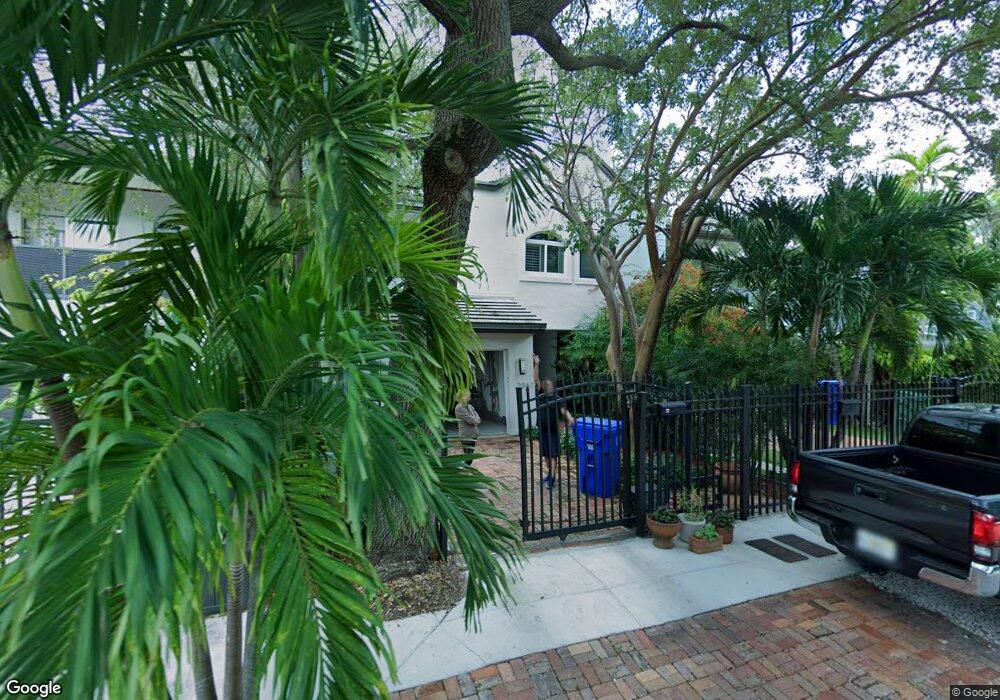
2967 Ruth St Unit 2967 Miami, FL 33133
Northeast Coconut Grove NeighborhoodEstimated Value: $903,000 - $1,417,000
3
Beds
2
Baths
1,677
Sq Ft
$726/Sq Ft
Est. Value
About This Home
This home is located at 2967 Ruth St Unit 2967, Miami, FL 33133 and is currently estimated at $1,218,328, approximately $726 per square foot. 2967 Ruth St Unit 2967 is a home located in Miami-Dade County with nearby schools including Coconut Grove Elementary School, Ponce de Leon Middle School, and Coral Gables Senior High School.
Ownership History
Date
Name
Owned For
Owner Type
Purchase Details
Closed on
Aug 9, 2004
Sold by
Barber Daniel Lee and Barber Gail Marie
Bought by
Liginos Peter
Current Estimated Value
Home Financials for this Owner
Home Financials are based on the most recent Mortgage that was taken out on this home.
Original Mortgage
$336,000
Outstanding Balance
$138,732
Interest Rate
3.52%
Mortgage Type
Unknown
Estimated Equity
$1,079,596
Purchase Details
Closed on
Sep 10, 2002
Sold by
Coconut Grove Redev Co Inc
Bought by
Barber Daniel L and Barber Gail M
Create a Home Valuation Report for This Property
The Home Valuation Report is an in-depth analysis detailing your home's value as well as a comparison with similar homes in the area
Home Values in the Area
Average Home Value in this Area
Purchase History
| Date | Buyer | Sale Price | Title Company |
|---|---|---|---|
| Liginos Peter | $420,000 | Waterway Title | |
| Barber Daniel L | $377,000 | -- |
Source: Public Records
Mortgage History
| Date | Status | Borrower | Loan Amount |
|---|---|---|---|
| Open | Liginos Peter | $336,000 |
Source: Public Records
Tax History Compared to Growth
Tax History
| Year | Tax Paid | Tax Assessment Tax Assessment Total Assessment is a certain percentage of the fair market value that is determined by local assessors to be the total taxable value of land and additions on the property. | Land | Improvement |
|---|---|---|---|---|
| 2025 | $7,616 | $358,445 | -- | -- |
| 2024 | $7,566 | $348,344 | -- | -- |
| 2023 | $7,566 | $338,199 | $0 | $0 |
| 2022 | $7,367 | $328,349 | $0 | $0 |
| 2021 | $7,350 | $318,786 | $0 | $0 |
| 2020 | $7,273 | $314,385 | $0 | $0 |
| 2019 | $7,135 | $307,317 | $0 | $0 |
| 2018 | $6,902 | $301,587 | $0 | $0 |
| 2017 | $6,837 | $295,384 | $0 | $0 |
| 2016 | $6,870 | $289,309 | $0 | $0 |
| 2015 | $5,467 | $287,298 | $0 | $0 |
| 2014 | $5,529 | $285,018 | $0 | $0 |
Source: Public Records
Map
Nearby Homes
- 2972 Shipping Ave Unit 2972
- 3149 Mary St Unit 3149
- 3164 Center St Unit 2
- 2924 Day Ave Unit PH4N
- 2924 Day Ave Unit N211
- 2778 Day Ave Unit 2
- 3242 Mary St Unit S215
- 2768 Day Ave Unit 1
- 3240 Mary St Unit S207
- 3245 Virginia St Unit 17
- 3245 Virginia St Unit 39
- 3071 Orange St
- 2926 Bird Ave Unit 2
- 2926 Bird Ave Unit 1
- 3025 Mary St Unit 12
- 3156 SW 27th Ave Unit 203
- 3067 Center St Unit 17
- 2715 Tigertail Ave Unit 102
- 2715 Tigertail Ave Unit 403
- 2715 Tigertail Ave Unit 404
- 2965 Ruth St
- 2965 Ruth St Unit 2965
- 2995 Ruth St
- 2995 Ruth St Unit 2995
- 2993 Ruth St
- 2993 Ruth St
- 2955 Ruth St
- 3102 Naomi St
- 2970 Shipping Ave
- 2986 Shipping Ave
- 3100 Naomi St Unit 3100
- 3100 Naomi St Unit 3102
- 3100 Naomi St
- 3125 Virginia St
- 3125 Virginia St Unit 2
- 3125 Virginia St
- 3123 Virginia St
- 3123 Virginia St Unit 2