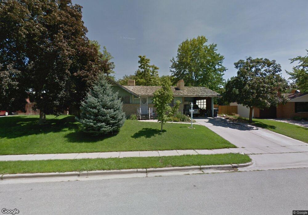
2967 S 450 W Bountiful, UT 84010
Estimated Value: $473,000 - $500,604
5
Beds
3
Baths
1,092
Sq Ft
$448/Sq Ft
Est. Value
About This Home
This home is located at 2967 S 450 W, Bountiful, UT 84010 and is currently estimated at $489,651, approximately $448 per square foot. 2967 S 450 W is a home located in Davis County with nearby schools including Boulton School, South Davis Junior High School, and Woods Cross High School.
Ownership History
Date
Name
Owned For
Owner Type
Purchase Details
Closed on
Jul 1, 2022
Sold by
Kennet Lamar Searcy Family Living Trust
Bought by
Benson David Allan
Current Estimated Value
Purchase Details
Closed on
Feb 28, 2005
Sold by
Searcy Kenneth Lamar
Bought by
Searcy Kenneth Lamar
Home Financials for this Owner
Home Financials are based on the most recent Mortgage that was taken out on this home.
Original Mortgage
$150,100
Interest Rate
5.66%
Mortgage Type
New Conventional
Purchase Details
Closed on
Mar 29, 2003
Sold by
Searcy Kenneth Lamar
Bought by
Searcy Kenneth Lamar
Create a Home Valuation Report for This Property
The Home Valuation Report is an in-depth analysis detailing your home's value as well as a comparison with similar homes in the area
Home Values in the Area
Average Home Value in this Area
Purchase History
| Date | Buyer | Sale Price | Title Company |
|---|---|---|---|
| Benson David Allan | -- | None Listed On Document | |
| Searcy Kenneth Lamar | -- | Eagle Pointe Title Ins Agenc | |
| Searcy Kenneth Lamar | -- | -- | |
| Searcy Kenneth Lamar | -- | -- |
Source: Public Records
Mortgage History
| Date | Status | Borrower | Loan Amount |
|---|---|---|---|
| Previous Owner | Searcy Kenneth Lamar | $150,100 |
Source: Public Records
Tax History Compared to Growth
Tax History
| Year | Tax Paid | Tax Assessment Tax Assessment Total Assessment is a certain percentage of the fair market value that is determined by local assessors to be the total taxable value of land and additions on the property. | Land | Improvement |
|---|---|---|---|---|
| 2025 | $2,692 | $245,300 | $127,547 | $117,753 |
| 2024 | $2,555 | $236,500 | $112,587 | $123,913 |
| 2023 | $2,463 | $411,000 | $208,455 | $202,545 |
| 2022 | $2,406 | $225,500 | $114,184 | $111,316 |
| 2021 | $2,212 | $318,000 | $149,380 | $168,620 |
| 2020 | $1,957 | $282,000 | $127,978 | $154,022 |
| 2019 | $1,964 | $280,000 | $137,730 | $142,270 |
| 2018 | $1,824 | $256,000 | $135,067 | $120,933 |
| 2016 | $1,435 | $114,675 | $40,920 | $73,755 |
| 2015 | $1,356 | $102,465 | $40,920 | $61,545 |
| 2014 | $1,351 | $104,449 | $40,920 | $63,529 |
| 2013 | -- | $105,595 | $43,945 | $61,650 |
Source: Public Records
Map
Nearby Homes
- 2943 S 400 W
- 527 Applewood Dr
- 3183 S 500 W
- 117 W 3000 S
- 3238 S 675 W
- 757 W 3200 S
- 298 Percival St Unit 354
- 310 N 675 E
- 8 E 3500 S
- 2095 S Main St Unit 17
- 2095 S Main St Unit 23
- 3463 S 50 E
- 260 E 1100 N
- 260 E 1100 N Unit A14
- 259 Lionel St Unit 373
- 626 Sagramore St
- 3474 S 100 E
- 785 Percival St
- 246 Galahad St
- 1036 E Fairway Dr