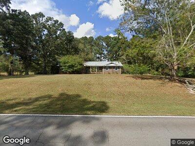
2969 Lovvorn Rd Carrollton, GA 30117
Mount Zion NeighborhoodEstimated Value: $246,000 - $383,280
3
Beds
3
Baths
2,733
Sq Ft
$118/Sq Ft
Est. Value
About This Home
This home is located at 2969 Lovvorn Rd, Carrollton, GA 30117 and is currently estimated at $323,320, approximately $118 per square foot. 2969 Lovvorn Rd is a home located in Carroll County with nearby schools including Mt. Zion Elementary School, Mt. Zion Middle School, and Mt. Zion High School.
Ownership History
Date
Name
Owned For
Owner Type
Purchase Details
Closed on
May 18, 2007
Sold by
Foster C R
Bought by
Smith Larry
Current Estimated Value
Home Financials for this Owner
Home Financials are based on the most recent Mortgage that was taken out on this home.
Original Mortgage
$134,400
Interest Rate
6.12%
Mortgage Type
New Conventional
Purchase Details
Closed on
Jul 16, 1982
Bought by
Foster C R Etal
Create a Home Valuation Report for This Property
The Home Valuation Report is an in-depth analysis detailing your home's value as well as a comparison with similar homes in the area
Home Values in the Area
Average Home Value in this Area
Purchase History
| Date | Buyer | Sale Price | Title Company |
|---|---|---|---|
| Smith Larry | $55,000 | -- | |
| Foster C R Etal | -- | -- |
Source: Public Records
Mortgage History
| Date | Status | Borrower | Loan Amount |
|---|---|---|---|
| Open | Smith Larry | $154,000 | |
| Closed | Smith Larry | $134,400 |
Source: Public Records
Tax History Compared to Growth
Tax History
| Year | Tax Paid | Tax Assessment Tax Assessment Total Assessment is a certain percentage of the fair market value that is determined by local assessors to be the total taxable value of land and additions on the property. | Land | Improvement |
|---|---|---|---|---|
| 2024 | $3,288 | $145,354 | $6,344 | $139,010 |
| 2023 | $3,288 | $133,151 | $5,076 | $128,075 |
| 2022 | $2,664 | $106,233 | $3,384 | $102,849 |
| 2021 | $2,386 | $93,060 | $2,707 | $90,353 |
| 2020 | $2,099 | $81,764 | $2,461 | $79,303 |
| 2019 | $1,940 | $74,962 | $2,461 | $72,501 |
| 2018 | $1,770 | $67,420 | $2,300 | $65,120 |
| 2017 | $1,776 | $67,420 | $2,300 | $65,120 |
| 2016 | $1,777 | $67,420 | $2,300 | $65,120 |
| 2015 | $1,473 | $52,672 | $2,318 | $50,354 |
| 2014 | $1,479 | $52,672 | $2,318 | $50,354 |
Source: Public Records
Map
Nearby Homes
- 137 Ashley Dr
- 111 Gwendolyn Ct
- 101 Bonnie Lynn Ln
- 2994 Mount Zion Rd
- 2994 Mount Zion Rd Unit 2
- 387 Simms Rd
- 0 Holmes Rd Unit 147218
- 0 Holmes Rd Unit 10415481
- 92 Old Bowdon Rd
- 2750 Mount Zion Rd
- 1202 Mount Zion Rd
- 101 Red Oak Dr
- 106 Red Oak Dr
- 102 Red Oak Dr
- 299 Beaver Pond Rd
- 299 Beaverpond Rd
- 246 Farmers High Rd
- 2969 Lovvorn Rd
- 2909 Lovvorn Rd
- 3025 Lovvorn Rd
- 2887 Lovvorn Rd
- 2985 Lovvorn Rd
- 2871 Lovvorn Rd
- 33 Lambert Ln
- 33 Lambert Ln Unit 2.51 Ac
- 96 Lambert Ln
- 260 Bethel Church Rd
- 33 Lambert Ln
- 178 Bethel Church Rd
- 3087 Lovvorn Rd
- 140 Bethel Church Rd
- 2851 Lovvorn Rd
- 81 Wynn Rd
- 2837 Lovvorn Rd
- 167 Bethel Church Rd
- 320 Bethel Church Rd
- 145 Bethel Church Rd