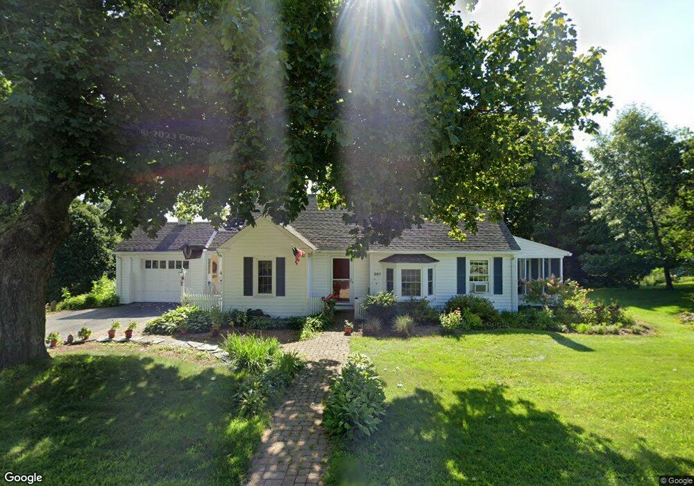
297 Maple St West Boylston, MA 01583
Estimated Value: $445,830 - $491,000
2
Beds
1
Bath
1,005
Sq Ft
$460/Sq Ft
Est. Value
About This Home
This home is located at 297 Maple St, West Boylston, MA 01583 and is currently estimated at $461,958, approximately $459 per square foot. 297 Maple St is a home located in Worcester County with nearby schools including Major Edwards Elementary School, West Boylston Junior/Senior High School, and Abby Kelley Foster Charter Public School.
Ownership History
Date
Name
Owned For
Owner Type
Purchase Details
Closed on
Aug 28, 1995
Sold by
Nutter William J and Nutter Doris
Bought by
Graham Lisa E
Current Estimated Value
Home Financials for this Owner
Home Financials are based on the most recent Mortgage that was taken out on this home.
Original Mortgage
$100,000
Interest Rate
7.32%
Mortgage Type
Purchase Money Mortgage
Create a Home Valuation Report for This Property
The Home Valuation Report is an in-depth analysis detailing your home's value as well as a comparison with similar homes in the area
Home Values in the Area
Average Home Value in this Area
Purchase History
| Date | Buyer | Sale Price | Title Company |
|---|---|---|---|
| Graham Lisa E | $125,000 | -- |
Source: Public Records
Mortgage History
| Date | Status | Borrower | Loan Amount |
|---|---|---|---|
| Open | Graham Lisa E | $82,900 | |
| Closed | Graham Lisa E | $100,000 |
Source: Public Records
Tax History Compared to Growth
Tax History
| Year | Tax Paid | Tax Assessment Tax Assessment Total Assessment is a certain percentage of the fair market value that is determined by local assessors to be the total taxable value of land and additions on the property. | Land | Improvement |
|---|---|---|---|---|
| 2025 | $52 | $373,200 | $108,200 | $265,000 |
| 2024 | $4,944 | $334,500 | $108,200 | $226,300 |
| 2023 | $5,321 | $341,500 | $107,100 | $234,400 |
| 2022 | $4,795 | $271,200 | $107,100 | $164,100 |
| 2021 | $4,811 | $260,600 | $102,600 | $158,000 |
| 2020 | $4,459 | $240,000 | $102,600 | $137,400 |
| 2019 | $4,296 | $227,900 | $102,600 | $125,300 |
| 2018 | $4,085 | $218,200 | $102,600 | $115,600 |
| 2017 | $4,057 | $215,800 | $102,600 | $113,200 |
| 2016 | $3,854 | $208,900 | $95,600 | $113,300 |
| 2015 | $3,688 | $201,100 | $94,600 | $106,500 |
Source: Public Records
Map
Nearby Homes
- 1 Highland Ave
- 12 Birchbrush Ln
- 740 Burncoat St Unit B
- 156 Hillside Village Dr
- 83 Hillside Village Dr
- 33 Meola Ave
- 1110 W Boylston St Unit A
- 7 Christy Ct
- 97 Hillside Village Dr
- 59 Santoro Rd
- 39 Meola Ave
- 33 Isleboro St
- 1097 W Boylston St
- 29 Isleboro St
- 39 Davidson Rd
- 44 Dixfield St
- 31 Danielles Way
- 22 Danielles Way
- 26 Danielles Way
- 12 Dixfield Rd