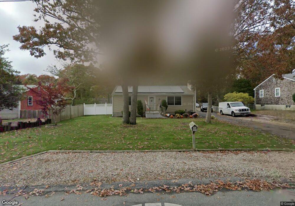
297 Megan Rd Hyannis, MA 02601
Estimated Value: $465,000 - $528,000
2
Beds
1
Bath
1,001
Sq Ft
$494/Sq Ft
Est. Value
About This Home
This home is located at 297 Megan Rd, Hyannis, MA 02601 and is currently estimated at $494,688, approximately $494 per square foot. 297 Megan Rd is a home located in Barnstable County with nearby schools including Hyannis West Elementary School, Barnstable United Elementary School, and Barnstable Intermediate School.
Ownership History
Date
Name
Owned For
Owner Type
Purchase Details
Closed on
Nov 22, 1996
Sold by
Scopino David A and Scopino Karen M
Bought by
Fulcher Michael P
Current Estimated Value
Home Financials for this Owner
Home Financials are based on the most recent Mortgage that was taken out on this home.
Original Mortgage
$76,431
Outstanding Balance
$7,347
Interest Rate
7.81%
Mortgage Type
Purchase Money Mortgage
Estimated Equity
$487,341
Purchase Details
Closed on
Sep 30, 1991
Sold by
Boggs Jean M and Bedard Leila M
Bought by
Scopino David A
Home Financials for this Owner
Home Financials are based on the most recent Mortgage that was taken out on this home.
Original Mortgage
$62,900
Interest Rate
9.1%
Mortgage Type
Purchase Money Mortgage
Purchase Details
Closed on
Jul 19, 1990
Sold by
Cowhey John J
Bought by
Boggs Jean M
Create a Home Valuation Report for This Property
The Home Valuation Report is an in-depth analysis detailing your home's value as well as a comparison with similar homes in the area
Home Values in the Area
Average Home Value in this Area
Purchase History
| Date | Buyer | Sale Price | Title Company |
|---|---|---|---|
| Fulcher Michael P | $76,500 | -- | |
| Scopino David A | $78,700 | -- | |
| Boggs Jean M | $97,000 | -- |
Source: Public Records
Mortgage History
| Date | Status | Borrower | Loan Amount |
|---|---|---|---|
| Open | Fulcher Michael P | $76,431 | |
| Previous Owner | Boggs Jean M | $62,900 |
Source: Public Records
Tax History Compared to Growth
Tax History
| Year | Tax Paid | Tax Assessment Tax Assessment Total Assessment is a certain percentage of the fair market value that is determined by local assessors to be the total taxable value of land and additions on the property. | Land | Improvement |
|---|---|---|---|---|
| 2025 | $3,675 | $396,400 | $135,000 | $261,400 |
| 2024 | $3,563 | $393,700 | $135,000 | $258,700 |
| 2023 | $3,365 | $351,600 | $129,500 | $222,100 |
| 2022 | $3,321 | $287,000 | $95,900 | $191,100 |
| 2021 | $2,944 | $247,200 | $90,900 | $156,300 |
| 2020 | $3,010 | $244,100 | $90,900 | $153,200 |
| 2019 | $2,768 | $220,000 | $85,800 | $134,200 |
| 2018 | $2,497 | $203,000 | $90,400 | $112,600 |
| 2017 | $2,114 | $176,300 | $69,100 | $107,200 |
| 2016 | $2,073 | $176,700 | $69,500 | $107,200 |
| 2015 | $1,895 | $163,800 | $67,000 | $96,800 |
Source: Public Records
Map
Nearby Homes
- 292 Megan Rd
- 220 Fawcett Ln
- 57 Suffolk Ave
- 15 Goldie Way
- 295 Sudbury Ln
- 7 Delta St
- 24 Bettys Pond Rd Unit K
- 24 Betty's Pond Rd Unit 1K
- 7 Arbeta Rd
- 29 Windshore Dr
- 297 W Main St Unit 12
- 720 Pitchers Way Unit 52
- 135 W Main St Unit 45
- 296 Lincoln Rd
- 142 Chestnut St
- 65 Olander Dr
- 75 Olander Dr
- 75 Olander Dr
- 68 Seaboard Ln
- 8 Jasmine Ln