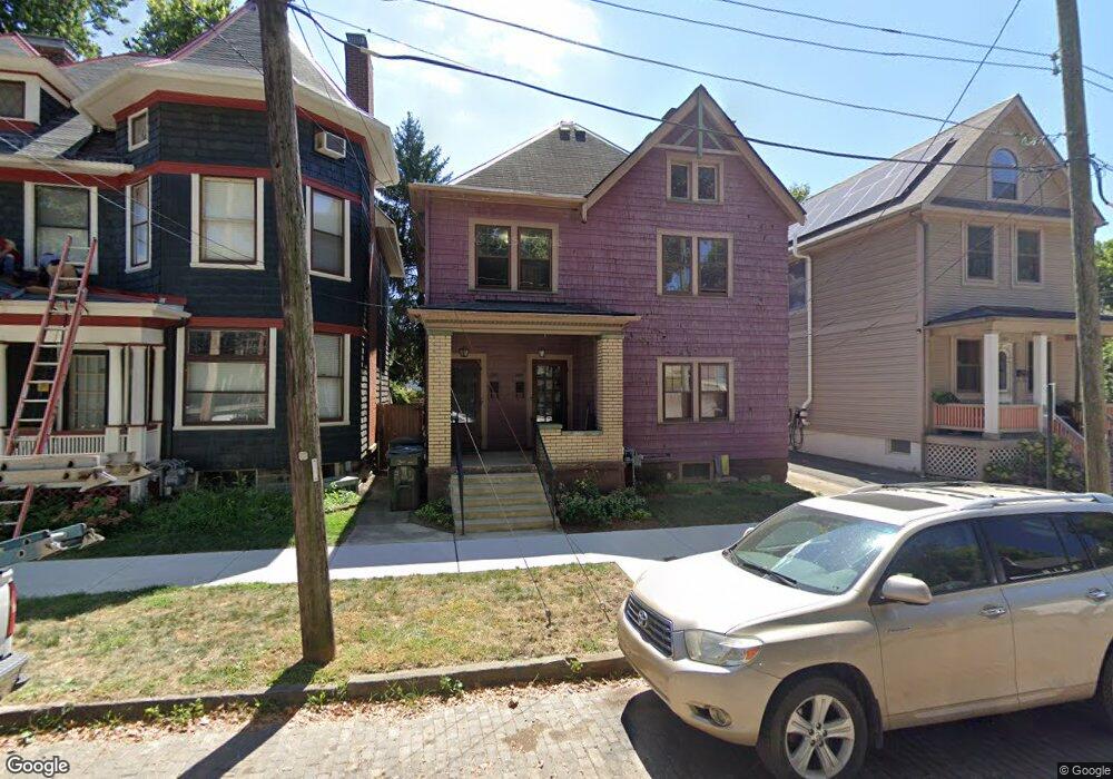
297 W 2nd Ave Unit 299 Columbus, OH 43201
Victorian Village NeighborhoodEstimated Value: $443,849 - $652,000
2
Beds
2
Baths
2,604
Sq Ft
$218/Sq Ft
Est. Value
About This Home
This home is located at 297 W 2nd Ave Unit 299, Columbus, OH 43201 and is currently estimated at $567,212, approximately $217 per square foot. 297 W 2nd Ave Unit 299 is a home located in Franklin County with nearby schools including Hubbard Elementary School, Dominion Middle School, and Whetstone High School.
Ownership History
Date
Name
Owned For
Owner Type
Purchase Details
Closed on
Nov 1, 1989
Bought by
King Christopher E and King Loui
Current Estimated Value
Purchase Details
Closed on
Mar 3, 1988
Purchase Details
Closed on
Jun 1, 1985
Create a Home Valuation Report for This Property
The Home Valuation Report is an in-depth analysis detailing your home's value as well as a comparison with similar homes in the area
Home Values in the Area
Average Home Value in this Area
Purchase History
| Date | Buyer | Sale Price | Title Company |
|---|---|---|---|
| King Christopher E | $77,500 | -- | |
| -- | -- | -- | |
| -- | -- | -- |
Source: Public Records
Tax History Compared to Growth
Tax History
| Year | Tax Paid | Tax Assessment Tax Assessment Total Assessment is a certain percentage of the fair market value that is determined by local assessors to be the total taxable value of land and additions on the property. | Land | Improvement |
|---|---|---|---|---|
| 2024 | $6,492 | $141,650 | $53,900 | $87,750 |
| 2023 | $6,410 | $141,650 | $53,900 | $87,750 |
| 2022 | $7,615 | $143,290 | $20,580 | $122,710 |
| 2021 | $7,628 | $143,290 | $20,580 | $122,710 |
| 2020 | $7,640 | $143,290 | $20,580 | $122,710 |
| 2019 | $7,426 | $119,420 | $17,150 | $102,270 |
| 2018 | $7,014 | $119,420 | $17,150 | $102,270 |
| 2017 | $7,345 | $119,420 | $17,150 | $102,270 |
| 2016 | $7,267 | $106,960 | $16,380 | $90,580 |
| 2015 | $6,616 | $106,960 | $16,380 | $90,580 |
| 2014 | $6,632 | $106,960 | $16,380 | $90,580 |
| 2013 | $2,974 | $97,230 | $14,875 | $82,355 |
Source: Public Records
Map
Nearby Homes
- 319 W 2nd Ave Unit 319
- 994 Harrison Ave
- 337 Tappan St
- 1018 Neil Ave
- 1016 Neil Ave
- 1042 Neil Ave
- 313 W 1st Ave
- 986 Highland St
- 1003 Pennsylvania Ave Unit 5
- 969 Hunter Ave
- 1025 Hunter Ave
- 867-871 Delaware Ave
- 884 Neil Ave
- 938 Hunter Ave
- 998 Ewing Alley Unit 998
- 162 E 2nd Ave
- 475 W 2nd Ave
- 1001 Dennison Ave
- 915 Dennison Ave Unit 915
- 496 W 1st Ave
- 301 W 2nd Ave
- 293 W 2nd Ave Unit 295
- 295 W 2nd Ave
- 586 W 2nd Ave
- 1003 Neil Ave
- 992 Delaware Ave Unit 996
- 298 W 2nd Ave
- 302 W 2nd Ave Unit 304
- 294 W 2nd Ave
- 304 W 2nd Ave
- 315 W 2nd Ave Unit 315
- 1017 Neil Ave
- 991 Neil Ave
- 1011 Delaware Ave Unit 1011
- 988 Delaware Ave Unit 990
- 1009 Delaware Ave Unit 1009
- 1023 Neil Ave
- 308 W 2nd Ave
- 983 Neil Ave
- 984 Delaware Ave