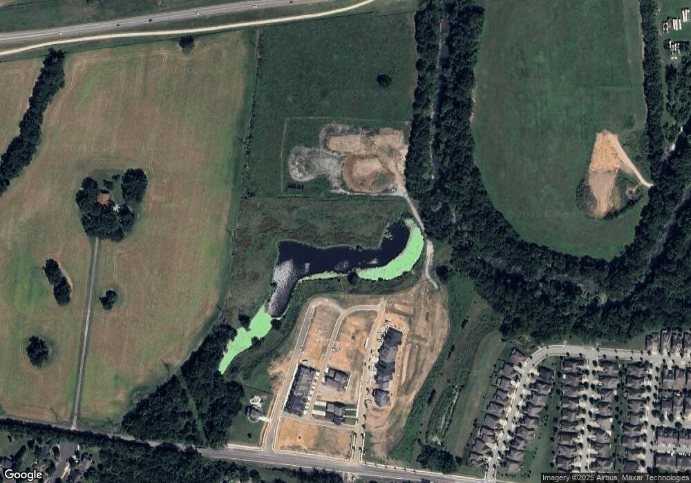
2970 Del Rio Pike Franklin, TN 37069
West Franklin NeighborhoodEstimated Value: $1,282,000 - $3,922,998
--
Bed
4
Baths
3,672
Sq Ft
$767/Sq Ft
Est. Value
About This Home
This home is located at 2970 Del Rio Pike, Franklin, TN 37069 and is currently estimated at $2,814,999, approximately $766 per square foot. 2970 Del Rio Pike is a home located in Williamson County with nearby schools including Poplar Grove K-4, Johnson Elementary School, and Poplar Grove 5-8.
Ownership History
Date
Name
Owned For
Owner Type
Purchase Details
Closed on
Jun 30, 2022
Sold by
Clayton Properties Group Inc
Bought by
Reese Farms Llc
Current Estimated Value
Home Financials for this Owner
Home Financials are based on the most recent Mortgage that was taken out on this home.
Original Mortgage
$11,268,306
Interest Rate
5.25%
Mortgage Type
New Conventional
Purchase Details
Closed on
May 8, 2019
Sold by
Reed Nancy L and Reese Pamela G
Bought by
Clayton Properties Group Inc
Purchase Details
Closed on
Oct 23, 2012
Sold by
Reese Gordon Owen
Bought by
Goodall Inc Builders
Create a Home Valuation Report for This Property
The Home Valuation Report is an in-depth analysis detailing your home's value as well as a comparison with similar homes in the area
Home Values in the Area
Average Home Value in this Area
Purchase History
| Date | Buyer | Sale Price | Title Company |
|---|---|---|---|
| Reese Farms Llc | $8,000,000 | None Listed On Document | |
| Clayton Properties Group Inc | $4,836,700 | None Available | |
| Goodall Inc Builders | $770,000 | None Available |
Source: Public Records
Mortgage History
| Date | Status | Borrower | Loan Amount |
|---|---|---|---|
| Closed | Reese Farms Llc | $11,268,306 |
Source: Public Records
Tax History Compared to Growth
Tax History
| Year | Tax Paid | Tax Assessment Tax Assessment Total Assessment is a certain percentage of the fair market value that is determined by local assessors to be the total taxable value of land and additions on the property. | Land | Improvement |
|---|---|---|---|---|
| 2024 | $16,065 | $567,450 | $567,450 | -- |
| 2023 | $25,818 | $948,775 | $857,425 | $91,350 |
| 2022 | $25,818 | $948,775 | $857,425 | $91,350 |
| 2021 | $25,818 | $948,775 | $857,425 | $91,350 |
| 2020 | $13,951 | $432,375 | $342,975 | $89,400 |
| 2019 | $4,123 | $127,775 | $38,375 | $89,400 |
| 2018 | $4,034 | $127,775 | $38,375 | $89,400 |
| 2017 | $3,970 | $127,775 | $38,375 | $89,400 |
| 2016 | $0 | $127,775 | $38,375 | $89,400 |
| 2015 | -- | $105,425 | $29,525 | $75,900 |
| 2014 | -- | $105,425 | $29,525 | $75,900 |
Source: Public Records
Map
Nearby Homes
- Azalea Plan at Reese
- Jordan Plan at Reese
- 5029 Owenruth Dr
- 5037 Owenruth Dr
- 4068 Penfield Dr
- 4064 Penfield Dr
- 4072 Penfield Dr
- 4060 Penfield Dr
- 5041 Owenruth Dr
- 4076 Penfield Dr
- 305 Abram Ct
- 2007 Hamilton Way
- 523 Antebellum Ct
- 527 Antebellum Ct
- 310 Devonshire Dr
- 3042 Blossom Trail Ln
- 454 Cardel Ln
- 714 Founders Pointe Blvd
- 1632 Cooper Creek Ln
- 1802 Thornbrook Ln
- 4000 Penfield Drive Unit D
- 4012 Penfield Dr Unit A
- 4024 Penfield Dr
- 4004 Penfield Drive Unit C
- 4048 Penfield Dr
- 2974 Del Rio Pike
- 632 Rutherford Ln
- 403 Mcphail Ct
- 631 Rutherford Ln
- 234 Lancelot Ln
- 402 Mcphail Ct
- 629 Rutherford Ln
- 630 Rutherford Ln
- 235 Lancelot Ln
- 232 Lancelot Ln
- 1001 Reese Dr
- 627 Rutherford Ln
- 1003 Reese Dr
- 1005 Reese Dr
- 1007 Reese Dr
