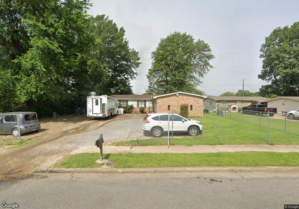
2971 Curtis St Memphis, TN 38118
Parkway Village NeighborhoodEstimated Value: $104,000 - $152,000
3
Beds
2
Baths
1,390
Sq Ft
$96/Sq Ft
Est. Value
About This Home
This home is located at 2971 Curtis St, Memphis, TN 38118 and is currently estimated at $133,767, approximately $96 per square foot. 2971 Curtis St is a home located in Shelby County with nearby schools including Evans Elementary School, Wooddale High School, and Cornerstone Prep School.
Ownership History
Date
Name
Owned For
Owner Type
Purchase Details
Closed on
Apr 1, 2009
Sold by
Wells Fargo Bank Na
Bought by
Kouch Ly K and Kouch Vouch E
Current Estimated Value
Purchase Details
Closed on
Jan 28, 2008
Sold by
Norrells Eugene and Norrells Debra
Bought by
Wells Fargo Bank Na and National City Mortgage Loan Trust 2005-1
Purchase Details
Closed on
Mar 30, 2005
Sold by
Johnson Robert Reed and Johnson John R
Bought by
Norrells Eugene and Norrells Debra
Home Financials for this Owner
Home Financials are based on the most recent Mortgage that was taken out on this home.
Original Mortgage
$67,600
Interest Rate
7.25%
Mortgage Type
Fannie Mae Freddie Mac
Create a Home Valuation Report for This Property
The Home Valuation Report is an in-depth analysis detailing your home's value as well as a comparison with similar homes in the area
Home Values in the Area
Average Home Value in this Area
Purchase History
| Date | Buyer | Sale Price | Title Company |
|---|---|---|---|
| Kouch Ly K | $28,000 | Associates Closing & Title | |
| Wells Fargo Bank Na | $65,229 | None Available | |
| Norrells Eugene | $84,500 | Chicago Title Insurance Co |
Source: Public Records
Mortgage History
| Date | Status | Borrower | Loan Amount |
|---|---|---|---|
| Previous Owner | Norrells Eugene | $67,600 | |
| Closed | Norrells Eugene | $16,900 |
Source: Public Records
Tax History Compared to Growth
Tax History
| Year | Tax Paid | Tax Assessment Tax Assessment Total Assessment is a certain percentage of the fair market value that is determined by local assessors to be the total taxable value of land and additions on the property. | Land | Improvement |
|---|---|---|---|---|
| 2025 | $685 | $30,825 | $4,200 | $26,625 |
| 2024 | $685 | $20,200 | $3,000 | $17,200 |
| 2023 | $1,231 | $20,200 | $3,000 | $17,200 |
| 2022 | $1,231 | $20,200 | $3,000 | $17,200 |
| 2021 | $1,245 | $20,200 | $3,000 | $17,200 |
| 2020 | $1,197 | $16,525 | $3,000 | $13,525 |
| 2019 | $1,197 | $16,525 | $3,000 | $13,525 |
| 2018 | $1,197 | $16,525 | $3,000 | $13,525 |
| 2017 | $679 | $16,525 | $3,000 | $13,525 |
| 2016 | $684 | $15,650 | $0 | $0 |
| 2014 | $684 | $15,650 | $0 | $0 |
Source: Public Records
Map
Nearby Homes
- 3016 Croley Dr
- 5067 Ginger Cir
- 5104 Christopher Ave
- 2883 Cottonwood Cove
- 3075 Dewitt Cove
- 2845 Clearbrook St
- 4876 Cottonwood Rd
- 3079 Castleman St
- 4843 Bridgedale Ave
- 4809 Bridgedale Ave
- 2937 Brandale St
- 4789 Judy Lynn Ave
- 4864 Cloister Ave
- 2849 S Mendenhall Rd
- 3068 S Mendenhall Rd
- 5134 Scottsdale Ave
- 3240 Boxdale St
- 3016 Egan Dr
- 3287 Boxdale St
- 4833 Scottsdale Ave
- 2963 Curtis St
- 2983 Curtis St
- 2957 Curtis St
- 2974 Croley Dr
- 2962 Curtis St
- 2949 Curtis St
- 2991 Curtis St
- 2984 Curtis St
- 5039 Colewood Ave
- 2978 Croley Dr
- 2943 Curtis St
- 2999 Curtis St
- 2992 Curtis St
- 5049 Colewood Ave
- 2987 Croley Dr
- 2980 Croley Dr
- 3000 Curtis St
- 5040 Colewood Ave
- 2935 Curtis St
- 5055 Colewood Ave