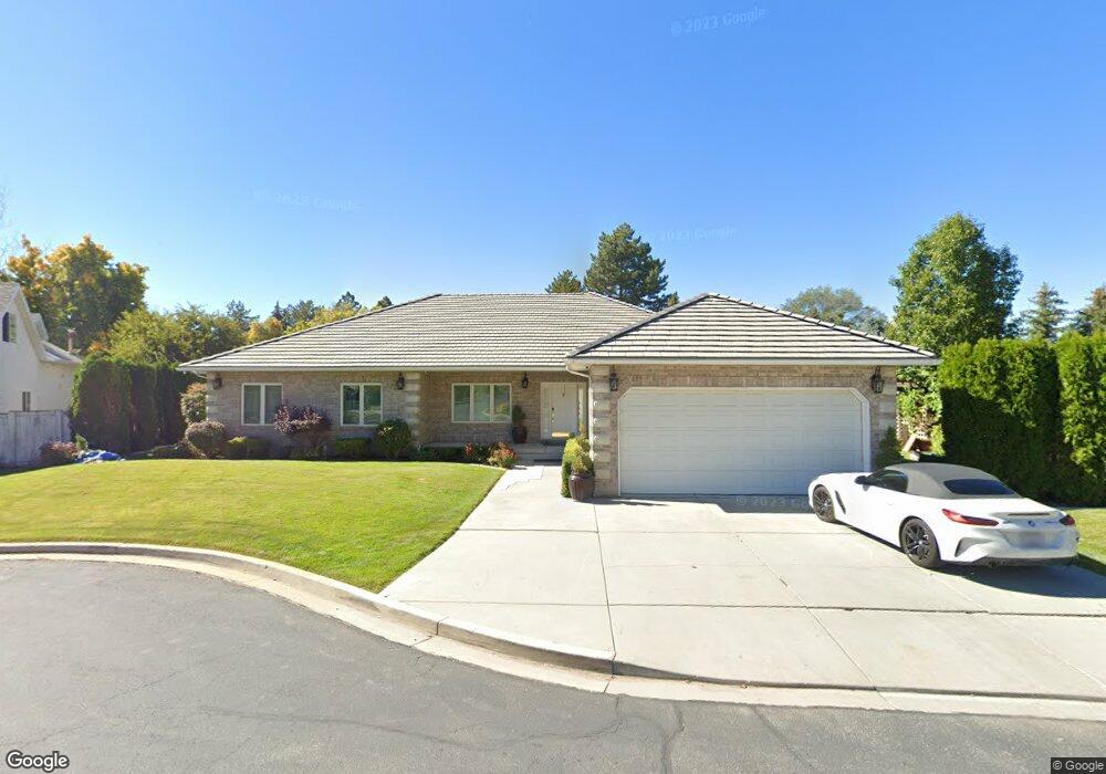
2971 N 100 W Provo, UT 84604
Riverside NeighborhoodEstimated Value: $757,000 - $1,032,000
4
Beds
3
Baths
2,826
Sq Ft
$297/Sq Ft
Est. Value
About This Home
This home is located at 2971 N 100 W, Provo, UT 84604 and is currently estimated at $839,121, approximately $296 per square foot. 2971 N 100 W is a home located in Utah County with nearby schools including Canyon Crest Elementary School, Centennial Middle School, and Timpview High School.
Ownership History
Date
Name
Owned For
Owner Type
Purchase Details
Closed on
Mar 23, 2016
Sold by
Barrow Jeffery R and Barrow Mitzi L
Bought by
Hermansen Mitzi L
Current Estimated Value
Home Financials for this Owner
Home Financials are based on the most recent Mortgage that was taken out on this home.
Original Mortgage
$118,400
Outstanding Balance
$93,713
Interest Rate
3.65%
Mortgage Type
New Conventional
Estimated Equity
$745,408
Purchase Details
Closed on
Nov 3, 2004
Sold by
Stiggins Charles F and Stiggins Rebecca A
Bought by
Barrow Jeffery R and Barrow Mitzi L
Home Financials for this Owner
Home Financials are based on the most recent Mortgage that was taken out on this home.
Original Mortgage
$216,700
Interest Rate
5.69%
Mortgage Type
Purchase Money Mortgage
Create a Home Valuation Report for This Property
The Home Valuation Report is an in-depth analysis detailing your home's value as well as a comparison with similar homes in the area
Home Values in the Area
Average Home Value in this Area
Purchase History
| Date | Buyer | Sale Price | Title Company |
|---|---|---|---|
| Hermansen Mitzi L | -- | None Available | |
| Barrow Jeffery R | -- | Old Republic Title Company |
Source: Public Records
Mortgage History
| Date | Status | Borrower | Loan Amount |
|---|---|---|---|
| Open | Hermansen Mitzi L | $118,400 | |
| Previous Owner | Barrow Jeffery R | $216,700 | |
| Closed | Barrow Jeffery R | $36,231 |
Source: Public Records
Tax History Compared to Growth
Tax History
| Year | Tax Paid | Tax Assessment Tax Assessment Total Assessment is a certain percentage of the fair market value that is determined by local assessors to be the total taxable value of land and additions on the property. | Land | Improvement |
|---|---|---|---|---|
| 2025 | $3,526 | $402,105 | $277,500 | $453,600 |
| 2024 | $3,526 | $347,105 | $0 | $0 |
| 2023 | $3,337 | $323,785 | $0 | $0 |
| 2022 | $3,204 | $313,500 | $0 | $0 |
| 2021 | $3,203 | $546,600 | $234,800 | $311,800 |
| 2020 | $3,187 | $509,900 | $204,200 | $305,700 |
| 2019 | $2,952 | $491,200 | $204,200 | $287,000 |
| 2018 | $2,646 | $446,500 | $196,900 | $249,600 |
| 2017 | $2,759 | $255,805 | $0 | $0 |
| 2016 | $2,405 | $207,845 | $0 | $0 |
| 2015 | $2,125 | $185,625 | $0 | $0 |
| 2014 | $1,842 | $202,620 | $0 | $0 |
Source: Public Records
Map
Nearby Homes
- 2939 N Marrcrest Dr W
- 3057 N 100 W
- 2823 N Marrcrest E
- 3240 Shadowbrook Dr
- 3305 N Shadowbrook Cir
- 1636 N 320 E Unit 5
- 1660 N 320 E Unit 3
- 1648 N 320 E Unit 4
- 1625 N 320 E Unit 1
- 1624 N 320 E Unit 6
- 1615 N 320 E Unit 1
- 1612 N 320 E Unit RES
- 111 Woodside Dr
- 2774 N 370 E
- 1311 S 1100 E
- 3535 N 160 St W
- 5600 N Canyon Rd
- 1171 S Carterville Rd
- 2244 N Canyon Rd Unit 305
- 2244 N Canyon Rd Unit 207
- 3064 N 100 St W Unit 26
- 2908 Marrcrest W
- 2993 N 100 W
- 2949 N 100 W
- 2918 Marrcrest W
- 2918 Marrcrest W Unit 2918
- 2932 Marrcrest W
- 2960 Marrcrest W
- 2982 Marrcrest W
- 2942 Marrcrest W
- 2998 Marrcrest W
- 76 W 2950 N
- 3018 Marrcrest W
- 3018 Marrcrest W
- 81 W 2950 N
- 2891 Marrcrest W
- 2889 Marrcrest W
- 2895 Marrcrest North Cir
- 82 Marrcrest N
- 2887 Marrcrest W