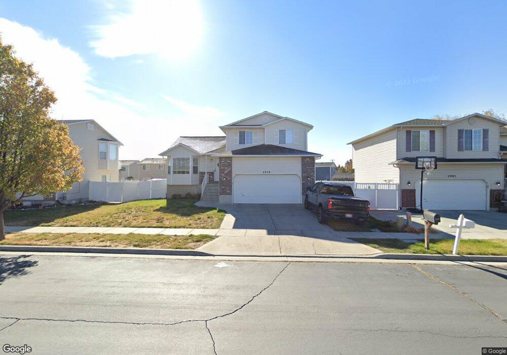
2973 W 2025 S Syracuse, UT 84075
Estimated Value: $473,000 - $510,000
4
Beds
3
Baths
2,199
Sq Ft
$225/Sq Ft
Est. Value
About This Home
This home is located at 2973 W 2025 S, Syracuse, UT 84075 and is currently estimated at $495,144, approximately $225 per square foot. 2973 W 2025 S is a home located in Davis County with nearby schools including Buffalo Point School, Syracuse Junior High School, and Syracuse High School.
Ownership History
Date
Name
Owned For
Owner Type
Purchase Details
Closed on
Jun 15, 2021
Sold by
Cowan Curtis and Cowan Megan
Bought by
Authentic Residential Llc
Current Estimated Value
Purchase Details
Closed on
May 15, 2019
Sold by
Cowan Curtis
Bought by
Cowan Curtis and Cowan Megan
Home Financials for this Owner
Home Financials are based on the most recent Mortgage that was taken out on this home.
Original Mortgage
$257,732
Interest Rate
3.5%
Mortgage Type
FHA
Purchase Details
Closed on
Apr 8, 2016
Sold by
United State Of America
Bought by
Cowan Curtis
Home Financials for this Owner
Home Financials are based on the most recent Mortgage that was taken out on this home.
Original Mortgage
$211,105
Interest Rate
4.62%
Mortgage Type
FHA
Purchase Details
Closed on
Feb 24, 2010
Sold by
Zenquiz Dannica L and Zenquiz Rodriguez David
Bought by
House Ii Carl E
Home Financials for this Owner
Home Financials are based on the most recent Mortgage that was taken out on this home.
Original Mortgage
$204,150
Interest Rate
5.03%
Mortgage Type
VA
Purchase Details
Closed on
Oct 12, 2006
Sold by
Conner Laine A and Conner Courtney L
Bought by
Zenquiz Dannica L and Zenquiz Rodriguez David
Home Financials for this Owner
Home Financials are based on the most recent Mortgage that was taken out on this home.
Original Mortgage
$198,681
Interest Rate
6.44%
Mortgage Type
VA
Purchase Details
Closed on
Feb 24, 2005
Sold by
Eubanks Benjamin L and Eubanks Heather S
Bought by
Conner Laine A and Conner Courtney L
Home Financials for this Owner
Home Financials are based on the most recent Mortgage that was taken out on this home.
Original Mortgage
$30,200
Interest Rate
5.61%
Mortgage Type
Stand Alone Second
Purchase Details
Closed on
Jul 30, 2002
Sold by
Woodside Homes Corp
Bought by
Eubanks Benjamin L and Eubanks Heather S
Home Financials for this Owner
Home Financials are based on the most recent Mortgage that was taken out on this home.
Original Mortgage
$131,645
Interest Rate
6.52%
Mortgage Type
VA
Create a Home Valuation Report for This Property
The Home Valuation Report is an in-depth analysis detailing your home's value as well as a comparison with similar homes in the area
Home Values in the Area
Average Home Value in this Area
Purchase History
| Date | Buyer | Sale Price | Title Company |
|---|---|---|---|
| Authentic Residential Llc | -- | Hickman Land Title | |
| Cowan Curtis | -- | Intermountain Title | |
| Cowan Curtis | -- | Us Title | |
| House Ii Carl E | -- | First American Title | |
| Zenquiz Dannica L | -- | First American Title | |
| Conner Laine A | -- | Us Title Company Of Utah | |
| Eubanks Benjamin L | -- | First American Title Ins Co |
Source: Public Records
Mortgage History
| Date | Status | Borrower | Loan Amount |
|---|---|---|---|
| Previous Owner | Cowan Curtis | $257,732 | |
| Previous Owner | Cowan Curtis | $211,105 | |
| Previous Owner | House Ii Carl E | $204,150 | |
| Previous Owner | Zenquiz Dannica L | $198,681 | |
| Previous Owner | Conner Laine A | $30,200 | |
| Previous Owner | Conner Laine A | $120,800 | |
| Previous Owner | Eubanks Benjamin L | $131,645 |
Source: Public Records
Tax History Compared to Growth
Tax History
| Year | Tax Paid | Tax Assessment Tax Assessment Total Assessment is a certain percentage of the fair market value that is determined by local assessors to be the total taxable value of land and additions on the property. | Land | Improvement |
|---|---|---|---|---|
| 2025 | $2,714 | $261,800 | $98,298 | $163,502 |
| 2024 | $2,599 | $252,449 | $71,243 | $181,206 |
| 2023 | $2,413 | $234,850 | $64,136 | $170,713 |
| 2022 | $2,619 | $462,000 | $98,671 | $363,329 |
| 2021 | $2,237 | $336,000 | $79,619 | $256,381 |
| 2020 | $1,561 | $227,000 | $59,933 | $167,067 |
| 2019 | $1,498 | $215,000 | $65,904 | $149,096 |
| 2018 | $1,390 | $198,000 | $65,546 | $132,454 |
| 2016 | $1,521 | $113,685 | $29,589 | $84,096 |
| 2015 | $1,492 | $106,150 | $29,589 | $76,561 |
| 2014 | $1,409 | $102,165 | $29,589 | $72,576 |
| 2013 | -- | $100,923 | $25,204 | $75,719 |
Source: Public Records
Map
Nearby Homes
- 2961 S 2425 W Unit 1123
- 2982 S 3000 W
- 2912 S 3000 W
- 3360 W 2280 S
- 2696 2495 S Unit 207
- 2524 S 3590 W Unit 602
- 2965 S 3000 W
- 2971 S 2425 W Unit 1124
- 2686 S 2440 W Unit 101
- 2635 S 2430 W Unit 114
- 3062 W Solace St
- 2679 W Antelope Dr
- 3704 W 2170 S Unit 111
- 2297 W 2175 S
- 2735 S Shoreline Dr
- 4344 W 1825 S Unit 102
- 4354 W 1825 S Unit 104
- 4348 W 1825 S Unit 103
- 2574 S 2430 W Unit 503
- 2237 Craig Ln