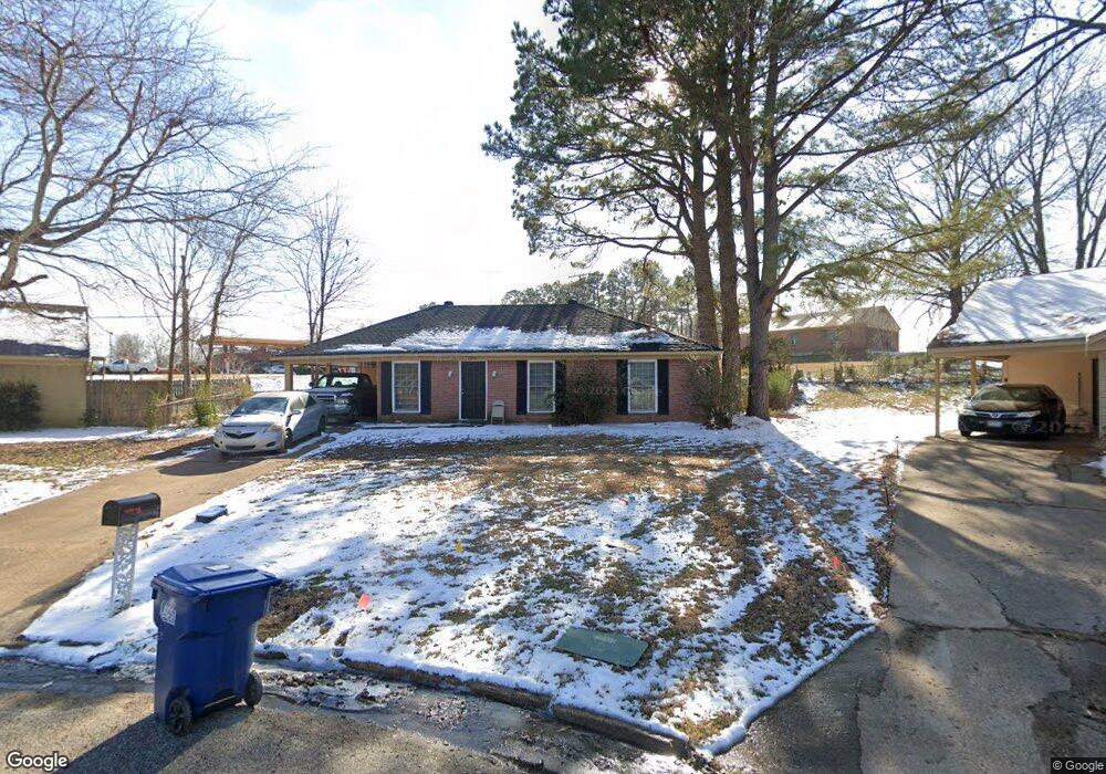
2975 Devon Cir Horn Lake, MS 38637
Estimated Value: $161,000 - $178,166
3
Beds
2
Baths
1,163
Sq Ft
$142/Sq Ft
Est. Value
About This Home
This home is located at 2975 Devon Cir, Horn Lake, MS 38637 and is currently estimated at $165,542, approximately $142 per square foot. 2975 Devon Cir is a home located in DeSoto County with nearby schools including Horn Lake Elementary School, Horn Lake Intermediate School, and Horn Lake Middle School.
Ownership History
Date
Name
Owned For
Owner Type
Purchase Details
Closed on
Aug 31, 2021
Sold by
Jm Investment Properties Llc
Bought by
Rs Rental I Llc
Current Estimated Value
Purchase Details
Closed on
Jul 9, 2009
Sold by
Secretary Of Housing & Urban Development
Bought by
Gma Properties Llc
Home Financials for this Owner
Home Financials are based on the most recent Mortgage that was taken out on this home.
Original Mortgage
$52,160
Interest Rate
5.27%
Mortgage Type
Purchase Money Mortgage
Create a Home Valuation Report for This Property
The Home Valuation Report is an in-depth analysis detailing your home's value as well as a comparison with similar homes in the area
Home Values in the Area
Average Home Value in this Area
Purchase History
| Date | Buyer | Sale Price | Title Company |
|---|---|---|---|
| Rs Rental I Llc | -- | Summit Title & Escrow Llc | |
| Gma Properties Llc | -- | None Available |
Source: Public Records
Mortgage History
| Date | Status | Borrower | Loan Amount |
|---|---|---|---|
| Previous Owner | Gma Properties Llc | $52,160 |
Source: Public Records
Tax History
| Year | Tax Paid | Tax Assessment Tax Assessment Total Assessment is a certain percentage of the fair market value that is determined by local assessors to be the total taxable value of land and additions on the property. | Land | Improvement |
|---|---|---|---|---|
| 2025 | $1,522 | $12,045 | $2,250 | $9,795 |
| 2024 | $5,409 | $9,010 | $2,250 | $6,760 |
| 2023 | $5,409 | $9,010 | $0 | $0 |
| 2022 | $1,341 | $9,010 | $2,250 | $6,760 |
| 2021 | $1,341 | $9,010 | $2,250 | $6,760 |
| 2020 | $1,261 | $8,469 | $2,250 | $6,219 |
| 2019 | $1,261 | $8,469 | $2,250 | $6,219 |
| 2017 | $1,234 | $14,240 | $8,245 | $5,995 |
| 2016 | $1,201 | $8,245 | $2,250 | $5,995 |
| 2015 | $1,193 | $14,240 | $8,245 | $5,995 |
| 2014 | $1,201 | $8,245 | $0 | $0 |
| 2013 | $1,168 | $8,245 | $0 | $0 |
Source: Public Records
Map
Nearby Homes
- 2947 Waverly Dr
- 6160 Lynnfield Rd
- 2845 Waverly Dr
- 6265 Foxbriar Dr
- 5635 Kentwood Dr
- 6445 Heather Rd
- 6470 Forest Glen Dr
- 3140 Forest Glen Dr
- 2715 Meadowbrook Dr
- 5508 Tulane Rd
- 2515 Bryce Cove
- 3045 Normandy Dr
- 6325 Collinwood Rd
- 2881 Normandy Dr
- 2880 Briarwood Dr
- 6770 Northwood Cove
- 5599 Claridge Ct
- 0 Horn Lake Rd
- 5318 Alpine Dr
- 1939 Ingleside Cove
- 6035 Devon Cir
- 2965 Devon Cir
- 6010 Tulane Rd
- 6026 Tulane Rd
- 2955 Devon Cove
- 6055 Devon Cir
- 2955 Devon Cir
- 6040 Tulane Rd
- 2945 Devon Cir
- 6065 Devon Cir
- 6060 Devon Cir
- 6056 Tulane Rd
- 2935 Devon Cir
- 6075 Devon Cir
- 2940 Devon Cir
- 6070 Tulane Rd
- 2880 Brachton Cove W
- 6070 Devon Cir
- 2900 Brachton Cove W
- 2930 Devon Cir
Your Personal Tour Guide
Ask me questions while you tour the home.