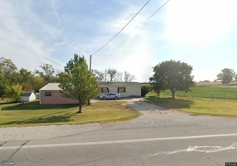
2976 Highway 92 Greenfield, IA 50849
Estimated Value: $118,068 - $160,000
3
Beds
2
Baths
1,120
Sq Ft
$124/Sq Ft
Est. Value
About This Home
This home is located at 2976 Highway 92, Greenfield, IA 50849 and is currently estimated at $138,517, approximately $123 per square foot. 2976 Highway 92 is a home located in Adair County with nearby schools including Eubank Elementary School, Nodaway Valley Elementary School, and Nodaway Valley Middle School.
Ownership History
Date
Name
Owned For
Owner Type
Purchase Details
Closed on
Oct 27, 2025
Sold by
Merical Jay Lee
Bought by
Galanakis Gabriel J
Current Estimated Value
Home Financials for this Owner
Home Financials are based on the most recent Mortgage that was taken out on this home.
Original Mortgage
$98,000
Outstanding Balance
$98,000
Interest Rate
5.41%
Mortgage Type
Credit Line Revolving
Estimated Equity
$40,517
Purchase Details
Closed on
Feb 14, 2006
Sold by
Gilbert Vickie S
Bought by
Merical Jay
Create a Home Valuation Report for This Property
The Home Valuation Report is an in-depth analysis detailing your home's value as well as a comparison with similar homes in the area
Home Values in the Area
Average Home Value in this Area
Purchase History
| Date | Buyer | Sale Price | Title Company |
|---|---|---|---|
| Galanakis Gabriel J | $47,000 | None Listed On Document | |
| Merical Jay | -- | None Available |
Source: Public Records
Mortgage History
| Date | Status | Borrower | Loan Amount |
|---|---|---|---|
| Open | Galanakis Gabriel J | $98,000 |
Source: Public Records
Tax History Compared to Growth
Tax History
| Year | Tax Paid | Tax Assessment Tax Assessment Total Assessment is a certain percentage of the fair market value that is determined by local assessors to be the total taxable value of land and additions on the property. | Land | Improvement |
|---|---|---|---|---|
| 2025 | $494 | $92,040 | $34,580 | $57,460 |
| 2024 | $494 | $86,410 | $31,850 | $54,560 |
| 2023 | $446 | $86,410 | $31,850 | $54,560 |
| 2022 | $428 | $55,850 | $22,750 | $33,100 |
| 2021 | $428 | $55,850 | $22,750 | $33,100 |
| 2020 | $426 | $52,640 | $22,750 | $29,890 |
| 2019 | $464 | $52,640 | $0 | $0 |
| 2018 | $454 | $55,409 | $0 | $0 |
| 2017 | $374 | $44,997 | $0 | $0 |
| 2016 | $370 | $44,997 | $9,100 | $35,897 |
| 2015 | $370 | $58,849 | $0 | $0 |
| 2014 | $458 | $58,849 | $0 | $0 |
Source: Public Records
Map
Nearby Homes
- 000 Vinton Ave
- 2543 Trenton Ave
- 2040 Stuart Rd
- 3280 260th St
- 3289 260th St
- 2169 Adair-Madison Ave
- 2169 Adair Madison Ave
- Vinton Ave
- 119 Foley St
- 2212 Deer Run Ave
- 1622 Stuart Rd
- 2548 Iowa 92
- 506 SE 4th St
- 107 NE 3rd St
- 605 NW 2nd St
- 203 NW 3rd St
- 308 NW Hayes St
- 1723 Creamery Rd
- 1103 170th St
- 0000 MacKsburg Rd