Estimated Value: $317,000 - $372,000
4
Beds
3
Baths
2,012
Sq Ft
$172/Sq Ft
Est. Value
About This Home
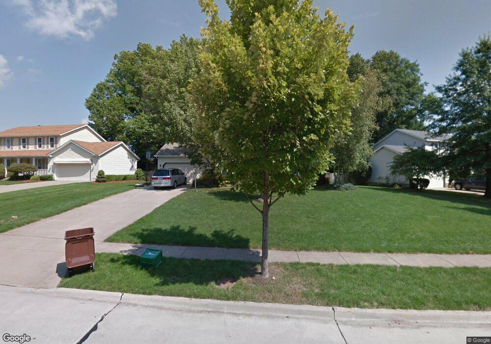
This home is located at 2976 Williamsburg Cir, Stow, OH 44224 and is currently estimated at $346,162, approximately $172 per square foot. 2976 Williamsburg Cir is a home located in Summit County with nearby schools including Stow-Munroe Falls High School and Walsh Jesuit High School.
Ownership History
Date
Name
Owned For
Owner Type
Purchase Details
Closed on
Jul 19, 2000
Sold by
Monago Gene V and Monago Diana E
Bought by
Byron B Michael and Shih Wendy W
Current Estimated Value
Home Financials for this Owner
Home Financials are based on the most recent Mortgage that was taken out on this home.
Original Mortgage
$142,400
Interest Rate
8.31%
Purchase Details
Closed on
Jul 10, 1999
Sold by
Gregory Deborah L and Gregory John C
Bought by
Monago Gene and Monago Diana E
Home Financials for this Owner
Home Financials are based on the most recent Mortgage that was taken out on this home.
Original Mortgage
$141,600
Interest Rate
6.87%
Create a Home Valuation Report for This Property
The Home Valuation Report is an in-depth analysis detailing your home's value as well as a comparison with similar homes in the area
Home Values in the Area
Average Home Value in this Area
Purchase History
| Date | Buyer | Sale Price | Title Company |
|---|---|---|---|
| Byron B Michael | $178,000 | Miller Examining Service Inc | |
| Monago Gene | $177,000 | Midland Commerce Group |
Source: Public Records
Mortgage History
| Date | Status | Borrower | Loan Amount |
|---|---|---|---|
| Previous Owner | Byron B Michael | $142,400 | |
| Previous Owner | Monago Gene | $141,600 |
Source: Public Records
Tax History Compared to Growth
Tax History
| Year | Tax Paid | Tax Assessment Tax Assessment Total Assessment is a certain percentage of the fair market value that is determined by local assessors to be the total taxable value of land and additions on the property. | Land | Improvement |
|---|---|---|---|---|
| 2025 | $6,918 | $99,387 | $17,175 | $82,212 |
| 2024 | $5,595 | $99,387 | $17,175 | $82,212 |
| 2023 | $6,918 | $99,387 | $17,175 | $82,212 |
| 2022 | $4,885 | $76,549 | $13,213 | $63,336 |
| 2021 | $4,373 | $76,549 | $13,213 | $63,336 |
| 2020 | $4,298 | $76,550 | $13,210 | $63,340 |
| 2019 | $4,049 | $67,360 | $13,080 | $54,280 |
| 2018 | $3,983 | $67,360 | $13,080 | $54,280 |
| 2017 | $3,651 | $67,360 | $13,080 | $54,280 |
| 2016 | $3,757 | $59,940 | $13,080 | $46,860 |
| 2015 | $3,651 | $59,940 | $13,080 | $46,860 |
| 2014 | $3,654 | $59,940 | $13,080 | $46,860 |
| 2013 | $3,695 | $61,030 | $13,080 | $47,950 |
Source: Public Records
Map
Nearby Homes
- 2831 Saybrooke Blvd
- 2908 Wexford Blvd
- 2714 Wexford Blvd
- 4444 Hickory Trail
- 4445 Kenneth Trail
- 4556 Fishcreek Rd
- 4638 Dresher Trail
- 3788 Woodbury Oval Unit 60
- 4078 Pardee Rd
- 3860 Lake Run Blvd
- 4155 Burton Dr
- 4131 Burton Dr
- 0 Vira Rd
- 4910 Independence Cir Unit D
- 4916 Friar Rd Unit B
- 3801 Baird Rd
- 2260 E Gilwood Dr
- 2410 Wrens Dr S
- 4322 Lorwood Dr
- 3711 Vira Rd
- 2970 Williamsburg Cir
- 2988 Williamsburg Cir
- 2956 Williamsburg Cir
- 4235 Williamsburg Dr
- 2996 Williamsburg Cir
- 4241 Williamsburg Dr
- 2975 Williamsburg Cir
- 2983 Williamsburg Cir
- 2942 Williamsburg Cir
- 4230 Williamsburg Dr
- 2967 Williamsburg Cir
- 2959 Williamsburg Cir
- 3004 Williamsburg Cir
- 2997 Williamsburg Cir
- 2951 Williamsburg Cir
- 2934 Williamsburg Cir
- 4247 Williamsburg Dr
- 2947 Williamsburg Cir
- 2766 Brookshire Ct
- 4236 Williamsburg Dr