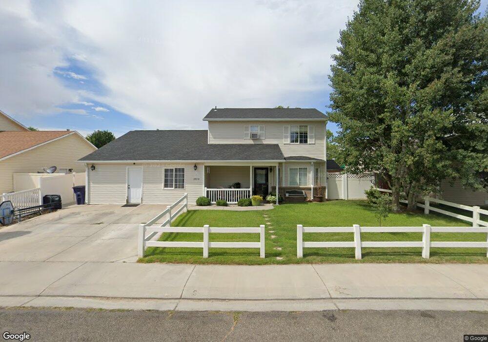
2978 Brookside Dr Grand Junction, CO 81504
Northeast Grand Junction NeighborhoodEstimated Value: $419,000 - $535,000
4
Beds
3
Baths
2,146
Sq Ft
$221/Sq Ft
Est. Value
About This Home
This home is located at 2978 Brookside Dr, Grand Junction, CO 81504 and is currently estimated at $473,447, approximately $220 per square foot. 2978 Brookside Dr is a home located in Mesa County with nearby schools including Thunder Mountain Elementary School, Bookcliff Middle School, and Central High School.
Ownership History
Date
Name
Owned For
Owner Type
Purchase Details
Closed on
Dec 3, 2014
Sold by
Cunningham Scott W and Cunningham Stormy
Bought by
Killpack Stormy
Current Estimated Value
Purchase Details
Closed on
Mar 19, 2003
Sold by
Cunningham Stormy and Killpack Scott
Bought by
Cunningham Stormy and Killpack Scott
Home Financials for this Owner
Home Financials are based on the most recent Mortgage that was taken out on this home.
Original Mortgage
$128,093
Interest Rate
5.77%
Mortgage Type
FHA
Create a Home Valuation Report for This Property
The Home Valuation Report is an in-depth analysis detailing your home's value as well as a comparison with similar homes in the area
Home Values in the Area
Average Home Value in this Area
Purchase History
| Date | Buyer | Sale Price | Title Company |
|---|---|---|---|
| Killpack Stormy | -- | None Available | |
| Cunningham Stormy | -- | Transcontinental Title Compa |
Source: Public Records
Mortgage History
| Date | Status | Borrower | Loan Amount |
|---|---|---|---|
| Previous Owner | Cunningham Stormy | $128,093 |
Source: Public Records
Tax History Compared to Growth
Tax History
| Year | Tax Paid | Tax Assessment Tax Assessment Total Assessment is a certain percentage of the fair market value that is determined by local assessors to be the total taxable value of land and additions on the property. | Land | Improvement |
|---|---|---|---|---|
| 2024 | $1,774 | $24,030 | $4,940 | $19,090 |
| 2023 | $1,774 | $24,030 | $4,940 | $19,090 |
| 2022 | $1,545 | $20,390 | $4,170 | $16,220 |
| 2021 | $1,550 | $20,980 | $4,290 | $16,690 |
| 2020 | $1,316 | $18,060 | $3,580 | $14,480 |
| 2019 | $1,248 | $18,060 | $3,580 | $14,480 |
| 2018 | $1,115 | $14,600 | $3,240 | $11,360 |
| 2017 | $1,046 | $14,600 | $3,240 | $11,360 |
| 2016 | $1,046 | $15,760 | $3,180 | $12,580 |
| 2015 | $1,059 | $15,760 | $3,180 | $12,580 |
| 2014 | $950 | $14,160 | $2,390 | $11,770 |
Source: Public Records
Map
Nearby Homes
- 2961 Brookside Dr
- 2990 Summerbrook Dr
- 2951 Bret Dr
- 2984 1/2 Kia Dr
- 648 Hudson Bay Ct
- 2990 1/2 Brookwood Dr
- 2997 Brookwood Ct
- 631 Hudson Bay Dr
- 2953 Heron Dr
- 670 Jax Ct
- 2948 Joan Way
- 623 Broken Spoke Rd
- 657 Starlight Dr
- 667 Cloverglen Dr
- 669 Cloverglen Dr
- 670 Welig Ct
- 2940 Braxton Ct
- 631 29 1 2 Rd
- 616 N Sunset Ct
- 694 29 1 2 Rd
- 2980 Brookside Dr
- 2976 Brookside Dr
- 2982 Brookside Dr
- 0 Brookside Dr Unit 597092
- 0 Brookside Dr Unit 603528
- 0 Brookside Dr Unit 642683
- 0 Brookside Dr Unit 643755
- 0 Brookside Dr Unit 643931
- 0 Brookside Dr Unit 644467
- 0 Brookside Dr Unit 648089
- 2979 Brookside Dr
- 2977 Brookside Dr
- 2974 Brookside Dr
- 2988 Babbling Brook Dr
- 2975 Brookside Dr
- 2981 Brookside Dr
- 2986 Babbling Brook Dr
- 2985 1/2 Summerbrook Dr
- 2987 Summerbrook Dr
- 2973 Brookside Dr