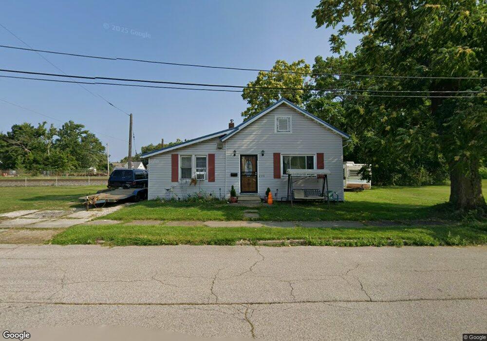
298 Depot St Conneaut, OH 44030
Estimated Value: $77,000 - $145,000
4
Beds
2
Baths
1,456
Sq Ft
$75/Sq Ft
Est. Value
About This Home
This home is located at 298 Depot St, Conneaut, OH 44030 and is currently estimated at $108,501, approximately $74 per square foot. 298 Depot St is a home located in Ashtabula County with nearby schools including Lakeshore Primary Elementary School, Gateway Elementary School, and Conneaut Middle School.
Ownership History
Date
Name
Owned For
Owner Type
Purchase Details
Closed on
Mar 22, 2007
Sold by
Soltese Builders Inc
Bought by
Beatman Robert and Beatman Barbara
Current Estimated Value
Home Financials for this Owner
Home Financials are based on the most recent Mortgage that was taken out on this home.
Original Mortgage
$36,500
Interest Rate
6.2%
Mortgage Type
Unknown
Purchase Details
Closed on
Oct 22, 1999
Sold by
Helsel Jerry B
Bought by
Soltese Keith B
Home Financials for this Owner
Home Financials are based on the most recent Mortgage that was taken out on this home.
Original Mortgage
$31,900
Interest Rate
7.91%
Mortgage Type
New Conventional
Purchase Details
Closed on
Aug 30, 1996
Sold by
Mullins Delmer
Bought by
Helsel Jerry B and Helsel Angela L
Home Financials for this Owner
Home Financials are based on the most recent Mortgage that was taken out on this home.
Original Mortgage
$29,973
Interest Rate
8.3%
Mortgage Type
New Conventional
Create a Home Valuation Report for This Property
The Home Valuation Report is an in-depth analysis detailing your home's value as well as a comparison with similar homes in the area
Home Values in the Area
Average Home Value in this Area
Purchase History
| Date | Buyer | Sale Price | Title Company |
|---|---|---|---|
| Beatman Robert | $36,500 | Chicago Title | |
| Soltese Keith B | $39,900 | -- | |
| Helsel Jerry B | $30,900 | -- |
Source: Public Records
Mortgage History
| Date | Status | Borrower | Loan Amount |
|---|---|---|---|
| Previous Owner | Beatman Robert | $36,500 | |
| Previous Owner | Soltese Keith B | $31,900 | |
| Previous Owner | Helsel Jerry B | $29,973 |
Source: Public Records
Tax History Compared to Growth
Tax History
| Year | Tax Paid | Tax Assessment Tax Assessment Total Assessment is a certain percentage of the fair market value that is determined by local assessors to be the total taxable value of land and additions on the property. | Land | Improvement |
|---|---|---|---|---|
| 2024 | $1,186 | $16,210 | $1,790 | $14,420 |
| 2023 | $869 | $16,210 | $1,790 | $14,420 |
| 2022 | $675 | $12,470 | $1,370 | $11,100 |
| 2021 | $687 | $12,470 | $1,370 | $11,100 |
| 2020 | $686 | $12,470 | $1,370 | $11,100 |
| 2019 | $584 | $10,400 | $980 | $9,420 |
| 2018 | $558 | $10,400 | $980 | $9,420 |
| 2017 | $654 | $10,400 | $980 | $9,420 |
| 2016 | $743 | $15,200 | $1,440 | $13,760 |
| 2015 | $1,526 | $15,200 | $1,440 | $13,760 |
| 2014 | $1,675 | $15,200 | $1,440 | $13,760 |
| 2013 | $954 | $10,290 | $1,190 | $9,100 |
Source: Public Records
Map
Nearby Homes