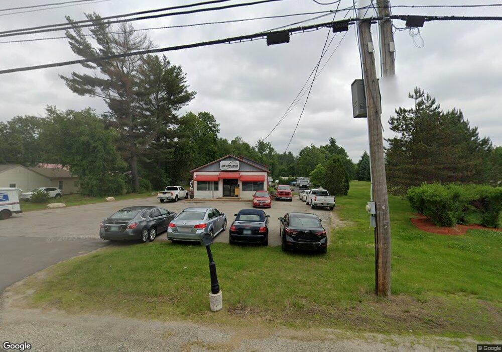
298 Derry Rd Hudson, NH 03051
Estimated Value: $814,003
--
Bed
--
Bath
3,000
Sq Ft
$271/Sq Ft
Est. Value
About This Home
This home is located at 298 Derry Rd, Hudson, NH 03051 and is currently estimated at $814,003, approximately $271 per square foot. 298 Derry Rd is a home located in Hillsborough County with nearby schools including Tabernacle Christian School.
Ownership History
Date
Name
Owned For
Owner Type
Purchase Details
Closed on
Jul 25, 2008
Sold by
Zupokfska Leon J and Zupokfska Michele I
Bought by
Ranney Realty Llc
Current Estimated Value
Home Financials for this Owner
Home Financials are based on the most recent Mortgage that was taken out on this home.
Original Mortgage
$373,500
Outstanding Balance
$245,379
Interest Rate
6.35%
Mortgage Type
Commercial
Estimated Equity
$568,624
Purchase Details
Closed on
Jan 3, 2000
Sold by
Mar Rlty Inc Don
Bought by
Zupokfska Leon J and Zupokfska Michele I
Home Financials for this Owner
Home Financials are based on the most recent Mortgage that was taken out on this home.
Original Mortgage
$91,600
Interest Rate
7.71%
Mortgage Type
Commercial
Create a Home Valuation Report for This Property
The Home Valuation Report is an in-depth analysis detailing your home's value as well as a comparison with similar homes in the area
Home Values in the Area
Average Home Value in this Area
Purchase History
| Date | Buyer | Sale Price | Title Company |
|---|---|---|---|
| Ranney Realty Llc | $415,000 | -- | |
| Zupokfska Leon J | $195,000 | -- |
Source: Public Records
Mortgage History
| Date | Status | Borrower | Loan Amount |
|---|---|---|---|
| Open | Zupokfska Leon J | $373,500 | |
| Previous Owner | Zupokfska Leon J | $42,800 | |
| Previous Owner | Zupokfska Leon J | $91,600 |
Source: Public Records
Tax History Compared to Growth
Tax History
| Year | Tax Paid | Tax Assessment Tax Assessment Total Assessment is a certain percentage of the fair market value that is determined by local assessors to be the total taxable value of land and additions on the property. | Land | Improvement |
|---|---|---|---|---|
| 2024 | $8,839 | $537,300 | $272,900 | $264,400 |
| 2023 | $8,425 | $537,300 | $272,900 | $264,400 |
| 2022 | $7,893 | $537,300 | $272,900 | $264,400 |
| 2021 | $8,818 | $406,900 | $209,900 | $197,000 |
| 2020 | $8,695 | $406,900 | $209,900 | $197,000 |
| 2019 | $8,252 | $406,900 | $209,900 | $197,000 |
| 2018 | $7,982 | $397,100 | $209,900 | $187,200 |
| 2017 | $7,831 | $397,100 | $209,900 | $187,200 |
| 2016 | $7,378 | $335,800 | $171,700 | $164,100 |
| 2015 | $7,136 | $335,800 | $171,700 | $164,100 |
| 2014 | $6,995 | $335,800 | $171,700 | $164,100 |
| 2013 | $6,904 | $335,800 | $171,700 | $164,100 |
Source: Public Records
Map
Nearby Homes
- 7A Kingston Way Unit A
- 8 Acadia Dr
- 3 Acadia Dr Unit 2-7
- 31 Page Rd Unit 20
- 12 Louise Dr
- 4 Sunset Dr Unit A
- 22 Cardinal Ln
- 11 Rotterdam Dr
- 4 Quincy Rd
- 4 Quincy Rd Unit A
- 11 Bradford Ln
- 27 Alvirne Dr
- 16 Evergreen Dr
- 36 Charles Bancroft Hwy
- 9 Sunshine Dr Unit A
- 22 Oliver Dr
- 36 Sutherland Dr
- 3 Robin Dr
- 9 Plaza Ave
- 11 Scottsdale Dr
- 296 Derry Rd Unit W177
- 296 Derry Rd Unit U 1C W173
- 296 Derry Rd Unit U 1A W173
- 296 Derry Rd Unit AC W175
- 296 Derry Rd Unit C W174
- 296 Derry Rd Unit A W173
- 294 Derry Rd Unit B
- 294B Derry Rd
- 292 Derry Rd
- 292 Derry Rd Unit B
- 297 Derry Rd Unit B (Rl-206)
- 297 Derry Rd Unit D (Rl-206)
- 297 Derry Rd Unit D (Rl-178)
- 297 Derry Rd Unit C
- 297 Derry Rd Unit B
- 297 Derry Rd Unit D
- 297 Derry Rd
- 297 Derry Rd Unit B Rd
- 290 Derry Rd Unit G
- 290 Derry Rd Unit RL-203