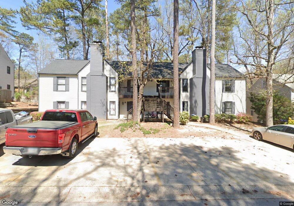
298 E Burns Ct SW Unit ABCD Marietta, GA 30008
Southwestern Marietta NeighborhoodEstimated Value: $633,500 - $821,000
8
Beds
8
Baths
4,284
Sq Ft
$162/Sq Ft
Est. Value
About This Home
This home is located at 298 E Burns Ct SW Unit ABCD, Marietta, GA 30008 and is currently estimated at $693,125, approximately $161 per square foot. 298 E Burns Ct SW Unit ABCD is a home located in Cobb County with nearby schools including Fair Oaks Elementary School, Osborne High School, and International Academy of Smyrna.
Ownership History
Date
Name
Owned For
Owner Type
Purchase Details
Closed on
Dec 1, 2020
Sold by
Lowery Ray and Lowery Raynard
Bought by
Rmim Homes Llc
Current Estimated Value
Purchase Details
Closed on
Jan 15, 2010
Sold by
Higdon Brian K
Bought by
Lowery Ray
Home Financials for this Owner
Home Financials are based on the most recent Mortgage that was taken out on this home.
Original Mortgage
$218,373
Interest Rate
4.94%
Mortgage Type
Trade
Purchase Details
Closed on
Oct 21, 2005
Sold by
Brown Michael E and Brown Jemma
Bought by
Higdon Brian K
Home Financials for this Owner
Home Financials are based on the most recent Mortgage that was taken out on this home.
Original Mortgage
$232,000
Interest Rate
5.76%
Mortgage Type
New Conventional
Purchase Details
Closed on
Mar 27, 2002
Sold by
Tyers Geoffrey I and Tyers Clare E
Bought by
Brown Michael E and Brown Jenna
Home Financials for this Owner
Home Financials are based on the most recent Mortgage that was taken out on this home.
Original Mortgage
$238,500
Interest Rate
6.8%
Mortgage Type
New Conventional
Purchase Details
Closed on
May 16, 1997
Sold by
Kubicek Albert W and Kubicek Linda K
Bought by
Tyers Geoffrey I and Tyers Clare E
Home Financials for this Owner
Home Financials are based on the most recent Mortgage that was taken out on this home.
Original Mortgage
$128,000
Interest Rate
7.37%
Mortgage Type
New Conventional
Create a Home Valuation Report for This Property
The Home Valuation Report is an in-depth analysis detailing your home's value as well as a comparison with similar homes in the area
Home Values in the Area
Average Home Value in this Area
Purchase History
| Date | Buyer | Sale Price | Title Company |
|---|---|---|---|
| Rmim Homes Llc | $373,996 | None Available | |
| Lowery Ray | $218,374 | -- | |
| Higdon Brian K | $290,000 | -- | |
| Brown Michael E | $265,000 | -- | |
| Tyers Geoffrey I | $160,000 | -- |
Source: Public Records
Mortgage History
| Date | Status | Borrower | Loan Amount |
|---|---|---|---|
| Previous Owner | Lowery Ray | $218,373 | |
| Previous Owner | Higdon Brian K | $232,000 | |
| Previous Owner | Brown Michael E | $238,500 | |
| Previous Owner | Tyers Geoffrey I | $128,000 |
Source: Public Records
Tax History Compared to Growth
Tax History
| Year | Tax Paid | Tax Assessment Tax Assessment Total Assessment is a certain percentage of the fair market value that is determined by local assessors to be the total taxable value of land and additions on the property. | Land | Improvement |
|---|---|---|---|---|
| 2025 | $8,926 | $296,236 | $44,000 | $252,236 |
| 2024 | $8,932 | $296,236 | $44,000 | $252,236 |
| 2023 | $4,509 | $149,560 | $22,600 | $126,960 |
| 2022 | $4,539 | $149,560 | $22,600 | $126,960 |
| 2021 | $4,539 | $149,560 | $22,600 | $126,960 |
| 2020 | $4,466 | $147,156 | $24,000 | $123,156 |
| 2019 | $4,466 | $147,156 | $24,000 | $123,156 |
| 2018 | $4,466 | $147,156 | $24,000 | $123,156 |
| 2017 | $4,231 | $147,156 | $24,000 | $123,156 |
| 2016 | $1,856 | $64,548 | $14,000 | $50,548 |
| 2015 | $1,902 | $64,548 | $14,000 | $50,548 |
| 2014 | $1,918 | $64,548 | $0 | $0 |
Source: Public Records
Map
Nearby Homes
- 264 Juliet Ln SW
- 393 Cedar Trace SW Unit 1
- 243 Brownstone Cir Unit 25
- 1048 Brownstone Dr Unit 3
- 1166 Booth Rd SW Unit 407
- 1166 Booth Rd SW Unit 205
- 1166 Booth Rd SW Unit 906
- 1166 Booth Rd SW Unit 908
- 1166 Booth Rd SW Unit 610
- 105 Grampian Ct Unit 13
- 1239 Grampian Pass Unit 11
- 1252 Grampian Pass Unit 9
- 994 Powder Springs St
- 1038 Arden Dr SW
- 1230 Arden Dr SW
- 150 Creighton Ln
- 1278 Houndslake Dr
- 852 Hickory Dr SW
- E E Burns Ct SW Unit C
- E E Burns Ct SW Unit D
- E E Burns Ct SW
- E E Burns Ct SW Unit B
- E E Burns Ct SW Unit A,D
- E E Burns Ct SW Unit A
- 296 E Burns Ct SW Unit D
- 296 E Burns Ct SW Unit ABCD
- 296 E Burns Ct SW
- 300 E Burns Ct SW Unit D
- 300 E Burns Ct SW
- 300 E Burns Ct SW Unit ABCD
- 967 Brownstone Ln Unit 18
- 297 E Burns Ct SW Unit ABCD
- 297 E Burns Ct SW Unit D
- 297 E Burns Ct SW
- 297 E Burns Ct SW Unit B
- 969 Brownstone Ln Unit 969
- 969 Brownstone Ln Unit 18
- 969 Brownstone Ln