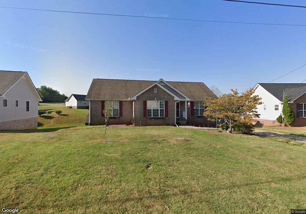
298 Joe McCraw Rd Clarksville, TN 37040
Estimated Value: $282,864 - $316,000
--
Bed
2
Baths
1,580
Sq Ft
$191/Sq Ft
Est. Value
About This Home
This home is located at 298 Joe McCraw Rd, Clarksville, TN 37040 and is currently estimated at $301,216, approximately $190 per square foot. 298 Joe McCraw Rd is a home located in Montgomery County with nearby schools including Burt Elementary School, St. Bethlehem Elementary School, and Kenwood Middle School.
Ownership History
Date
Name
Owned For
Owner Type
Purchase Details
Closed on
Jun 1, 2021
Sold by
Schumer Mark A
Bought by
Schumer Michele A
Current Estimated Value
Home Financials for this Owner
Home Financials are based on the most recent Mortgage that was taken out on this home.
Original Mortgage
$116,000
Outstanding Balance
$105,024
Interest Rate
2.9%
Mortgage Type
New Conventional
Estimated Equity
$196,192
Purchase Details
Closed on
Nov 19, 2002
Sold by
James Vick
Bought by
Schumer Mark A
Purchase Details
Closed on
Jun 13, 2002
Sold by
Odd Job Llc
Bought by
James Vick
Create a Home Valuation Report for This Property
The Home Valuation Report is an in-depth analysis detailing your home's value as well as a comparison with similar homes in the area
Home Values in the Area
Average Home Value in this Area
Purchase History
| Date | Buyer | Sale Price | Title Company |
|---|---|---|---|
| Schumer Michele A | -- | None Available | |
| Schumer Mark A | $127,000 | -- | |
| James Vick | $13,000 | -- |
Source: Public Records
Mortgage History
| Date | Status | Borrower | Loan Amount |
|---|---|---|---|
| Open | Schumer Michele A | $116,000 |
Source: Public Records
Tax History Compared to Growth
Tax History
| Year | Tax Paid | Tax Assessment Tax Assessment Total Assessment is a certain percentage of the fair market value that is determined by local assessors to be the total taxable value of land and additions on the property. | Land | Improvement |
|---|---|---|---|---|
| 2024 | $2,357 | $79,075 | $0 | $0 |
| 2023 | $2,357 | $49,175 | $0 | $0 |
| 2022 | $2,075 | $49,175 | $0 | $0 |
| 2021 | $2,075 | $48,775 | $0 | $0 |
| 2020 | $1,960 | $48,775 | $0 | $0 |
| 2019 | $1,960 | $48,775 | $0 | $0 |
| 2018 | $2,005 | $39,225 | $0 | $0 |
| 2017 | $577 | $46,525 | $0 | $0 |
| 2016 | $1,451 | $47,275 | $0 | $0 |
| 2015 | $1,993 | $47,275 | $0 | $0 |
| 2014 | $1,966 | $47,275 | $0 | $0 |
| 2013 | $2,020 | $46,125 | $0 | $0 |
Source: Public Records
Map
Nearby Homes
- 1845 Rapids Ct
- 1846 Rapids Ct
- 333 Harold Dr
- 1810 Apex Dr
- 294 Cardinal Creek
- 404 Warren Cir
- 1823 Patricia Dr
- 1849 Patricia Dr
- 410 River Heights Dr
- 414 River Heights Dr
- 1816 Patricia Dr
- 180 Quarry Ridge Rd
- 200 Quarry Overlook Way
- 1882 Old Trenton Rd
- 204 Quarry Overlook Way
- 208 Quarry Overlook Way
- 139 Quarry Point Dr Unit D-147
- 139 Quarry Point Dr Unit D-139
- 139 Quarry Point Dr Unit D-151
- 139 Quarry Point Dr Unit D-141
- 300 Joe McCraw Rd
- 296 Joe McCraw Rd
- 61 West Dr
- 63 West Dr
- 302 Joe McCraw Rd
- 276 Harold Dr
- 274 Harold Dr
- 299 Joe McCraw Rd
- 65 West Dr
- 1874 Murfield Ct
- 280 Harold Dr
- 1872 Murfield Ct
- 297 Joe McCraw Rd
- 294 Joe McCraw Rd
- 501 Fox Crossing
- 67 West Dr
- 282 Harold Dr
- 405 Bonny Castle Rd
- 402 Bonny Castle Rd
- 314 Atlantic Blvd