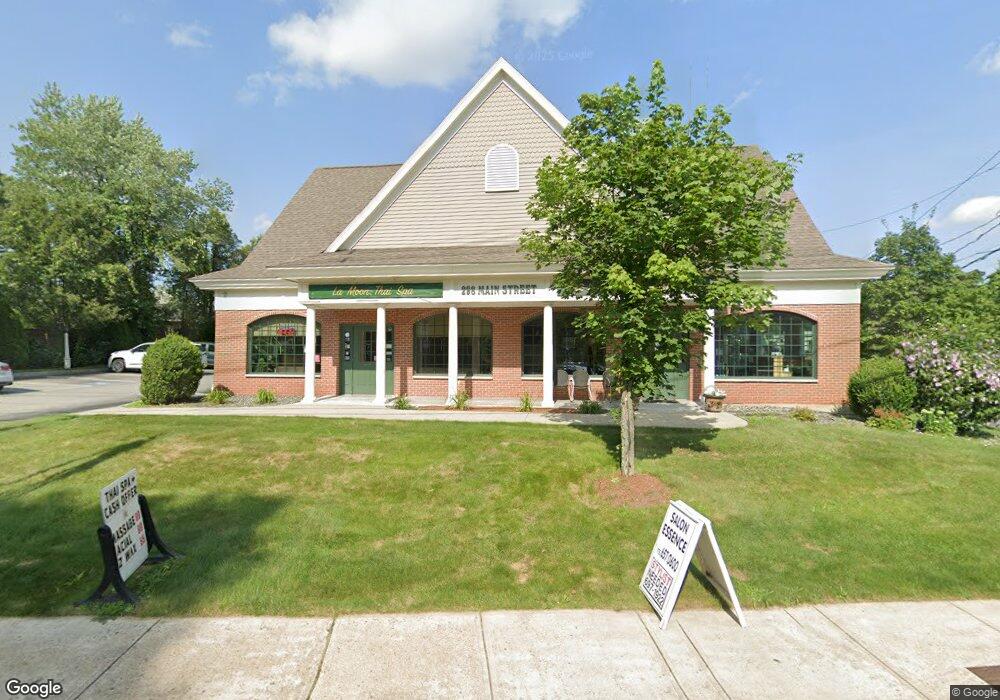
298 Main St Wilmington, MA 01887
--
Bed
--
Bath
19,364
Sq Ft
0.44
Acres
About This Home
This home is located at 298 Main St, Wilmington, MA 01887. 298 Main St is a home located in Middlesex County with nearby schools including Wilmington Middle School, Wilmington High School, and Abundant Life Christian School and Childcare.
Ownership History
Date
Name
Owned For
Owner Type
Purchase Details
Closed on
Jan 17, 2003
Sold by
Tutela Domenic V and Tutela Joan
Bought by
298 Main St Rt and Langone
Purchase Details
Closed on
Mar 31, 1993
Sold by
Progressive Cons Fcu
Bought by
Tutela Domenic
Purchase Details
Closed on
Feb 10, 1993
Sold by
Monson John A
Bought by
Progressive Consum Fcu
Purchase Details
Closed on
Sep 26, 1988
Sold by
Branscombe Robert E
Bought by
Monson John A
Home Financials for this Owner
Home Financials are based on the most recent Mortgage that was taken out on this home.
Original Mortgage
$280,000
Interest Rate
10.51%
Mortgage Type
Commercial
Create a Home Valuation Report for This Property
The Home Valuation Report is an in-depth analysis detailing your home's value as well as a comparison with similar homes in the area
Home Values in the Area
Average Home Value in this Area
Purchase History
| Date | Buyer | Sale Price | Title Company |
|---|---|---|---|
| 298 Main St Rt | $265,000 | -- | |
| 298 Main St Rt | $265,000 | -- | |
| Tutela Domenic | $140,000 | -- | |
| Tutela Domenic V | $140,000 | -- | |
| Progressive Consum Fcu | $161,000 | -- | |
| Progressive Consum Fcu | $161,000 | -- | |
| Monson John A | $350,000 | -- |
Source: Public Records
Mortgage History
| Date | Status | Borrower | Loan Amount |
|---|---|---|---|
| Open | Monson John A | $400,000 | |
| Closed | Monson John A | $300,000 | |
| Previous Owner | Monson John A | $280,000 |
Source: Public Records
Tax History Compared to Growth
Tax History
| Year | Tax Paid | Tax Assessment Tax Assessment Total Assessment is a certain percentage of the fair market value that is determined by local assessors to be the total taxable value of land and additions on the property. | Land | Improvement |
|---|---|---|---|---|
| 2025 | $19,729 | $737,000 | $346,400 | $390,600 |
| 2024 | $18,977 | $723,500 | $346,400 | $377,100 |
| 2023 | $18,006 | $658,600 | $315,000 | $343,600 |
| 2022 | $17,931 | $596,500 | $286,300 | $310,200 |
| 2021 | $18,141 | $577,200 | $260,200 | $317,000 |
| 2020 | $17,868 | $584,100 | $260,200 | $323,900 |
| 2019 | $17,945 | $580,000 | $260,200 | $319,800 |
| 2018 | $16,860 | $519,400 | $232,700 | $286,700 |
| 2017 | $16,386 | $504,800 | $232,700 | $272,100 |
| 2016 | $16,555 | $499,100 | $232,700 | $266,400 |
| 2015 | $15,849 | $484,100 | $232,700 | $251,400 |
| 2014 | $16,163 | $489,200 | $232,700 | $256,500 |
Source: Public Records
Map
Nearby Homes
- 48 Brand Ave
- 27 Fairview Ave
- 142 Burlington Ave
- 11 Patchs Pond Ln
- 14 Roberts Rd
- 9 Parker St
- 56 Grove Ave
- 7 Cross St Unit 306
- 7 Cross St Unit 304
- 7 Cross St Unit 205
- 7 Cross St (Units 201 & 202)
- 8 Cushing Dr
- 61 Lowell St
- 17 Molloy Rd
- 15 Forest St
- 3 Cochrane Rd
- 17 Lake St
- 3 Oakdale Rd
- 40 Faulkner Ave
- 151 Grove Ave
- 298 Main St Unit A
- 298 Main St Unit A
- 8 Washington Ave
- 299 Main St Unit 202b
- 299 Main St Unit 101
- 299 Main St
- 292 Main St
- 11 Clark St
- 10 Washington Ave
- 14 Clark St
- 312 Main St
- 15 Clark St
- 10 Shawsheen Ave
- 12 Washington Ave
- 284 Main St
- 1 Shawsheen Ave
- 2 Shawsheen Ave
- 12 Shawsheen Ave
- 37 Shawsheen Ave
- 3 Shawsheen Ave