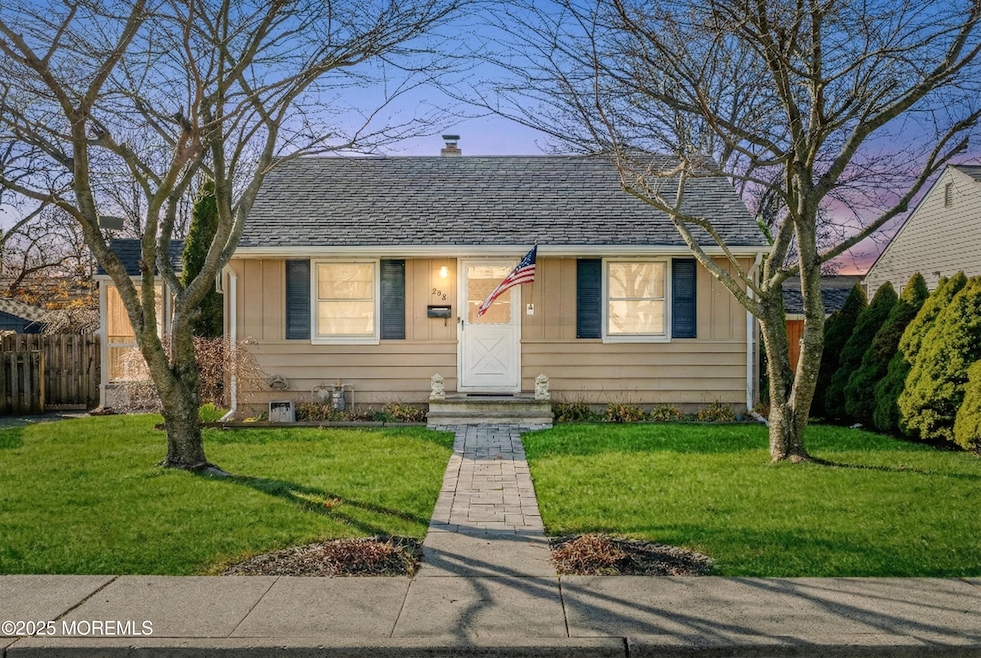

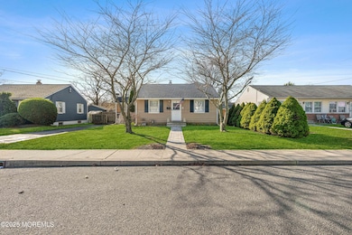
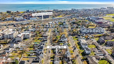

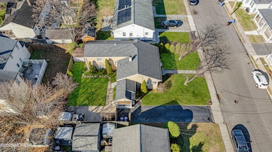
298 Poole Ave Long Branch, NJ 07740
Estimated payment $3,230/month
Highlights
- Wood Flooring
- No HOA
- Multiple cooling system units
- Attic
- Eat-In Kitchen
- Patio
About This Home
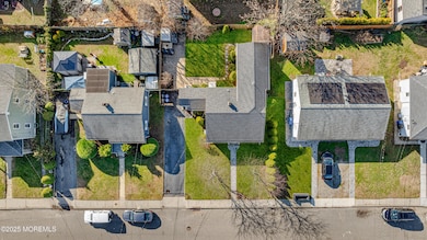
This is a Coming Soon Listing and cannot be shown until 12/6/25. Welcome to 298 Poole Avenue, an expanded ranch offering 4 bedrooms, 1 bath, and a bright, flexible layout perfect for everyday living. The home provides excellent storage with a full walk-out basement and attic, plus a fenced backyard ideal for relaxing, gardening, or hosting friends. A paved driveway adds convenient off-street parking. Located in a quiet Long Branch neighborhood, you're just five minutes from the beach, the Long Branch train station, Monmouth Medical Center, and Pier Village. Whether for full-time living or a weekend getaway, this home delivers comfort, convenience, and the best of shore living.
Open House Schedule
-
Saturday, December 06, 20251:00 to 3:00 pm12/6/2025 1:00:00 PM +00:0012/6/2025 3:00:00 PM +00:00Add to Calendar
-
Sunday, December 07, 20251:00 to 3:00 pm12/7/2025 1:00:00 PM +00:0012/7/2025 3:00:00 PM +00:00Add to Calendar
Home Details
Home Type
- Single Family
Est. Annual Taxes
- $7,164
Year Built
- Built in 1955
Lot Details
- 4,792 Sq Ft Lot
- Lot Dimensions are 59 x 87
- Fenced
Home Design
- Shingle Roof
- Vinyl Siding
Interior Spaces
- 1,392 Sq Ft Home
- 1-Story Property
- Living Room
- Attic
Kitchen
- Eat-In Kitchen
- Stove
- Dishwasher
Flooring
- Wood
- Laminate
Bedrooms and Bathrooms
- 4 Bedrooms
- 1 Full Bathroom
- Primary Bathroom Bathtub Only
Unfinished Basement
- Walk-Out Basement
- Basement Fills Entire Space Under The House
- Basement Hatchway
Parking
- No Garage
- Driveway
- Paved Parking
- On-Street Parking
Outdoor Features
- Patio
- Shed
Schools
- Long Branch Middle School
- Long Branch High School
Utilities
- Multiple cooling system units
- Central Air
- Heating System Uses Natural Gas
- Baseboard Heating
- Natural Gas Water Heater
Community Details
- No Home Owners Association
Listing and Financial Details
- Exclusions: Personal Items. Washer & Dryer are Negotiable
- Assessor Parcel Number 27-00187-0000-00019
Map
Home Values in the Area
Average Home Value in this Area
Tax History
| Year | Tax Paid | Tax Assessment Tax Assessment Total Assessment is a certain percentage of the fair market value that is determined by local assessors to be the total taxable value of land and additions on the property. | Land | Improvement |
|---|---|---|---|---|
| 2025 | $6,732 | $477,600 | $256,600 | $221,000 |
| 2024 | $5,877 | $438,000 | $226,600 | $211,400 |
| 2023 | $5,877 | $378,400 | $176,600 | $201,800 |
| 2022 | $5,305 | $296,700 | $118,900 | $177,800 |
| 2021 | $5,305 | $265,100 | $98,900 | $166,200 |
| 2020 | $5,292 | $253,200 | $87,900 | $165,300 |
| 2019 | $5,181 | $246,500 | $88,900 | $157,600 |
| 2018 | $5,088 | $240,700 | $88,900 | $151,800 |
| 2017 | $4,901 | $237,800 | $88,900 | $148,900 |
| 2016 | $4,830 | $239,000 | $93,900 | $145,100 |
| 2015 | $5,449 | $244,700 | $79,700 | $165,000 |
| 2014 | $4,976 | $235,500 | $89,100 | $146,400 |
Purchase History
| Date | Type | Sale Price | Title Company |
|---|---|---|---|
| Deed | $147,500 | -- |
Mortgage History
| Date | Status | Loan Amount | Loan Type |
|---|---|---|---|
| Open | $145,200 | FHA |
Source: MOREMLS (Monmouth Ocean Regional REALTORS®)
MLS Number: 22535936
APN: 27-00187-0000-00019
Disclaimer: Certain information contained herein is derived from information provided by parties other than Homes.com. All information provided is deemed reliable, but is not guaranteed to be accurate and should be independently verified.
![]() IDX information is provided exclusively for personal, non-commercial use, and may not be used for any purpose other than to identify prospective properties consumers may be interested in purchasing.
IDX information is provided exclusively for personal, non-commercial use, and may not be used for any purpose other than to identify prospective properties consumers may be interested in purchasing.
Information is deemed reliable but not guaranteed.
- 303 Westwood Ave
- 215 Cleveland Ave
- 364 Westwood Ave Unit 39
- 364 Westwood Ave Unit 71
- 364 Westwood Ave Unit 21
- 399 Willow Ave
- 377 Westwood Ave
- 237 3rd Ave Unit 1-4
- 144 Westwood Ave
- 430 Broadway
- 434 Westwood Ave
- 153 Vanderbilt Ave
- 170 Franklin Ave
- 168 Franklin Ave
- 158 Franklin Ave
- 152 Franklin Ave
- 150 Franklin Ave Unit 5
- 14 Slocum Place
- 12 Coral Place
- 166 Franklin Ave Unit 8
- 286 Cleveland Ave Unit 1
- 258 Morris Ave
- 258 Morris Ave Unit 203
- 258 Morris Ave Unit 418
- 258 Morris Ave Unit 216
- 393 Bath Ave
- 380 Division St Unit 2A
- 364 Westwood Ave Unit 39
- 364 Westwood Ave
- 364 Westwood Ave Unit 64
- 346 Chelsea Ave
- 162 3rd Ave
- 185 Morris Ave
- 185 Morris Ave Unit 303
- 185 Morris Ave Unit 401
- 185 Morris Ave Unit 305
- 185 Morris Ave Unit 511
- 185 Morris Ave Unit 411
- 165 Pavilion Ave Unit 303
- 165 Pavilion Ave Unit 206
