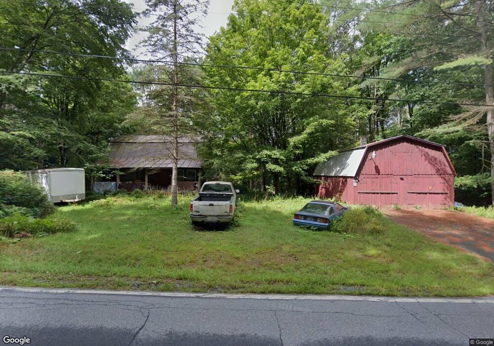
298 Route 12a Plainfield, NH 03781
Estimated Value: $416,101 - $601,000
4
Beds
2
Baths
1,769
Sq Ft
$283/Sq Ft
Est. Value
About This Home
This home is located at 298 Route 12a, Plainfield, NH 03781 and is currently estimated at $500,025, approximately $282 per square foot. 298 Route 12a is a home located in Sullivan County with nearby schools including Plainfield Elementary School, Lebanon High School, and Estabrook Christian School.
Create a Home Valuation Report for This Property
The Home Valuation Report is an in-depth analysis detailing your home's value as well as a comparison with similar homes in the area
Home Values in the Area
Average Home Value in this Area
Tax History Compared to Growth
Tax History
| Year | Tax Paid | Tax Assessment Tax Assessment Total Assessment is a certain percentage of the fair market value that is determined by local assessors to be the total taxable value of land and additions on the property. | Land | Improvement |
|---|---|---|---|---|
| 2023 | $6,080 | $386,000 | $149,600 | $236,400 |
| 2022 | $5,832 | $234,200 | $76,600 | $157,600 |
| 2021 | $6,218 | $234,200 | $76,600 | $157,600 |
| 2020 | $5,949 | $234,200 | $76,600 | $157,600 |
| 2019 | $6,089 | $234,200 | $76,600 | $157,600 |
| 2018 | $5,940 | $234,200 | $76,600 | $157,600 |
| 2017 | $5,835 | $210,800 | $71,900 | $138,900 |
| 2016 | $5,976 | $210,800 | $71,900 | $138,900 |
| 2015 | $5,744 | $210,800 | $71,900 | $138,900 |
| 2014 | $5,797 | $210,800 | $71,900 | $138,900 |
| 2013 | $5,797 | $210,800 | $71,900 | $138,900 |
Source: Public Records
Map
Nearby Homes
- 40 Mill St
- 654 Us Route 5
- 6 Rockwood St
- 149 Old County Rd
- 00 Nh Route 12a Unit 7
- 25 Maxfield Ln
- 152 Webster Rd
- 846 New Hampshire 12a
- 66 Webster Rd
- 56 Mount Hunger Rd
- 561 Neal Rd
- 286 Ladieu Rd
- 00 Willow Brook Rd
- 527 Neal Rd
- 25 Independent Dr
- 0 Freeman Rd Unit 22
- 1118 New Hampshire 12a
- 307 Remick Rd
- 1041 Stage Rd
- 6 Blodgett Ln