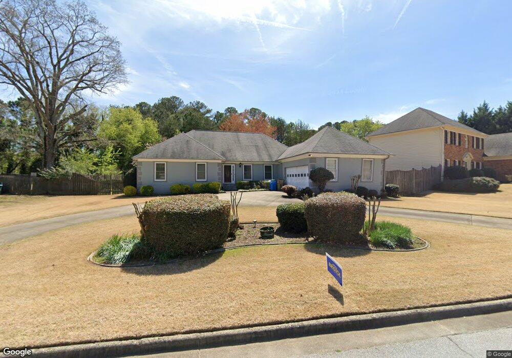
2980 Brookside Run Unit 1 Snellville, GA 30078
Estimated Value: $399,831 - $437,000
3
Beds
2
Baths
2,142
Sq Ft
$194/Sq Ft
Est. Value
About This Home
This home is located at 2980 Brookside Run Unit 1, Snellville, GA 30078 and is currently estimated at $416,208, approximately $194 per square foot. 2980 Brookside Run Unit 1 is a home located in Gwinnett County with nearby schools including Brookwood Elementary School, Alton C. Crews Middle School, and Brookwood High School.
Ownership History
Date
Name
Owned For
Owner Type
Purchase Details
Closed on
May 23, 2005
Sold by
Seddon William D and Seddon Donna
Bought by
Bristol Donald
Current Estimated Value
Home Financials for this Owner
Home Financials are based on the most recent Mortgage that was taken out on this home.
Original Mortgage
$19,230
Outstanding Balance
$9,936
Interest Rate
5.7%
Mortgage Type
Unknown
Estimated Equity
$406,272
Create a Home Valuation Report for This Property
The Home Valuation Report is an in-depth analysis detailing your home's value as well as a comparison with similar homes in the area
Home Values in the Area
Average Home Value in this Area
Purchase History
| Date | Buyer | Sale Price | Title Company |
|---|---|---|---|
| Bristol Donald | $192,300 | -- |
Source: Public Records
Mortgage History
| Date | Status | Borrower | Loan Amount |
|---|---|---|---|
| Open | Bristol Donald | $19,230 | |
| Open | Bristol Donald | $153,840 |
Source: Public Records
Tax History Compared to Growth
Tax History
| Year | Tax Paid | Tax Assessment Tax Assessment Total Assessment is a certain percentage of the fair market value that is determined by local assessors to be the total taxable value of land and additions on the property. | Land | Improvement |
|---|---|---|---|---|
| 2025 | $5,495 | $143,720 | $36,000 | $107,720 |
| 2024 | $5,071 | $130,080 | $36,000 | $94,080 |
| 2023 | $5,071 | $151,200 | $33,600 | $117,600 |
| 2022 | $4,987 | $128,720 | $29,600 | $99,120 |
| 2021 | $3,968 | $98,640 | $24,000 | $74,640 |
| 2020 | $3,851 | $94,800 | $20,800 | $74,000 |
| 2019 | $3,356 | $84,640 | $20,800 | $63,840 |
| 2018 | $3,357 | $84,640 | $20,800 | $63,840 |
| 2016 | $2,776 | $67,560 | $14,000 | $53,560 |
| 2015 | $2,803 | $67,560 | $14,000 | $53,560 |
| 2014 | -- | $67,560 | $14,000 | $53,560 |
Source: Public Records
Map
Nearby Homes
- 1220 Edgebrook Ln
- 1526 Lechemin Dr
- 3173 Falconhurst Dr SW
- 1686 Norton Estates Dr
- 1328 Apple Orchard Ln
- 2950 Hadrian Dr SW
- 2691 Holly Springs Dr
- 1750 Manor Brook Way
- 3190 Wood Springs Trace SW
- 3063 Bruckner Blvd
- 1201 Barkwood Ct
- 1845 Lisa Springs Dr
- 3207 Aspen Cir SW
- 1953 Watson Park Dr
- 2936 Spanish Oak Dr SW
- 1809 Mornington Ln
- 1141 Holly Hills Dr SW
- 2970 Brookside Run Unit 1
- 3000 Brookside Run
- 2981 Brookside Run 0
- 2960 Brookside Run Unit 1
- 2981 Brookside Run SW
- 2981 Brookside Run
- 2991 Brookside Run
- 2971 Brookside Run Unit 1
- 3001 Brookside Run
- 0 Brookside Run SW Unit 8894040
- 0 Brookside Run SW Unit 8555035
- 0 Brookside Run SW Unit 7456600
- 2950 Brookside Run Unit 1
- 1476 Oak Rd SW
- 1451 Springside Ct SW
- 1460 Springside Ct
- 1451 Springside Ct
- 2940 Brookside Run
- 1450 Springside Ct
- 0 Springside Ct SW Unit 8880278