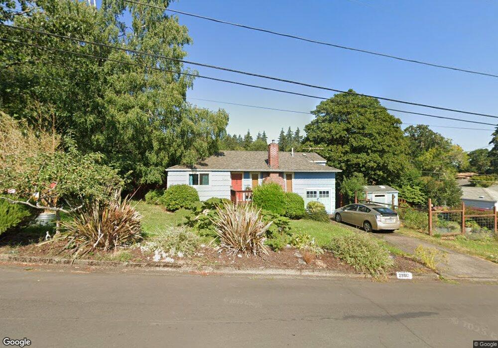
2980 Powell St Eugene, OR 97405
Crest Drive NeighborhoodEstimated Value: $388,000 - $444,000
3
Beds
1
Bath
1,014
Sq Ft
$400/Sq Ft
Est. Value
About This Home
This home is located at 2980 Powell St, Eugene, OR 97405 and is currently estimated at $405,164, approximately $399 per square foot. 2980 Powell St is a home located in Lane County with nearby schools including Adams Elementary School, Arts And Technology Academy At Jefferson, and Churchill High School.
Ownership History
Date
Name
Owned For
Owner Type
Purchase Details
Closed on
Oct 29, 2020
Sold by
Hess Jennifer and Wanke Paul
Bought by
Hess Jennifer
Current Estimated Value
Purchase Details
Closed on
Jun 11, 2002
Sold by
Fleitell Paula Jean
Bought by
Wanke Paul and Hess Jennifer
Home Financials for this Owner
Home Financials are based on the most recent Mortgage that was taken out on this home.
Original Mortgage
$100,000
Interest Rate
6.74%
Mortgage Type
Balloon
Create a Home Valuation Report for This Property
The Home Valuation Report is an in-depth analysis detailing your home's value as well as a comparison with similar homes in the area
Home Values in the Area
Average Home Value in this Area
Purchase History
| Date | Buyer | Sale Price | Title Company |
|---|---|---|---|
| Hess Jennifer | -- | None Listed On Document | |
| Wanke Paul | $133,000 | Western Pioneer Title Co |
Source: Public Records
Mortgage History
| Date | Status | Borrower | Loan Amount |
|---|---|---|---|
| Previous Owner | Wanke Paul | $100,000 |
Source: Public Records
Tax History
| Year | Tax Paid | Tax Assessment Tax Assessment Total Assessment is a certain percentage of the fair market value that is determined by local assessors to be the total taxable value of land and additions on the property. | Land | Improvement |
|---|---|---|---|---|
| 2025 | $3,405 | $174,738 | -- | -- |
| 2024 | $3,362 | $169,649 | -- | -- |
| 2023 | $3,362 | $164,708 | -- | -- |
| 2022 | $3,150 | $159,911 | $0 | $0 |
| 2021 | $2,958 | $155,254 | $0 | $0 |
| 2020 | $2,969 | $150,733 | $0 | $0 |
| 2019 | $2,867 | $146,343 | $0 | $0 |
| 2018 | $2,699 | $137,943 | $0 | $0 |
| 2017 | $2,578 | $137,943 | $0 | $0 |
| 2016 | $2,514 | $133,925 | $0 | $0 |
| 2015 | $2,442 | $130,024 | $0 | $0 |
| 2014 | $2,393 | $126,237 | $0 | $0 |
Source: Public Records
Map
Nearby Homes
- 3160 Whitten Dr
- 865 W 28th Ave
- 0 Mclean Blvd Unit 24671448
- 0 Mclean Blvd Unit 697374759
- 1783 Graham Dr
- 1 Storey Blvd
- 2 Storey Blvd
- 2673 Garfield St
- 2525 Friendly St
- 1955 W 28th Ave
- 2850 Garfield St
- 0 Hidden Meadows
- 605 Fulvue Dr
- 350 Loma Linda Ln
- 3023 Ashley Loop
- 2037 Morning View Dr
- 3093 Soloman Loop
- 2225 W 28th Ave
- 453 Dellwood Dr
- 2030 W 34th Ave
- 1260 Mclean Blvd
- 2986 Powell St
- 2910 Powell St
- 2949 Powell St
- 2915 Durbin St
- 2937 Powell St
- 2961 Powell St
- 1290 Mclean Blvd
- 2988 Powell St
- 2925 Durbin St
- 2977 Powell St
- 2925 Powell St
- 1285 Mclean Blvd Unit 1
- 2990 Powell St
- 2952 Ingalls Way
- 1265 Mclean Blvd
- 1245 Mclean Blvd
- 2989 Powell St
- 2928 Ingalls Way
- 2985 Durbin St
Your Personal Tour Guide
Ask me questions while you tour the home.