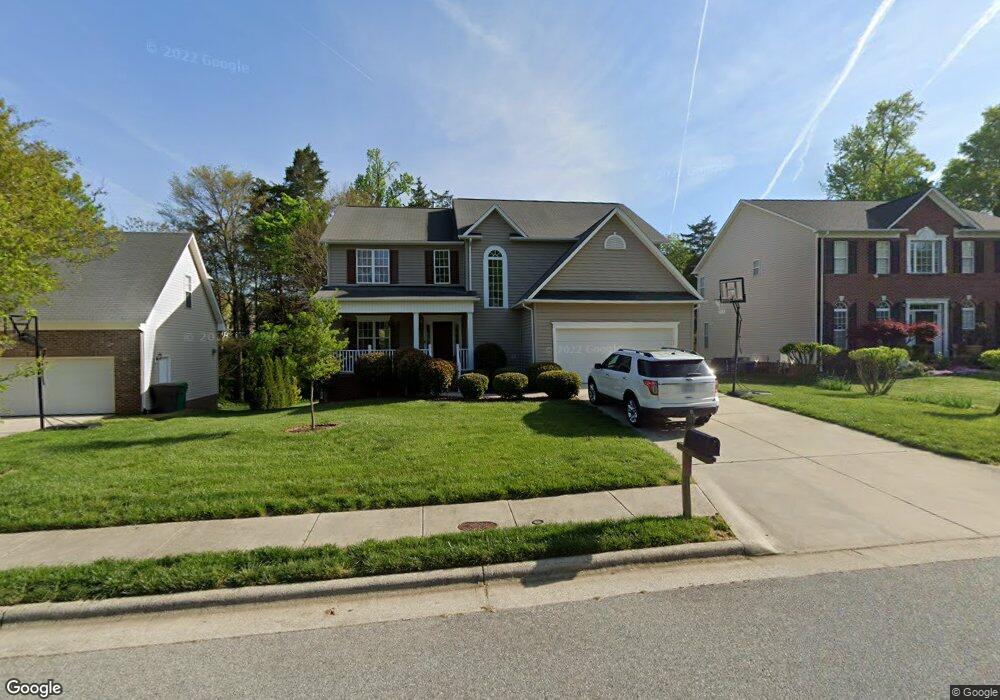
2981 Maple Branch Dr High Point, NC 27265
Bent Tree NeighborhoodEstimated Value: $450,000 - $477,000
4
Beds
3
Baths
2,920
Sq Ft
$159/Sq Ft
Est. Value
About This Home
This home is located at 2981 Maple Branch Dr, High Point, NC 27265 and is currently estimated at $464,967, approximately $159 per square foot. 2981 Maple Branch Dr is a home located in Guilford County with nearby schools including Southwest Elementary School, Southwest Guilford Middle School, and Southwest Guilford High School.
Ownership History
Date
Name
Owned For
Owner Type
Purchase Details
Closed on
Jan 9, 2017
Sold by
Schwertner Kenneth V and Schwertner Mitsi E
Bought by
Schwertner Kenneth V
Current Estimated Value
Purchase Details
Closed on
Aug 27, 2001
Sold by
The New Fortis Corp
Bought by
Schwertner Kenneth and Schwertner Mitsi E
Home Financials for this Owner
Home Financials are based on the most recent Mortgage that was taken out on this home.
Original Mortgage
$196,250
Outstanding Balance
$77,028
Interest Rate
7.08%
Estimated Equity
$387,939
Create a Home Valuation Report for This Property
The Home Valuation Report is an in-depth analysis detailing your home's value as well as a comparison with similar homes in the area
Home Values in the Area
Average Home Value in this Area
Purchase History
| Date | Buyer | Sale Price | Title Company |
|---|---|---|---|
| Schwertner Kenneth V | -- | None Available | |
| Schwertner Kenneth | $207,000 | -- |
Source: Public Records
Mortgage History
| Date | Status | Borrower | Loan Amount |
|---|---|---|---|
| Open | Schwertner Kenneth | $196,250 |
Source: Public Records
Tax History Compared to Growth
Tax History
| Year | Tax Paid | Tax Assessment Tax Assessment Total Assessment is a certain percentage of the fair market value that is determined by local assessors to be the total taxable value of land and additions on the property. | Land | Improvement |
|---|---|---|---|---|
| 2025 | $5,145 | $373,400 | $85,000 | $288,400 |
| 2024 | $5,145 | $373,400 | $85,000 | $288,400 |
| 2023 | $5,145 | $373,400 | $85,000 | $288,400 |
| 2022 | $5,033 | $373,400 | $85,000 | $288,400 |
| 2021 | $3,302 | $239,600 | $48,000 | $191,600 |
| 2020 | $3,302 | $239,600 | $48,000 | $191,600 |
| 2019 | $3,302 | $239,600 | $0 | $0 |
| 2018 | $3,285 | $239,600 | $0 | $0 |
| 2017 | $3,302 | $239,600 | $0 | $0 |
| 2016 | $2,965 | $211,400 | $0 | $0 |
| 2015 | $2,981 | $211,400 | $0 | $0 |
| 2014 | $3,031 | $211,400 | $0 | $0 |
Source: Public Records
Map
Nearby Homes
- 3007 Maple Branch Dr
- 3171 Riley Ford Trail Unit Lot 38
- Richmond Plan at Williard Place
- 3296 Alyssa Way
- Cameron Plan at Williard Place
- Southport Plan at Williard Place
- Columbia Plan at Williard Place
- Bailey Plan at Williard Place
- 3273 Alyssa Way
- 3301 Alyssa Way
- 3171 Riley Ford Trail
- 3199 Riley Ford Trail
- 3199 Riley Ford Trail Unit Lot 33
- 3525 Covent Oak Ct
- 2350 Birch View Dr
- 2305 Faircloth Way
- 737 Carneros Cir
- 4711 Willowstone Dr
- 4713 Willowstone Dr
- 4715 Willowstone Dr
- 2985 Maple Branch Dr
- 2977 Maple Branch Dr
- 2989 Maple Branch Dr
- 2973 Maple Branch Dr
- 3092 Sycamore Point Trail
- 3096 Sycamore Point Trail
- 3088 Sycamore Point Trail
- 2980 Maple Branch Dr
- 2974 Maple Branch Dr
- 2993 Maple Branch Dr
- 3100 Sycamore Point Trail
- 3084 Sycamore Point Trail
- 2970 Maple Branch Dr
- 2969 Maple Branch Dr
- 3080 Sycamore Point Trail
- 2992 Maple Branch Dr
- 2997 Maple Branch Dr
- 2965 Maple Branch Dr
- 4301 Tealwood Vista Ct
- 3076 Sycamore Point Trail