Estimated Value: $120,183 - $152,000
3
Beds
1
Bath
768
Sq Ft
$185/Sq Ft
Est. Value
About This Home
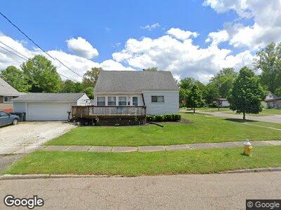
This home is located at 2981 Stockton St, Akron, OH 44314 and is currently estimated at $142,296, approximately $185 per square foot. 2981 Stockton St is a home located in Summit County with nearby schools including St. Francis de Sales School and Sam Salem Community Learning Center.
Ownership History
Date
Name
Owned For
Owner Type
Purchase Details
Closed on
Nov 21, 1995
Sold by
Brian P Burns Trst
Bought by
Frame Ronald C and Frame Joyce M
Current Estimated Value
Home Financials for this Owner
Home Financials are based on the most recent Mortgage that was taken out on this home.
Original Mortgage
$58,800
Interest Rate
7.65%
Mortgage Type
New Conventional
Purchase Details
Closed on
Jul 21, 1995
Sold by
Bogart Jack L
Bought by
Patrick Burns Trustee
Create a Home Valuation Report for This Property
The Home Valuation Report is an in-depth analysis detailing your home's value as well as a comparison with similar homes in the area
Home Values in the Area
Average Home Value in this Area
Purchase History
| Date | Buyer | Sale Price | Title Company |
|---|---|---|---|
| Frame Ronald C | $62,000 | -- | |
| Patrick Burns Trustee | $40,000 | -- |
Source: Public Records
Mortgage History
| Date | Status | Borrower | Loan Amount |
|---|---|---|---|
| Open | Frame Ronald C | $66,500 | |
| Closed | Frame Ronald C | $70,000 | |
| Closed | Frame Ronald C | $58,800 |
Source: Public Records
Tax History Compared to Growth
Tax History
| Year | Tax Paid | Tax Assessment Tax Assessment Total Assessment is a certain percentage of the fair market value that is determined by local assessors to be the total taxable value of land and additions on the property. | Land | Improvement |
|---|---|---|---|---|
| 2025 | $2,225 | $40,079 | $9,104 | $30,975 |
| 2024 | $2,225 | $40,079 | $9,104 | $30,975 |
| 2023 | $2,225 | $40,079 | $9,104 | $30,975 |
| 2022 | $1,837 | $25,544 | $5,653 | $19,891 |
| 2021 | $1,839 | $25,544 | $5,653 | $19,891 |
| 2020 | $1,813 | $25,540 | $5,650 | $19,890 |
| 2019 | $1,678 | $21,310 | $5,490 | $15,820 |
| 2018 | $1,657 | $21,310 | $5,490 | $15,820 |
| 2017 | $1,571 | $21,310 | $5,490 | $15,820 |
| 2016 | $1,572 | $19,740 | $5,490 | $14,250 |
| 2015 | $1,571 | $19,740 | $5,490 | $14,250 |
| 2014 | $1,559 | $19,740 | $5,490 | $14,250 |
| 2013 | $1,813 | $23,870 | $5,490 | $18,380 |
Source: Public Records
Map
Nearby Homes
- 2933 Unclmorse Ave
- 985 Winston St
- 859 Sutherland Ave
- 2976 Greer Rd
- 3143 Ethan Allen Rd
- 3153 Ethan Allen Rd
- 32 Joyce Ave
- 0 Joyce Ave NW Unit 35 5043152
- 0 Joyce Ave NW Unit 34 5043158
- 2984 Manchester Rd
- 665 Cove Blvd
- 625 Cove Blvd
- 632 Cove Blvd
- 2983 Saralee Ave
- 1235 Sevilla Ave
- 288 Kohler Ave
- 0 E State St
- 3366 Manchester Rd
- 517 E State St
- 1160 Mcintosh Ave
- 2981 Stockton St
- 851 Hancock Ave
- 2973 Stockton St
- 845 Hancock Ave
- 871 Hancock Ave
- 2976 Stockton St
- 2967 Stockton St
- 2924 Unclmorse Ave
- 2972 Stockton St
- 2934 Unclmorse Ave
- 856 Hancock Ave
- 2963 Stockton St
- 850 Hancock Ave
- 2918 Unclmorse Ave
- 875 Hancock Ave
- 866 Hancock Ave
- 2966 Stockton St
- 844 Hancock Ave
- 870 Hancock Ave
- 2960 Stockton St